Pan-American Highway: The Massive Road Network Linking Two Continents
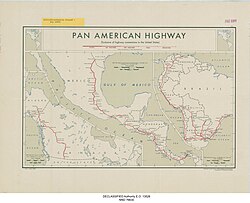
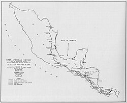
The Pan-American Highway is one of the most ambitious engineering feats in history, forming a vast network of roads that spans approximately 30,000 kilometers (19,000 miles). This monumental system connects the northernmost reaches of North America at Prudhoe Bay, Alaska, to the southern tip of South America in Ushuaia, Argentina.
Connecting 14 different countries, the highway serves as a vital artery for trade, travel, and cultural exchange across the Western Hemisphere. While it is often discussed as a single road, it is actually a complex system of official and unofficial routes, including national highways and interstate systems.
Key Facts
- Total Length: Approximately 30,000 kilometers (19,000 miles).
- Countries Connected: Canada, United States, Mexico, Guatemala, El Salvador, Honduras, Nicaragua, Costa Rica, Panama, Colombia, Ecuador, Peru, Chile, and Argentina.
- Northern Terminus: Prudhoe Bay, Alaska, USA.
- Southern Terminus: Ushuaia, Argentina.
- Major Gap: The Darién Gap, a 100 km stretch of jungle between Panama and Colombia.
The North American Segment
The journey begins in the far north, utilizing the Alaska Highway to traverse the rugged landscapes of Alaska and Canada. In British Columbia, the route passes through settlements like Lower Post and Fort Nelson before reaching Dawson Creek.
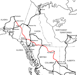
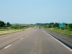
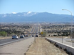
As the route moves into Alberta, it utilizes Alberta Highway 43 and Highway 2, passing through Grande Prairie and Edmonton. In the contiguous United States, the system integrates with the Interstate Highway System. Two primary de facto branches exist: Interstate 35, which runs from Laredo, Texas, to the Canadian border near Duluth, Minnesota, and Interstate 25, which is officially designated as the "Pan-American Freeway" in Albuquerque, New Mexico.
The Mexican Route
In Mexico, the highway is primarily designated as Mexico Highway 85D. To avoid the congestion of downtown Mexico City, travelers can use bypasses via Highway 136 and 115. The system also includes several spurs connecting to the U.S. border at Nogales, El Paso, Eagle Pass, Pharr, and Brownsville.
Heading south from Mexico City, the road passes through Cuernavaca and the state of Puebla via Federal Highway 190. It then traverses the mountains and jungles of Oaxaca and Chiapas, eventually crossing the border into Guatemala at Ciudad Cuauhtémoc.
Central American Transit
The highway continues through Guatemala, passing the Mayan ruins of Iximché and the capital, Guatemala City. In El Salvador, the route connects San Salvador to San Miguel before entering Honduras.
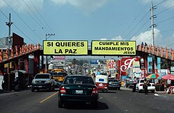
In Honduras, the highway covers about 148 kilometers, linking the border at El Amatillo to the border of Nicaragua. Through Nicaragua, the road follows Central America Highway 1, passing through Managua and offering views of Lake Nicaragua, the largest lake in Central America.
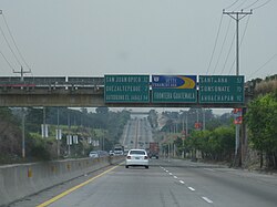
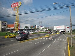
The route then proceeds through Costa Rica and into Panama. In Panama, the highway passes through David and Tolé, eventually reaching the village of Yaviza. This marks the official end of the northern segment.
The Darién Gap
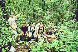
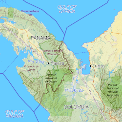
The most famous interruption in the system is the Darién Gap. This is a 100-kilometer (62-mile) stretch of virtually impenetrable mountainous jungle and swampland between Yaviza, Panama, and Turbo, Colombia. Because of this terrain, there is no road connecting the North and South American segments of the highway.
The South American Segment
The southern portion of the network begins in Turbo, Colombia. In Colombia, the route is a complex series of highways, including Route 66, Route 45A, and Route 25, passing through major cities such as Bucaramanga, Bogotá, and Cali.
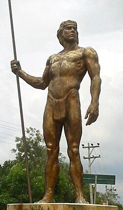
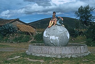
From Colombia, the highway extends through Ecuador, Peru, and Chile. In Ecuador, the road passes near the Equator at Cayambe. The network eventually reaches its southernmost point in Ushuaia, Argentina.
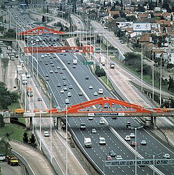
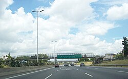
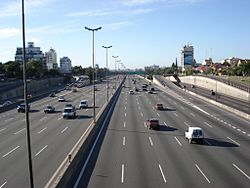
In Argentina, the highway integrates with modern infrastructure, particularly in the Gran Buenos Aires region, where the roads are largely modern highways.
Route Summary Table
| Segment | Northern Terminus | Southern Terminus | Key Feature |
|---|---|---|---|
| North American | Prudhoe Bay, USA | Yaviza, Panama | Integrates with US Interstates |
| South American | Turbo, Colombia | Ushuaia, Argentina | Crosses the Andes and Atacama |
| The Gap | Yaviza, Panama | Turbo, Colombia | Impenetrable jungle (Darién Gap) |
Frequently Asked Questions
Is the Pan-American Highway one single continuous road?
No. While it is a coordinated network, it is interrupted by the Darién Gap between Panama and Colombia, meaning you cannot drive the entire length without using a ferry or aircraft to bypass the jungle.
Which countries does the highway pass through?
The highway connects 14 countries: Canada, United States, Mexico, Guatemala, El Salvador, Honduras, Nicaragua, Costa Rica, Panama, Colombia, Ecuador, Peru, Chile, and Argentina.
What is the longest distance covered by the highway?
The total network stretches approximately 30,000 kilometers (19,000 miles) from Alaska to the tip of Argentina.
Who was the first woman to bike the entire highway?
Canadian Ashleigh Myles became the first woman to bike the entire Pan-American Highway, completing the journey in 118 days between August 23 and December 19, 2025.
What are the de facto branches in the United States?
Interstate 35 and Interstate 25 serve as the primary northerly continuations of the highway through the contiguous United States.