Pampas Plain: The Fertile Grasslands of South America
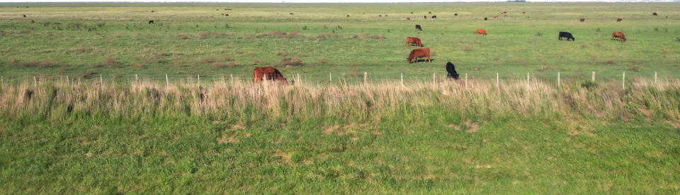
The Pampas (derived from the Quechua word pampa, meaning "plain") are vast, fertile low grasslands located in the southeastern region of South America. Spanning over 1,200,000 square kilometers, this natural region is a cornerstone of the continent's geography, stretching across all of Uruguay, the southernmost Brazilian state of Rio Grande do Sul, and several Argentine provinces, including Buenos Aires, La Pampa, Santa Fe, Entre Ríos, and Córdoba.
While predominantly flat, the landscape is occasionally interrupted by low hills and mountains. The region is bounded to the north by the Great Chaco Plain and the Atlantic Forest, to the west by the Cuyo Region and the Pampas Mountains, and to the south by the rugged terrain of Patagonia.
Key Facts
- Total Area: Approximately 1,200,000 km² (460,000 sq mi).
- Countries: Argentina, Brazil, and Uruguay.
- Average Elevation: 160 meters (520 ft).
- Highest Point: Cerro Tres Picos in the Sierra de la Ventana (1,239 meters).
- Population: Over 44 million people.
- Climate: Generally temperate, ranging from humid subtropical to cold semi-arid.
Topography and Landscape
The Pampas are characterized by generally low elevations, rarely exceeding 600 meters. The coastal regions and the majority of the Buenos Aires Province consist of flat plains and wetlands. In contrast, the interior areas of Uruguay and southern Rio Grande do Sul feature low ranges of hills, such as the Cuchilla Grande in Uruguay and the Serras de Sudeste in Brazil.
A defining feature of the northern Pampas are the coxilhas (in Portuguese) or cuchillas (in Spanish)—low, rolling hills covered in lush grasslands.
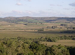
The most significant topographical interruptions are the Ventana and Tandil hills near Bahía Blanca, Argentina. The Sierra de la Ventana mountains represent the region's highest elevations, peaking at 1,239 meters at Cerro Tres Picos.
Climate and Weather Patterns
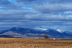
The climate of the Pampas is primarily temperate, though it varies by zone. The north leans toward a humid subtropical climate, while the southeastern coast experiences an oceanic climate. The southern and western fringes are characterized by a cold semi-arid climate.
Precipitation is a critical factor for the region's fertility, ranging from 1,400 mm in the northeast to 400 mm or less in the southwest. While rainfall is relatively evenly distributed in the east, it is highly seasonal in the west.
The region is globally noted for its atmospheric activity. It is one of the most active tornado regions outside of the United States and experiences some of the world's most frequent lightning and highest convective cloud tops, often resulting in severe thunderstorms, hailstorms, and flash floods.
Vegetation and Ecoregions
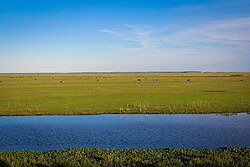
The World Wildlife Fund (WWF) categorizes the Pampas into three distinct ecoregions:
- Uruguayan Savanna: Located east of the Paraná River, covering Uruguay, southern Rio Grande do Sul, and parts of Entre Ríos and Corrientes.
- Humid Pampas: Encompassing southern Entre Ríos and eastern Buenos Aires Province.
- Semiarid Pampas: Covering western Buenos Aires and portions of La Pampa, Córdoba, and Santa Fe.
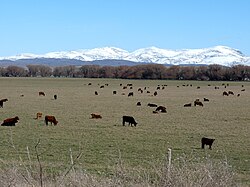
These grasslands are bordered by the Argentine Espinal, a drier grassland system. Today, the region is a global agricultural powerhouse, utilized for cattle ranching, honey production via European honeybees, and the cultivation of vineyards in the Buenos Aires wine region.
Wildlife: From Megafauna to Modernity
The Pampas were once home to an array of massive mammals known as megafauna, most of which went extinct approximately 12,000 years ago during the end-Pleistocene extinction event. These included the Megatherium americanum (a giant ground sloth), the Smilodon populator (a massive sabertooth cat), and the Glyptodon (a car-sized relative of the armadillo).
Other prehistoric inhabitants included the Toxodon (a rhinoceros-like ungulate), Macrauchenia (a camel-like creature), and various early equines such as Hippidion.
History and Human Settlement
Human history in the Pampas was shaped by the arrival of Spanish colonists in the 16th century, leading to early conflicts with indigenous tribes like the Querandí. By the late 18th century, the Salado River served as a boundary between colonial settlements and native territories.
The 19th century saw frequent raids by the Mapuche people, who drove stolen cattle across the Andes to Chile via the Camino de los chilenos. To combat these incursions, Argentina constructed the Zanja de Alsina, a deep trench designed to prevent cattle from being driven west. This era of conflict culminated in the "Conquest of the Desert" after significant raids led by the lonco Calfucurá.
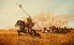
The region is also the ancestral home of the Gauchos, nomadic horsemen who became iconic symbols of the grasslands of Argentina and Uruguay.
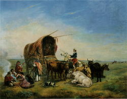
Starting in the 1840s, European immigration surged. While some arrived through government colonization schemes to farm the land, many later transitioned to urban industrial jobs after the 1930s, particularly in the Buenos Aires Province.
Regional Summary
| Feature | Details |
|---|---|
| Total Area | 1,200,000 km² |
| Primary Countries | Argentina, Brazil, Uruguay |
| Key Topography | Plains, Wetlands, Coxilhas (low hills) |
| Climate Types | Temperate, Humid Subtropical, Cold Semi-arid, Oceanic |
| Major Economic Uses | Cattle, Agriculture, Viticulture, Honey |
| Highest Peak | Cerro Tres Picos (1,239 m) |
Frequently Asked Questions
What does the word "Pampas" mean?
The word "Pampas" comes from the Quechua language, where pampa means "plain."
Which countries share the Pampas region?
The Pampas span across Argentina, Brazil (specifically the state of Rio Grande do Sul), and the entirety of Uruguay.
What are "coxilhas"?
Coxilhas (or cuchillas in Spanish) are the low, rolling hills covered by grasslands that are typical of the northern Pampas landscape.
What kind of animals used to live in the Pampas?
Before the end-Pleistocene extinction, the region was home to megafauna such as the giant ground sloth (Megatherium), the sabertooth cat (Smilodon populator), and the Glyptodon.
Why is the Pampas region important for agriculture?
The combination of fertile soils and a temperate climate with well-distributed precipitation makes the region ideal for growing crops, raising cattle, and producing wine.
Is the Pampas region prone to severe weather?
Yes, the region is known for intense thunderstorms, frequent lightning, and is one of the most active tornado regions outside of the central and southeastern United States.