Pahaquarry Township: The Rise and Fall of a New Jersey Community
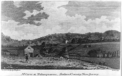
Nestled along the Delaware River in Warren County, Pahaquarry Township was a unique American community that existed for nearly 173 years. From its incorporation in 1824 to its eventual dissolution in 1997, the township's story is one of industrial ambition, rural charm, and a dramatic decline driven by federal infrastructure projects.
The name Pahaquarry is derived from Pahaquarra, a variation of the Native American word Pahaqualong, which translates to "the place between the mountains beside the waters." This evocative name perfectly describes the geography of the region, situated between the Kittatinny Ridge and the river.
Key Facts
- Established: December 27, 1824, from portions of Walpack Township.
- Dissolved: July 2, 1997, and incorporated into Hardwick Township.
- Primary Industry: Copper mining and agriculture.
- Key Landmark: Millbrook Village, now part of the Delaware Water Gap National Recreation Area.
- Final Population: Only 20 residents remained by the 1990 census.
Industrial Ambitions and the Copper Mine
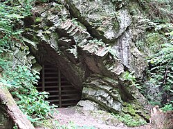
One of the most defining features of the township was the Pahaquarry Copper Mine. Established around 1750, the mine operated through the 18th and 19th centuries until it finally closed in 1928. Despite the implementation of modern mining technology and improved extraction methods, the venture was never profitable. The copper ore found in the rock was too diffuse and of too low a concentration to make the operation commercially viable.
Life in Millbrook Village
While the mines struggled, the community found stability in agriculture. Millbrook Village, located along the historic Old Mine Road, was centered around the Van Campen family farmsteads. In 1832, Abram Garis established a grist mill—a facility used for grinding grain—along Van Campen Brook. This mill acted as a catalyst for growth, attracting other businesses and transforming Millbrook into a thriving farm village by the 1870s.
However, the prosperity was short-lived. By 1910, the village's hotel, store, and mill had all closed. Today, the area is preserved as part of the Old Mine Road Historic District within the Delaware Water Gap National Recreation Area, where several buildings serve as living history exhibits of late-19th and early-20th-century valley life.
Education in Pahaquarry
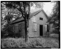
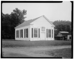
Education was a cornerstone of the community, though it faced significant challenges. The Calno School, established in 1870 and rebuilt in 1910, served local children until 1940. Records from 1881 show that while 48 school-age pupils lived in the district, only 30 were registered, and daily attendance averaged just 15 students. Teachers were poorly paid and often boarded with local families, rarely staying more than two years. Students typically walked four to five miles to reach school, sometimes attending the Millbrook School located five miles to the north.
The Tocks Island Dam and Dissolution
The decline of Pahaquarry was accelerated by the federal government in the late 1960s. To facilitate the construction of the proposed Tocks Island Dam, the government purchased the majority of the township's land, forcing most residents to leave. Although grassroots environmental opposition eventually stopped the dam project—which was officially deauthorized by Congress in 1992—the community never recovered.
By 1997, the township had dwindled to just six residents. In a historic and poignant meeting held inside the old Calno School, Mayor Jean Zipser and Harold Van Campen—the only two eligible members of the Township Committee—voted 2-0 to dissolve the municipality. On July 2, 1997, Pahaquarry Township ceased to exist and was incorporated into Hardwick Township.
Population Trends
The demographic history of Pahaquarry reflects a steady rise followed by a precipitous drop, coinciding with the industrial decline and federal land acquisitions.
| Census Year | Population | Percentage Change |
|---|---|---|
| 1830 | 258 | — |
| 1850 | 460 | +57.5% |
| 1870 | 405 | -12.9% |
| 1900 | 257 | -11.7% |
| 1930 | 80 | -37.5% |
| 1970 | 71 | +12.7% |
| 1990 | 20 | -23.1% |
Frequently Asked Questions
What does the name Pahaquarry mean?
The name is derived from the Native American word Pahaqualong, meaning "the place between the mountains beside the waters."
Why did the Pahaquarry Copper Mine fail?
Despite using the latest mining machinery, the mine was unprofitable because the copper ore concentration in the rock was too low.
What happened to the land after the Tocks Island Dam was cancelled?
Most of the land became part of the Delaware Water Gap National Recreation Area.
How was the township officially dissolved?
In March 1997, the only two eligible Township Committee members voted 2-0 to proceed with dissolution, which became official on July 2, 1997.
Where is Pahaquarry located today?
The former township land is now part of Hardwick Township in Warren County, New Jersey.