Pacific Ocean: The Earth's Largest Water Body and Its Global Impact
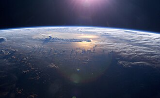
The Pacific Ocean is the largest and deepest of Earth's oceanic divisions. Covering approximately 46% of the planet's water surface and 32% of its total surface area, it is so vast that it exceeds the combined land area of every continent on Earth. From the frozen reaches of the Arctic to the icy borders of Antarctica, the Pacific serves as a critical regulator of global climate and a bridge between the Americas, Asia, and Australia.
Due to the Coriolis effect—the deflection of moving objects caused by Earth's rotation—the ocean is divided into two primary volumes: the North Pacific and the South Pacific. These meet at the Equator, creating a complex system of currents and climatic zones that influence weather patterns worldwide.
Key Facts
- Total Surface Area: 165,250,000 square kilometers.
- Maximum Depth: 10,911 meters in the Mariana Trench.
- Average Depth: 4,280 meters.
- Water Volume: Approximately 710 million cubic kilometers.
- Most Remote Point: Point Nemo, located at 48°52.6′S 123°23.6′W.
- Geological Trend: Shrinking by roughly 2.5 centimeters per year due to plate tectonics.
Geography and Physical Characteristics
The Pacific stretches roughly 8,400 nautical miles from the Bering Sea to the Southern Ocean. At its widest point, near 5°N latitude, it spans approximately 10,700 nautical miles from Indonesia to Colombia—a distance more than five times the diameter of the Moon.
The Deepest Points on Earth
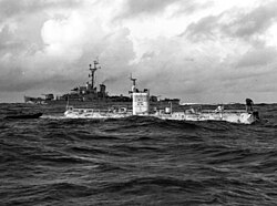
The Pacific is home to the world's most extreme depths. The Challenger Deep in the Mariana Trench is the deepest known point on the planet, reaching 10,928 meters. The region also contains the Sirena Deep and the Horizon Deep in the Tonga Trench, the latter being the deepest point in the Southern Hemisphere.
Water Composition and Movement
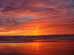
Surface temperatures vary drastically, from -1.4°C near the poles to 30°C at the equator. Salinity also fluctuates; it is highest in the southeastern areas (37 parts per thousand) and lowest in the far north due to reduced evaporation in frigid climates. Water movement generally follows a clockwise pattern in the Northern Hemisphere (the North Pacific gyre) and counter-clockwise in the Southern Hemisphere.
History and Human Exploration
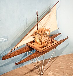
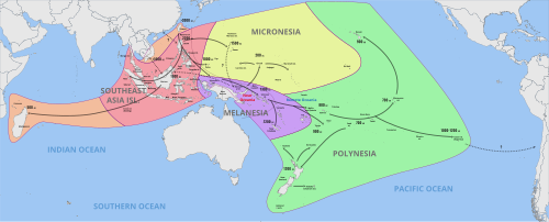
Long before European arrival, the Pacific was navigated by skilled voyagers. The Austronesian peoples utilized advanced maritime technology to settle vast reaches of the ocean.
European Discovery and Imperialism
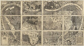
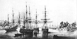
In 1520, Ferdinand Magellan and his crew became the first recorded Europeans to cross the ocean. Magellan named it Pacífico (peaceful) after encountering calm waters following a stormy passage through Cape Horn. By the 19th century, the region became a focal point of New Imperialism, with Britain, France, the United States, Germany, Japan, and Chile establishing control over various island chains.
Cultural Regions of Oceania
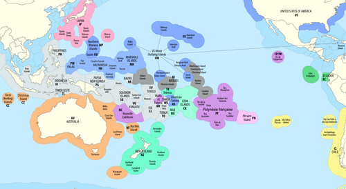
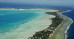
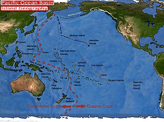
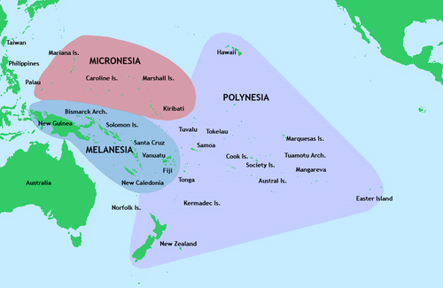
The islands of the Pacific are generally categorized into three major cultural and geographic areas: Micronesia, Melanesia, and Polynesia.
Geology and Environmental Challenges
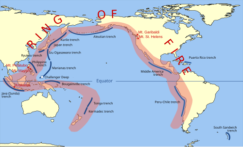
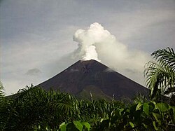
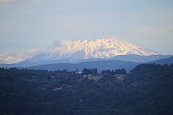
The Pacific is defined by the Ring of Fire, a massive horseshoe-shaped zone of high seismic and volcanic activity caused by the movement of tectonic plates. This results in frequent earthquakes and the presence of numerous stratovolcanoes.
Pollution and Ecological Threats
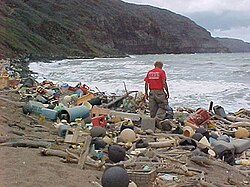
Modern industrialization has led to severe environmental degradation. The Great Pacific Garbage Patch, located between California and Japan, is three times the size of France and contains an estimated 1.8 trillion pieces of plastic. Additionally, the region has a history of nuclear contamination, including 67 U.S. nuclear tests in the Marshall Islands between 1946 and 1958 and the recent discharge of treated radioactive water from the Fukushima plant.
![Pacific Ocean currents have created three islands of debris.[100]](/images/fb/aa/fbaaad0a552a1f82f521ad29a4b1471e5d2b4691e8538bb8c1d6508245972447.jpg)
![In 2020, Japanese Prime Minister Suga declined to drink the bottle of Fukushima's treated radioactive water that he was holding, which would otherwise be discharged to the Pacific.[107]](/images/84/0a/840a1c58ebf6006929b4a5bc4fc2d493bf13f661f1a7c47f546afb39ea3ccbcc.jpg)
Pacific Ocean Summary Table
| Feature | Detail |
|---|---|
| Surface Area | 165,250,000 km² |
| Percentage of Earth's Surface | ~32% |
| Deepest Point | Challenger Deep (10,928 m) |
| Average Depth | 4,280 m |
| Primary Currents | North Pacific Gyre, Kuroshio Current |
| Major Environmental Issue | Great Pacific Garbage Patch |
Frequently Asked Questions
Why is the Pacific Ocean shrinking?
The Pacific is shrinking due to plate tectonics. It is currently decreasing in size by approximately 2.5 centimeters per year on three sides, while the Atlantic Ocean is expanding.
What is Point Nemo?
Point Nemo is the oceanic pole of inaccessibility, the point in the ocean that is farthest from any land on Earth.
What is the Ring of Fire?
The Ring of Fire is a region around the Pacific basin characterized by frequent volcanic eruptions and earthquakes, caused by the subduction of tectonic plates.
How large is the Great Pacific Garbage Patch?
The patch is estimated to be three times the size of France, containing roughly 80,000 metric tons of plastic debris.
Who was the first European to cross the Pacific?
Ferdinand Magellan and his crew were the first to cross the Pacific in recorded history during a Spanish expedition that eventually achieved the first world circumnavigation.