Articles/Northeastern United States: A Comprehensive Overview of History, Geography, and Economy
Northeastern United StatesNew EnglandMid-AtlanticUS Northeast economyNortheast US history
Northeastern United States: A Comprehensive Overview of History, Geography, and Economy
Exploring the Northeastern United States: A Guide to History, Geography, and Economy The Northeastern United States, often referred to as the East Coast or the American Northeast, is a re...
Exploring the Northeastern United States: A Guide to History, Geography, and Economy
The Northeastern United States, often referred to as the East Coast or the American Northeast, is a region of profound historical significance and economic power. Comprising nine states and divided into the subregions of New England and the Mid-Atlantic, this area serves as a cornerstone of American identity. From the rugged coastlines of Maine to the bustling streets of New York City, the Northeast offers a diverse tapestry of landscapes, cultures, and urban centers.
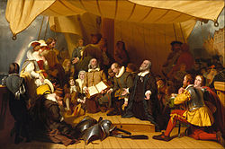
Embarkation of the Pilgrims, an 1857 portrait by Robert Walter Weir: Embarkation of the Pilgrims, an 1857 portrait by Robert Walter Weir
Key Facts
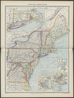
Northeastern United States in 1908 from The Harmsworth atlas and Gazetter
States: Connecticut, Maine, Massachusetts, New Hampshire, Rhode Island, Vermont, New York, New Jersey, and Pennsylvania.
Largest City: New York City, New York.
Total Population: Approximately 57.6 million (2020 Census).
Economic Power: Projected regional GDP of $5.969 trillion by 2025.
Highest Point: Mount Washington, New Hampshire (6,288.3 ft).
Major Subregions: New England and the Mid-Atlantic.
Geography and Topography
The Northeast is characterized by a varied landscape that ranges from mountainous terrains to expansive coastal waters. The region covers a total area of 181,324 square miles, with water accounting for approximately 9.51% of that space. The highest elevation in the region is found at Mount Washington in New Hampshire, reaching 6,288.3 feet, while the lowest point is the Atlantic Ocean at sea level.
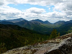
Adirondack Park: Adirondack Park
Natural landmarks define the character of the region. Visitors can explore the Adirondack Mountains, the scenic Palisades along the Hudson River, or the breathtaking Niagara Falls. For those seeking coastal beauty, Cape Cod Bay in Massachusetts and the shores of Maine provide iconic maritime scenery.
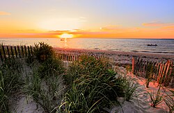
Cape Cod Bay, a leading tourist destination in Massachusetts: Cape Cod Bay, a leading tourist destination in Massachusetts
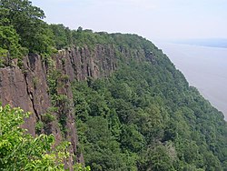
The Palisades along the Hudson River in New Jersey: The Palisades along the Hudson River in New Jersey
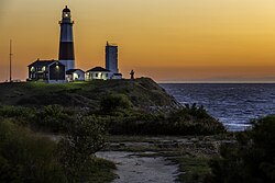
Montauk Point Lighthouse on the east end of Long Island: Montauk Point Lighthouse on the east end of Long Island
Regional Statistics at a Glance
Northeastern United States Regional Overview
Category
Value
Total Area
181,324 sq mi
Land Area
162,257 sq mi
Water Area
19,067 sq mi
Urban Area
74,800 sq mi
Population (2020)
57,609,148
Population Density
355.049/sq mi
A Rich Historical Legacy
The history of the Northeast is inextricably linked to the founding of the United States. The region played a central role during the American Revolution, with significant battles fought on its soil. Notable conflicts include the Battle of Trenton in New Jersey and the Battle of Gettysburg in Pennsylvania, the latter being the bloodiest battle of the American Civil War.
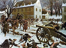
The Battle of Trenton, fought in New Jersey in December 1776 following Washington's covert crossing of the Delaware during the night of December 25, 1776, represented an inspiring victory for Washington's Continental Army and began to turn the Revolutionary War in the Americans' favor.: The Battle of Trenton, fought in New Jersey in December 1776 following Washington's covert crossing of the Delaware during the night of December 25, 1776, represented an inspiring victory for Washington's Continental Army and began to turn the Revolutionary War in the Americans' favor.
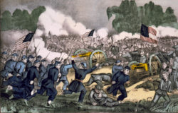
The Battle of Gettysburg, fought in and around Gettysburg, Pennsylvania, was the American Civil War's bloodiest battle; the Union's victory at Gettysburg represented a turning point in the war in the Union's favor.: The Battle of Gettysburg, fought in and around Gettysburg, Pennsylvania, was the American Civil War's bloodiest battle; the Union's victory at Gettysburg represented a turning point in the war in the Union's favor.
The political framework of the nation was also forged here. The Constitutional Convention was held in Philadelphia in 1787, where the U.S. Constitution was drafted. Following ratification, the first Congress convened at Federal Hall in New York City in March 1789.
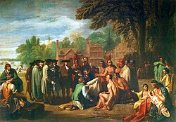
Penn's Treaty with the Indians, a 1772 portrait by Benjamin West: Penn's Treaty with the Indians, a 1772 portrait by Benjamin West
Urban Centers and Economic Might
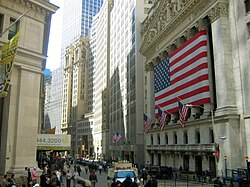
The Northeast is an economic powerhouse, boasting a massive GDP and high per capita income. New York City stands as the region's largest city and a global hub for finance, home to the New York Stock Exchange, the largest stock exchange in the world by market capitalization.
The New York Stock Exchange in Lower Manhattan is the largest stock exchange in the world by market capitalization.: The New York Stock Exchange in Lower Manhattan is the largest stock exchange in the world by market capitalization.
Other major cities contribute significantly to the region's vitality, including Philadelphia, Boston, Newark, and Jersey City. These urban centers are characterized by dense populations and diverse ethnic origins, creating vibrant cultural landscapes.
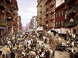
Little Italy in Lower Manhattan, c. 1900: Little Italy in Lower Manhattan, c. 1900
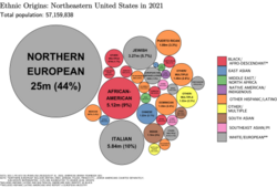
Ethnic origins in the Northeast: Ethnic origins in the Northeast
Economic Output by State (Projected 2025)
State GDP and Per Capita Income
State
GDP (USD)
Per Capita (USD)
New York
$2.1 trillion
$105,226
Pennsylvania
$931 billion
$71,825
New Jersey
$753 billion
$81,307
Massachusetts
$693 billion
$99,274
Connecticut
$323 billion
$89,301
Transportation and Infrastructure
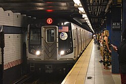
Connectivity is a defining feature of the Northeast, facilitated by complex rail, air, and road networks. The region hosts some of the world's busiest transit systems, such as the New York City Subway, which serves over two billion passengers annually.
The New York City Subway, one of the busiest transit systems in the world, used by over two billion passengers annually: The New York City Subway, one of the busiest transit systems in the world, used by over two billion passengers annually
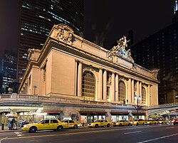
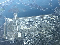
Major rail hubs like Grand Central Terminal in New York City and the Jersey City Terminal provide essential links for commuters and travelers alike. Air travel is equally robust, with JFK International Airport serving as the busiest airport in the Northeast.
Grand Central Terminal in New York City, a National Historic Landmark and the second-busiest train station in the nation after New York Penn Station, also in New York City: Grand Central Terminal in New York City, a National Historic Landmark and the second-busiest train station in the nation after New York Penn Station, also in New York City
JFK International Airport in Queens, New York. The busiest airport in the Northeast and the 13th busiest in the nation.: JFK International Airport in Queens, New York. The busiest airport in the Northeast and the 13th busiest in the nation.
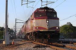
A MBTA Commuter Train. one of the Northeast's busiest commuter rail systems, entering Mansfield station in Mansfield, Massachusetts: A MBTA Commuter Train. one of the Northeast's busiest commuter rail systems, entering Mansfield station in Mansfield, Massachusetts
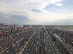
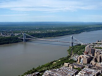
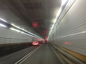
The region's road infrastructure includes critical crossings and highways. The New Jersey Turnpike and the George Washington Bridge are vital arteries for interstate traffic, while the Holland Tunnel provides a key connection under the Hudson River.
The New Jersey Turnpike (I-95) is one of the busiest highways in the nation.: The New Jersey Turnpike (I-95) is one of the busiest highways in the nation.
The George Washington Bridge crossing the Hudson River, carrying most traffic on Interstate 95 from New Jersey to New York.: The George Washington Bridge crossing the Hudson River, carrying most traffic on Interstate 95 from New Jersey to New York.
The Holland Tunnel crossing under the Hudson River, connecting Jersey City with Lower Manhattan.: The Holland Tunnel crossing under the Hudson River, connecting Jersey City with Lower Manhattan.
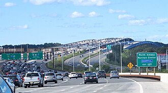
The Driscoll Bridge is one of the world's widest and busiest motor vehicle bridges, crossing the Raritan River on New Jersey's Garden State Parkway.: The Driscoll Bridge is one of the world's widest and busiest motor vehicle bridges, crossing the Raritan River on New Jersey's Garden State Parkway.
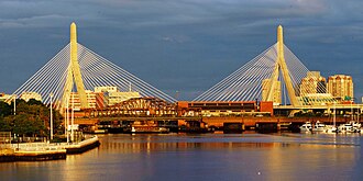
The Zakim Bridge carrying traffic on Intestate 93 from Boston across the Charles River.: The Zakim Bridge carrying traffic on Intestate 93 from Boston across the Charles River.
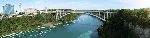
The Rainbow Bridge, connecting New York to Canada nearby Niagara Falls.: The Rainbow Bridge, connecting New York to Canada nearby Niagara Falls.
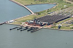
The Jersey City Terminal, a major rail and ferry connection between New Jersey and New York City.: The Jersey City Terminal, a major rail and ferry connection between New Jersey and New York City.
The Cross-Bronx Expressway (I-95) is an urban freeway which was built using slum clearance policies in the 1950s and 1960s. Today it is one of the most congested highways in the nation. It is regarded as a major cause for urban decay in the Bronx.[103]: The Cross-Bronx Expressway (I-95) is an urban freeway which was built using slum clearance policies in the 1950s and 1960s. Today it is one of the most congested highways in the nation. It is regarded as a major cause for urban decay in the Bronx.
Frequently Asked Questions
What are the subregions of the Northeast?
The Northeast is divided into two primary subregions: New England and the Mid-Atlantic.
Which city is the largest in the Northeast?
New York City is the most populated city in both the Northeast and the United States.
What is the highest point in the region?
The highest elevation is Mount Washington in New Hampshire, which stands at 6,288.3 feet.
How many states make up the Northeast?
According to the Census Bureau, there are nine states in the Northeast: Connecticut, Maine, Massachusetts, New Hampshire, Rhode Island, Vermont, New York, New Jersey, and Pennsylvania.
What is the primary time zone used in the Northeast?
The region operates on Eastern Standard Time (EST), which is UTC-5, and switches to Eastern Daylight Time (EDT), which is UTC-4, during the summer.
The U.S. Census Bureau reorganized its administrative units, and its regional offices do not cover the Census regions (the northeasternmost regional office headquartered in New York covers New England, New York, New Jersey, and Puerto Rico).[60]
Based on U.S. Census Bureau population projections to 2030 (and assuming constant land area) the population density for the South Atlantic division will increase significantly to 294.6/mi2, New England's density will increase to 249.2/mi2 and the East North Central division will increase only slightly to 200.2/mi2. The division with the 5th highest density is projected to be the East South Central division at 111.6/mi2.[93]
![The Cross-Bronx Expressway (I-95) is an urban freeway which was built using slum clearance policies in the 1950s and 1960s. Today it is one of the most congested highways in the nation. It is regarded as a major cause for urban decay in the Bronx.[103]](/images/b5/5f/b55f17aa9f1025e55abbb70321b9c0146e94b998b52a0ed281c8bd3a3511f8f3.jpg)