New Orleans Drainage: The Engineering Battle Against Water
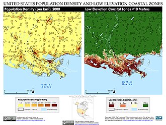
Since its founding in the early 18th century, New Orleans has faced a relentless struggle against water. Situated in the Mississippi River Delta, the metropolitan area—comprising New Orleans, Metairie, and Kenner—is uniquely positioned, almost entirely surrounded by Lake Pontchartrain to the north, Lake Borgne to the east, the Mississippi River to the south, and vast wetlands to the east and west.
The city's geography presents a critical challenge: half of the land area between these bodies of water sits at or below sea level. Because the terrain lacks a natural outlet for surface water, the city relies on evapotranspiration (the process by which water is transferred from the land to the atmosphere by evaporation from the soil and by transpiration from plants) and mechanical pumping to prevent permanent flooding.
Key Facts
- Elevation: Approximately 65% of New Orleans proper is at or below mean sea level.
- Pumping Capacity: The system can move over 45,000 cubic feet (1,300 m³) of water per second.
- Rainfall Threshold: The system is designed to handle 1 inch of rain in the first hour, followed by 0.5 inches per hour.
- Primary Threats: Flooding risks stem from the Mississippi River, Lake Pontchartrain, internal canals, and heavy rainfall.
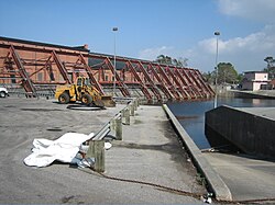
- Infrastructure: The city utilizes a complex network of artificial levees, floodwalls, and pumping stations.
The Geography of a Sinking City
New Orleans was originally settled on the natural levees—the higher ground along the Mississippi River. However, as the city expanded in the 1960s, man-made levees and floodwalls were constructed to encompass marshlands and swamps. This expansion, combined with the pumping of nearby marshes, led to development in lower elevation areas.
Current data highlights the severity of the city's position. While a 2007 study suggested 51% of urbanized portions of Orleans, Jefferson, and St. Bernard parishes were above sea level, a 2016 ASCE Journal of Hydrologic Engineering study found that about 65% of New Orleans proper is at or below the mean sea level of Lake Pontchartrain. Furthermore, the city is experiencing subsidence, a gradual sinking of the land surface.
Evolution of the Drainage System
For much of the 19th century, residents adapted to frequent street flooding by raising their homes several feet above street level. Early attempts to solve the problem included George T. Dunbar's 1830s proposal for underground drainage canals and the first steam-powered pumps, which were adapted from ship paddle wheels.
The modern era of water management began in 1899 with the creation of the Sewerage & Water Board of New Orleans. This entity was tasked with draining the city and establishing modern sewage and tap water systems. A key figure in this era was engineer A. Baldwin Wood, who invented pump and plumbing improvements that were adopted globally.
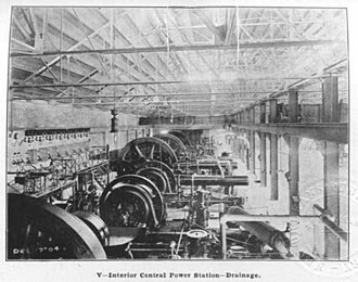
As the 20th century progressed, the city drained former swampland to allow for urban expansion. However, this growth increased the city's reliance on its mechanical systems. A pivotal moment occurred during the "Good Friday Flood" of April 15, 1927, when 15 inches of rain fell in 19 hours. The municipal power grid failed, knocking the pumps offline and causing extensive flooding. In response, the city installed backup diesel generators at pumping stations to ensure operation during power outages.
Catastrophic Failures: From Betsy to Katrina
While the system proved effective during the 1947 Fort Lauderdale Hurricane, other events exposed critical vulnerabilities. In 1965, Hurricane Betsy caused catastrophic flooding in the Lower Ninth Ward, not due to rain, but because of a breach in the Industrial Canal levee.
The most devastating event in the city's history occurred on August 29, 2005, during Hurricane Katrina. Contrary to popular belief, the hurricane's rainfall did not flood the city; instead, a series of mis-designed levees and floodwalls failed. A storm surge (an abnormal rise of water generated by a storm, over and above the predicted astronomical tide) funneled by the Mississippi River Gulf Outlet breached the Industrial Canal, flooding the Lower Ninth Ward and Eastern New Orleans.
Simultaneously, breaches in the 17th Street and London Avenue canals allowed Lake Pontchartrain to pour into the city. In some areas, water did not enter through the streets but surged up from the storm drains. By August 30, 80% of the city was underwater, and most pumping stations were submerged or lacked power.
Post-Katrina Challenges and Modern Risks
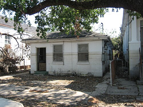
The aftermath of Katrina revealed fundamental design mistakes by the U.S. Army Corps of Engineers, particularly regarding the 17th Street Canal levee. Recovery was slow, hampered by corrosion in pumps caused by brackish water and defective temporary pumps installed during the cleanup.
Recent years have shown that the city remains vulnerable to extreme weather. In August 2017, heavy rainfall overwhelmed the system, flooding central New Orleans. Investigations revealed that 16 of the 148 drainage pumps and 3 of the 5 power turbines were out of service at the time, significantly reducing the city's ability to manage the deluge.
| Feature | Detail/Capacity |
|---|---|
| Total Drainage Pumps (2005) | 148 |
| Pumping Rate | > 45,000 cubic feet per second |
| Design Rainfall Capacity | 1" (1st hour), then 0.5" per hour |
| Primary Management Agency | Sewerage & Water Board of New Orleans |
| Key Infrastructure | Levees, Floodwalls, Canals, Pumping Stations |
Frequently Asked Questions
Why does New Orleans flood even when it doesn't rain heavily?
Flooding can occur due to levee or floodwall breaches, which allow water from the Mississippi River or Lake Pontchartrain to enter the city, as seen during Hurricane Katrina.
What is the role of the Sewerage & Water Board?
The Sewerage & Water Board is responsible for the city's drainage, as well as the construction and maintenance of the modern sewage and tap water systems.
How does subsidence affect the city?
Subsidence is the gradual sinking of the land. As the city drops in elevation, it becomes more susceptible to flooding and requires more aggressive pumping to remove surface water.
Why did the pumps fail during the 1927 flood?
The pumps relied entirely on the municipal electricity system, which failed during the storm. This led to the subsequent installation of backup diesel generators.
What caused the flooding during Hurricane Katrina?
The flooding was caused by the failure of mis-designed levees and floodwalls, which allowed storm surges from the Gulf of Mexico and Lake Pontchartrain to breach the city's defenses.