Natural Borders: Geography, Strategy, and Political History
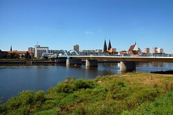
A natural border is a political boundary between states or subdivisions that coincides with prominent natural formations. These geographical markers, such as mountain ranges or rivers, provide a physical demarcation of territory that is often more intuitive than a line drawn on a map.
The conceptualization of these boundaries varies by culture. In Western culture, the "doctrine of natural boundaries" emerged during the 18th century, influenced by the philosophies of Jean-Jacques Rousseau and the rise of nationalism. Conversely, a similar concept developed earlier in China, rooted in the practical management of natural zones of control.
Key Facts
- Natural borders are defined by physical formations like rivers, mountains, and deserts.
- They are historically prized for being easier to defend than open terrain.
- The Roman Empire used the Alps, Rhine, Danube, and Sahara as strategic limits.
- Shifting natural features, such as river courses, can lead to territorial disputes.
- Natural borders differ from landscape borders, which are manmade modifications of geography.
The Strategic Value of Geography
Historically, natural borders have been highly valued because they are strategically useful for defense. A mountain range or a wide river acts as a physical barrier that slows down invading forces and provides a clear line of sight for defenders.
While modern military technology and engineering have reduced the absolute strategic advantage of these barriers, they remain meaningful in contemporary warfare. The inherent difficulty of crossing rugged terrain or large bodies of water still influences military planning and national security.
Historical Ambitions and Expansion
For many states, expanding territory until a natural border is reached has been a primary policy goal. Once these boundaries are conquered, they are often maintained as permanent limits of the state.
The Roman Example
The Roman Republic and the subsequent Roman Empire followed this pattern of expansion. Their growth was characterized by a push toward natural limits, starting with the Alps and eventually extending to the Rhine and Danube rivers, as well as the Sahara desert.
The French Ambition
From the Middle Ages through the 19th century, France pursued a similar strategy. French territorial goals were frequently centered on expanding toward the Pyrenees, the Alps, and the Rhine River to secure the nation's perimeter.
Challenges and Distinctions
Despite their utility, natural borders are not always stable. Because nature is dynamic, these boundaries can shift, leading to political friction. A prominent example is the Rio Grande, which forms part of the border between the United States and Mexico; the river's movement over time has resulted in multiple territorial conflicts.
Natural Borders vs. Landscape Borders
It is important to distinguish natural borders from landscape borders. While both involve geographical features, landscape borders are manmade. These are artificial modifications to the environment designed to demarcate treaty-designated political boundaries.
Unlike natural borders, landscape borders go against the existing geography. For instance, during the Song Dynasty, China constructed an extensive defensive forest along its northern border specifically to thwart the nomadic Khitan people.
| Feature | Natural Border | Landscape Border |
|---|---|---|
| Origin | Naturally occurring formations | Manmade modifications |
| Examples | Rivers, Mountains, Deserts | Planted forests, Artificial barriers |
| Primary Purpose | Strategic defense and demarcation | Treaty enforcement and demarcation |
| Stability | Can shift due to natural changes | Fixed by human construction |
Frequently Asked Questions
What is the difference between a natural border and a landscape border?
A natural border is a pre-existing geographical feature, such as a river or mountain range, that serves as a boundary. A landscape border is a manmade geographical feature, such as a planted forest, created to mark a political boundary.
Why are natural borders strategically useful?
They are generally easier to defend than open land because the physical terrain creates obstacles for attackers and provides defensive advantages for the state controlling the border.
Can natural borders cause conflict?
Yes. When the natural feature defining the border shifts—such as a river changing its course—it can lead to territorial disputes between the neighboring states.
Which empires historically sought natural borders?
The Roman Empire expanded toward the Alps, Rhine, Danube, and Sahara. Similarly, France sought to reach the Alps, Pyrenees, and Rhine River between the Middle Ages and the 19th century.
How did the concept of natural boundaries develop in the West?
The doctrine developed in the 18th century, drawing on the "natural" ideas of philosopher Jean-Jacques Rousseau and the evolving concepts of nationalism.