Understanding the National Weather Service: History, Operations, and Technology
For over 150 years, the National Weather Service (NWS) has served as the backbone of meteorological safety in the United States. As a specialized agency within the National Oceanic and Atmospheric Administration (NOAA), the NWS provides the critical data, forecasts, and warnings that protect lives, property, and the economy from severe weather events.
From its origins as a military-led service to its current status as a high-tech scientific powerhouse, the NWS has evolved alongside the technology used to observe our atmosphere. Today, it manages a vast network of radar, satellites, and field offices to ensure that whether you are flying a plane, sailing a ship, or walking to work, you have the information you need to stay safe.

Key Facts
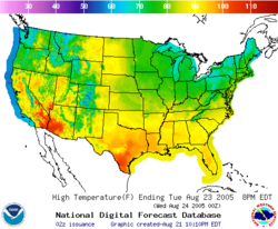
- Founded: February 9, 1870
- Parent Agency: National Oceanic and Atmospheric Administration (NOAA)
- Headquarters: Silver Spring, Maryland
- Workforce: Approximately 4,900 employees
- Primary Mission: Providing weather, hydrologic, and climate forecasts and warnings.
A Brief History of American Forecasting
The NWS traces its roots back to February 9, 1870, when it began as a division of the U.S. Army Signal Service. During this era, the organization was under military control, and its leaders held the title of Chief Signal Officer. In 1891, the agency transitioned into a civilian organization known as the United States Weather Bureau.

The modern identity of the agency was solidified on October 1, 1970, when the Weather Bureau became part of the newly formed National Oceanic and Atmospheric Administration (NOAA). This transition marked the official birth of the National Weather Service as we know it today.
Challenges and Privatization Attempts
The agency's history has not been without controversy. In 1983, a proposal by NOAA administrator John V. Byrne sought to auction off weather satellites and outsource various observation services to private companies; however, this was defeated in Congress. Similarly, in 2005, the National Weather Service Duties Act was introduced to restrict the free distribution of weather data. The bill was met with heavy criticism from aviation and emergency management groups and ultimately died in committee.
How the NWS Operates
The NWS is a massive organizational structure designed to handle everything from local thunderstorms to global climate trends. It is organized into several specialized sub-organizations and centers.
National Centers and Specialized Forecasts
The agency operates several high-level centers that focus on specific types of weather phenomena:
- National Hurricane Center (NHC): Specializes in tropical cyclone tracking.
- Storm Prediction Center (SPC): Focuses on severe convective storms, such as tornadoes.
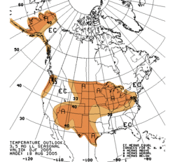
- Climate Prediction Center (CPC): Provides long-term climate outlooks.
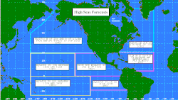
- Ocean Prediction Center (OPC): Monitors marine weather conditions.
- Space Weather Prediction Center (SWPC): Tracks solar activity and its effects on Earth.
Field Offices and Regional Coverage
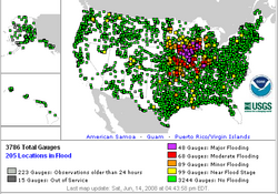
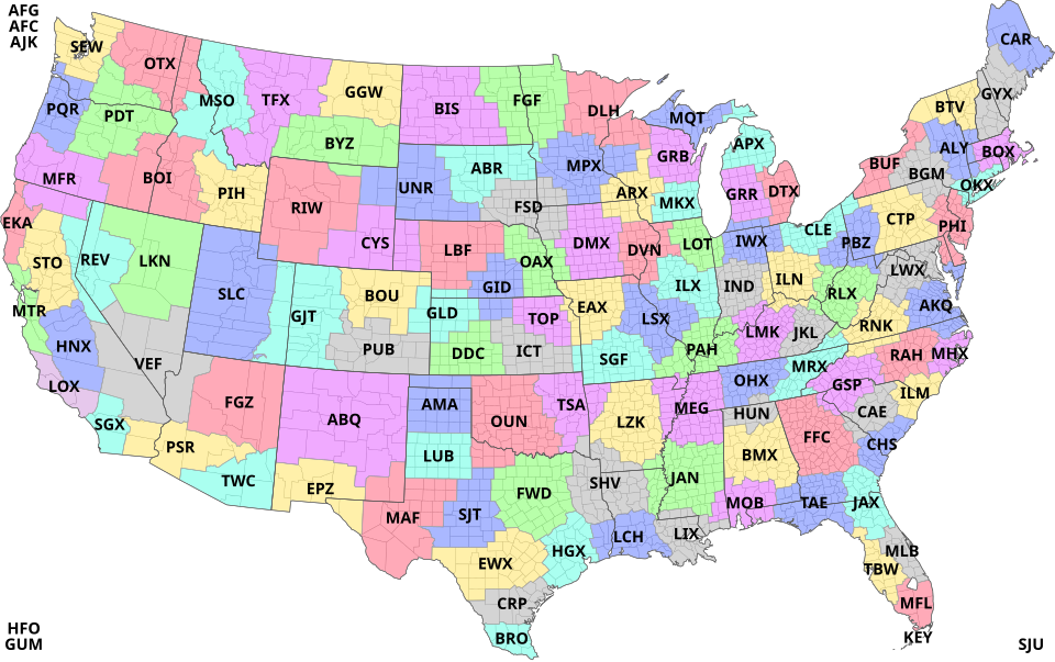
To provide localized accuracy, the NWS utilizes Weather Forecast Offices (WFOs). As of 2016, the agency's structure included 122 WFOs, 21 Center Weather Service Units (CWSU) for aviation, and 13 River Forecast Centers (RFC) for managing flood risks.
Data Acquisition and Advanced Technology
Modern forecasting relies on a constant stream of data collected from the surface, the oceans, and the upper atmosphere. This process, known as data acquisition, involves a variety of sophisticated tools.
Surface and Marine Observations
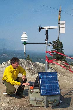
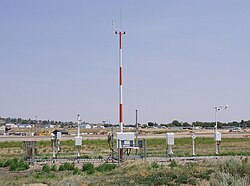
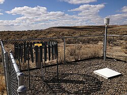
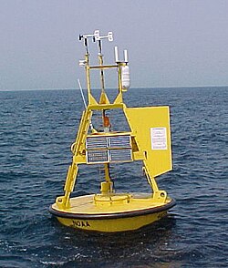
On the ground, the NWS relies on systems like the Automated Surface Observing System (ASOS) and the Cooperative Observer Program to gather real-time data. In the oceans, discus buoys and other marine observation tools provide essential information for maritime safety.
Radar and Upper-Air Monitoring
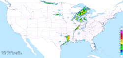
One of the most critical technologies in the NWS arsenal is the WSR-88D Doppler weather radar, also known as NEXRAD. Deployed extensively by 1997, these 158 radar sites allow meteorologists to detect intra-cloud motions, which is vital for issuing severe weather warnings.
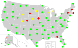
To understand the vertical structure of the atmosphere, meteorologists use radiosondes—instruments carried by weather balloons to collect data at various altitudes. This process, known as upper-air sounding, is essential for predicting storm development.

Agency Overview Summary
| Category | Details |
|---|---|
| Parent Agency | National Oceanic and Atmospheric Administration (NOAA) |
| Headquarters | Silver Spring, Maryland |
| FY 2023 Budget | US$ 1.364 billion |
| Current Director | Ken Graham |
| Key Technology | NEXRAD (WSR-88D) Doppler Radar |
Frequently Asked Questions
What is the difference between a weather advisory and a warning?
While the source does not provide specific definitions for every term, it notes that the NWS issues weather warnings and advisories as event-driven products to alert the public to imminent or expected hazardous weather.
How does the NWS protect its staff during extreme weather?
The agency utilizes specialized infrastructure, such as hurricane-proof buildings, to ensure that critical forecasting operations can continue even during severe storms.
![Specially designed hurricane-proof building constructed to house joint offices of the Houston-Galveston National Weather Service Forecast Office and the Galveston County Emergency Management Office[73]](/images/78/38/7838205602faaf099b8a29f835b36c69f53f064c8a96a741ac40a9c506f01252.jpg)
What is a "convective" alert?
A convective alert is issued for areas affected by thunderstorms covering at least 3,000 square miles, a line of thunderstorms at least 60 nautical miles long, or severe/embedded thunderstorms expected to last 30 minutes or longer.
Why is the NWS important for aviation?
Weather is a major factor in flight safety; the NWS provides specialized services through the Aviation Weather Center and Center Weather Service Units, noting that approximately 40% of all aviation accidents are at least partially weather-related.