MyanmarBurmaSoutheast AsiaBamarNaypyidaw

Myanmar: A Comprehensive Overview of History, Geography, and Culture

Myanmar: A Comprehensive Overview of History, Geography, and Culture The Republic of the Union of Myanmar, also known as Burma, is a diverse nation located in Southeast Asia. Defined by i...

Myanmar: A Comprehensive Overview of History, Geography, and Culture

The Republic of the Union of Myanmar, also known as Burma, is a diverse nation located in Southeast Asia. Defined by its rich spiritual heritage, complex political history, and varied landscapes, Myanmar serves as a bridge between the Indian subcontinent and East Asia. From the ancient plains of Bagan to the bustling streets of Yangon, the country is a tapestry of ethnic diversity and resilience.
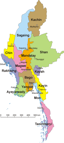
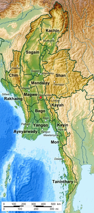
Map of Myanmar and its divisions

Key Facts

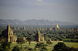
Pagodas and kyaungs in present-day Bagan, the capital of the Pagan Kingdom
  • Capital: Naypyidaw
  • Largest City: Yangon
  • Official Language: Burmese
  • Primary Religion: Buddhism (87.9%)
  • Total Area: 676,579 km²
  • Estimated Population: 55,770,232 (2022)
  • Currency: Myanmar kyat (MMK)

Historical Evolution
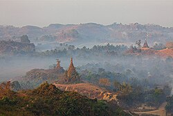
Temples at Mrauk U
Temples at Mrauk U

Myanmar's history is marked by the rise and fall of powerful dynasties and periods of foreign colonial rule. The early era was characterized by city-states, eventually leading to the Pagan Kingdom, established around December 849, which solidified the region's Buddhist foundations.
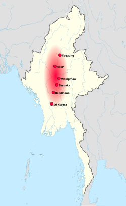
Pyu city-states, c. 8th century

Following the Pagan era, the Taungoo (1510) and Konbaung (1752) dynasties expanded the empire's reach. However, the 19th century brought British intervention, leading to the establishment of British Burma by January 1, 1886. This period of colonial rule ended on January 4, 1948, when Myanmar gained independence from the United Kingdom.
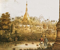
A British 1825 lithograph of Shwedagon Pagoda shows British occupation during the First Anglo-Burmese War.

The post-independence era has been defined by political instability, including military coups in 1962, 1988, and most recently on February 1, 2021. These events have led to prolonged periods of military rule and ongoing civil conflicts.
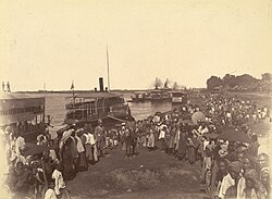
The landing of British forces in Mandalay after the last of the Anglo-Burmese Wars, which resulted in the abdication of the last Burmese monarch, King Thibaw Min

Geography and Climate

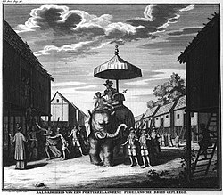
Portuguese ruler mounting an Elephant and his soldiers. Philips, Jan Caspar (draughtsman and engraver)

Myanmar is divided into several states and regions, including the Kachin, Kayah, Kayin, Chin, Mon, Rakhine, and Shan states, alongside various regions and the Naypyidaw Union Territory. The landscape is highly varied, featuring the limestone formations of Kayin State and diverse climatic zones.
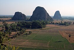
The limestone landscape of Kayin State

The country's climate is categorized by the Köppen climate classification, influencing its rich biodiversity and agricultural output. Water makes up approximately 3.06% of the total land area.
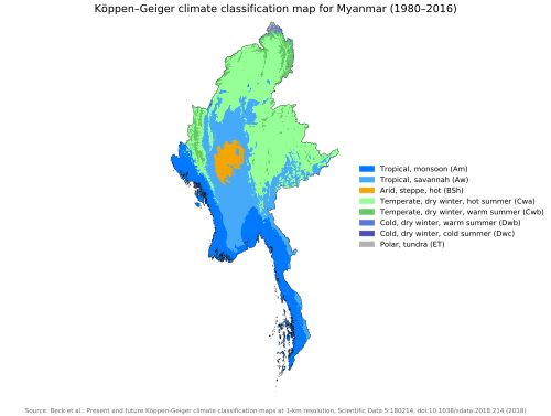
Myanmar map of Köppen climate classification

Demographics and Society

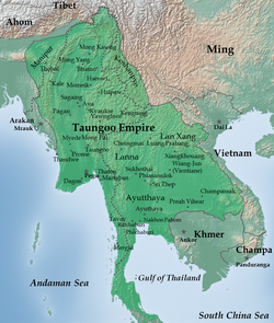
Toungoo Empire under Bayinnaung in 1580

Myanmar is a multi-ethnic society. The Bamar people constitute the largest group at approximately 68.78%, followed by the Karen, Rakhine, Shan, and Mon peoples. This ethnic diversity is reflected in the recognized regional languages, which include Chin, Kachin, Karen, Kayah, Mon, Rakhine, and Shan.
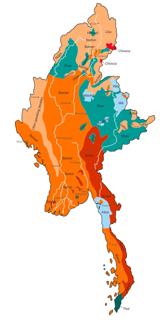
Ethnolinguistic groups of Burma/Myanmar

Religion plays a central role in daily life, with Buddhism serving as the official religion. Other significant faith groups include Christians (6.2%), Muslims (4.3%), and Hindus (0.5%).
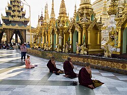
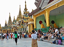
Praying Buddhist monks in Shwedagon Pagoda

Cultural Traditions

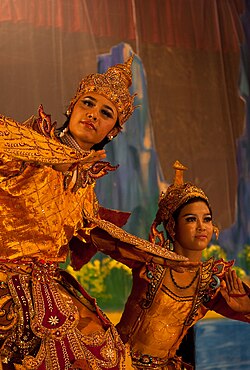
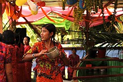
The culture of Myanmar is deeply intertwined with Buddhist practices, such as the Shinbyu ceremony (a novitiation rite for boys). Traditional arts include the Kinnayi Kinnaya dance and the celebration of the Thingyan Water Festival, marking the Burmese New Year.
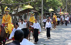
A Buddhist Shinbyu ceremony in Mandalay

Economy and Infrastructure

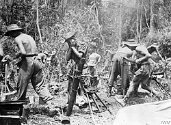
British troops firing a mortar on the Mawchi road, July 1944

Myanmar's economy is heavily reliant on agriculture, with rice being the largest agricultural product. The nation is also world-renowned for its precious gemstones, particularly the high-quality rubies found in Mogok.
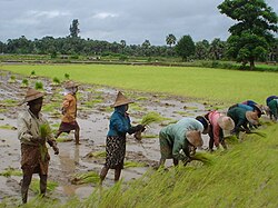
Rice is Myanmar's largest agricultural product.

Large ruby (corundum) crystal from Mogok. Size: 5.5 × 3.2 × 3 cm.[260]

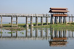
Infrastructure remains a challenge; for example, the railway system is relatively slow, with a trip from Bagan to Mandalay taking roughly 7.5 hours to cover 179 km. Tourism is another key sector, with visitors drawn to the pagodas of Bagan and the U Bein Bridge in Mandalay.
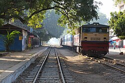
The trains are relatively slow in Myanmar. The railway trip from Bagan to Mandalay takes about 7.5 hours (179 km or 111 mi).

U Bein Bridge in Mandalay

Administrative and Economic Summary

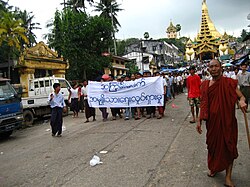
Protesters in Yangon during the 2007 Saffron Revolution with a banner that reads non-violence: national movement in Burmese. In the background is Shwedagon Pagoda.
Myanmar National Profile Summary
Category Detail
GDP (PPP) 2025 Est. $273.200 billion
GDP (Nominal) 2025 Est. $60.560 billion
HDI (2023) 0.609 (Medium)
Gini Coefficient (2017) 30.7 (Medium inequality)
Population Density 217/sq mi

Frequently Asked Questions

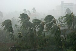
Cyclone Nargis in southern Myanmar, May 2008
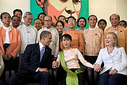
U.S. President Barack Obama and Secretary of State Hillary Clinton with Aung San Suu Kyi and her staff at her home in Yangon, 2012
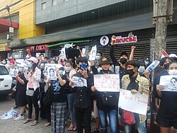
Protesters against the military coup in Myanmar
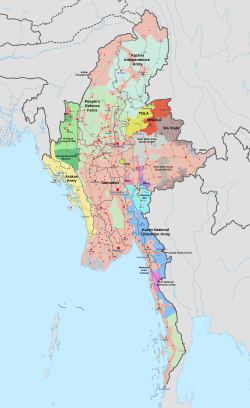
Military situation in Myanmar as of 4 April 2025. Areas controlled by the Tatmadaw are highlighted in pink.
A clickable map of Burma/Myanmar exhibiting its first-level administrative divisions.
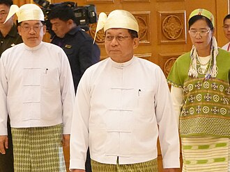
President Min Aung Hlaing (center) flanked by first and second vice-presidents, respectively, Nyo Saw (left) and Nan Ni Ni Aye (right) at the Pyidaungsu Hluttaw in 2026
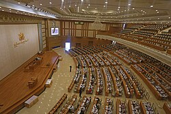
Assembly of the Union (Pyidaungsu Hluttaw)
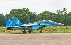
A Myanmar Air Force Mikoyan MiG-29 multirole fighter
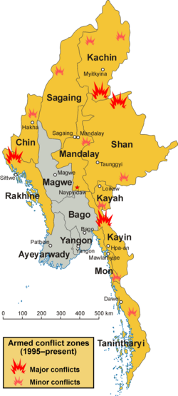
Map of conflict zones in Myanmar. States and regions affected by fighting during and after 1995 are highlighted in yellow.
Mae La camp, Tak, Thailand, one of the largest of nine UNHCR camps in Thailand[218]
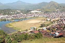
Mogok City
Mogok City
Tourists in Myanmar
Tourists in Myanmar
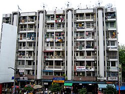
A block of apartments in downtown Yangon, facing Bogyoke Market. Much of Yangon's urban population resides in densely populated flats.
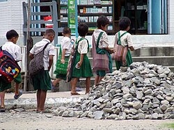
Students on their way to school, Kalaymyo, Sagaing Region, Myanmar
Burmese Kinnayi Kinnaya dance
An Arakan (Rakhine) girl pours water at travellers during the Burmese New Year Thingyan Water Festival in Yangon.
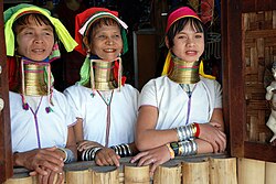
Kayan women in a village near Inle Lake, 2010

What is the difference between Burma and Myanmar?

Burma was the name used during the British colonial period and by many international entities after independence. Myanmar is the official name adopted by the government.

Which is the largest city in Myanmar?

Yangon is the largest city, while Naypyidaw serves as the official capital.

What are the primary ethnic groups in the country?

The Bamar are the majority (68%), followed by the Shan, Karen, Rakhine, and other minority groups.

What is the main economic driver of Myanmar?

Agriculture is the primary driver, specifically rice production, supplemented by the mining of precious stones like rubies.

What is the official religion of Myanmar?

Buddhism is the official religion, practiced by approximately 87.9% of the population.