Manchuria: The Complex History and Geography of Northeast China
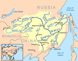
The term Manchuria refers to a vast and historically significant region in Northeast Asia. While the name is widely recognized globally, its usage is deeply intertwined with shifting political boundaries, ethnic identities, and the complex legacy of 20th-century imperialism. Today, the area is most commonly referred to in China as the Northeast, a term that reflects modern administrative realities and moves away from the colonial connotations associated with the older name.
Key Facts
- Modern Designation: Primarily known today as Northeast China.
- Historical Names: Also referred to as the Three Eastern Provinces or Guandong.
- Major Ethnic Groups: Historically home to the Jurchen and Manchu peoples, with significant Han Chinese migration.
- Political History: Once the heartland of the Qing dynasty and later the site of the Japanese puppet state, Manchukuo.
- Etymology: "Manchuria" is an exonym of Japanese origin derived from the endonym "Manchu."
Naming and Terminology
The nomenclature of this region is a subject of scholarly debate. The name "Manchuria" (Mǎnzhōu in Mandarin) is an exonym—a name given to a place by outsiders—derived from the Manchu people. While the term gained prominence in the 18th and 19th centuries through Japanese usage and subsequent European adoption, its status as a traditional Chinese toponym is disputed.
![One of the earliest European maps using the term "Manchuria" (Mandchouria) (John Tallis, 1851). Previously, the term "Chinese Tartary" had been commonly applied in the West to Manchuria and Mongolia[8]](/images/cc/d7/ccd787fe4fc478481c30bc9212d7399f2455129444a2d2f575dd9f2c1d76e399.jpg)
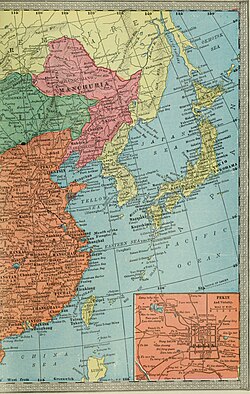
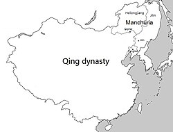
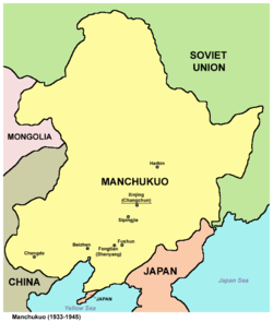
During the Qing dynasty, the region was officially organized as the Three Eastern Provinces (Dōngsānshěng), comprising Fengtian (modern-day Liaoning), Jilin, and Heilongjiang. Following the Mukden Incident in 1931 and the establishment of the puppet state Manchukuo, the term "Manchuria" saw increased use by the Empire of Japan. In contemporary China, the term is often avoided or deprecated due to its associations with Japanese imperialism, with "Northeast" serving as the orthodox designation.
![Map of the three provinces of Northeast China (1911)[9]](/images/00/43/004342697f92cf3064bc489cf241532cf474f8f50c81fae18eb441eb1f9d0a75.png)
Historical Evolution
Early Dynasties and the Jurchen People
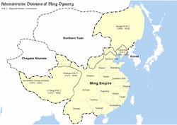
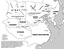
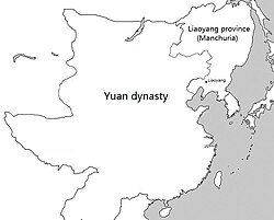
The history of the region is defined by the various groups that inhabited its forests and plains. Long before the rise of the Manchus, the Khitan people established the Liao dynasty (916–1125), becoming the first state to control the entirety of the region. Later, the Jurchen people inhabited areas such as Nurgan, a name used during the Ming dynasty.
The Jurchens eventually evolved into the Manchu people, who founded the Later Jin dynasty in 1616, which later became the Qing dynasty. This lineage transformed the region from a frontier territory into the ancestral homeland of the emperors who would go on to rule much of China.
The Qing Dynasty and Demographic Shifts
Under the Qing, the region underwent significant demographic changes. Although the Qing government initially placed restrictions on Han Chinese settlement to preserve Manchu and Mongol lands, economic and environmental factors led to massive migration. By the 18th century, the Qianlong Emperor allowed Han peasants fleeing famine and drought to settle in the area to restore land to cultivation.
This migration was so substantial that by 1800, Han Chinese made up approximately 80 to 90 percent of the population in many towns and garrisons. By 1900, the population was overwhelmingly Han, with 15 million out of 17 million inhabitants being Han Chinese. This shift was compounded by the fact that many Manchus moved away from the region to live in Beijing.
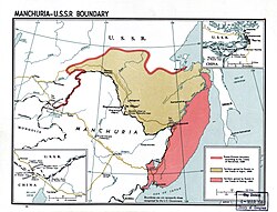
The borders of the region also shifted through diplomacy and conflict. The Treaty of Nerchinsk in 1689 established early boundaries, but subsequent treaties, such as the Treaty of Aigun (1858) and the Treaty of Peking (1860), resulted in territorial losses to Russia.
The 20th Century: Manchukuo and Beyond
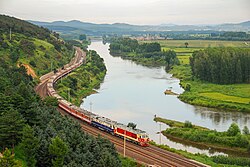
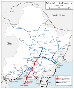
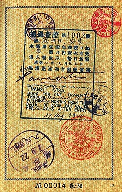
The early 20th century brought profound political upheaval. Following the 1931 Manchurian Incident, Japan established Manchukuo, a puppet state that existed until 1945. This era was characterized by intense Japanese colonial activity, including the development of extensive rail networks and the migration of Japanese farmers to the region.
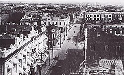
The region also became a melting pot of international influence, seen in cities like Harbin, which developed a distinct architectural and cultural character influenced by Russian presence.
Summary of Regional Designations
| Term | Context/Origin | Primary Usage Period |
|---|---|---|
| Northeast (Dongbei) | Chinese administrative term | Modern/Contemporary |
| Three Eastern Provinces | Qing Dynasty administrative division | 1683 – Early 20th Century |
| Manchuria | Japanese exonym | 18th Century – Mid 20th Century |
| Manchukuo | Japanese puppet state | 1932 – 1945 |
Frequently Asked Questions
Why is the term "Manchuria" controversial in China?
The term is often associated with the period of Japanese imperialism and the establishment of the puppet state Manchukuo. Because of these colonial connotations, the term is frequently deprecated in favor of "Northeast China."
Who were the Jurchen people?
The Jurchen were a Tungusic people who inhabited the region long before the Manchu identity was formalized. They eventually became the Manchus, who founded the Later Jin and later the Qing dynasty.
What were the Three Eastern Provinces?
This was the official administrative designation used during the Qing dynasty, referring to the provinces of Fengtian, Jilin, and Heilongjiang.
How did the population of the region change over time?
While originally inhabited by groups like the Khitan, Jurchen, and Manchu, massive migration of Han Chinese peasants—encouraged by the Qing government to farm wasteland—resulted in a Han Chinese majority by the late 19th and early 20th centuries.
What is the difference between Manchu and Manchuria?
"Manchu" is an endonym, referring to the ethnic group itself. "Manchuria" is an exonym, a geographical name used by outsiders (primarily of Japanese origin) to describe the region inhabited by the Manchu people.