Jilin Province: A Hub of Industry and Natural Beauty in Northeast China
Located in the heart of northeastern China, Jilin Province is a region defined by its dramatic landscapes, strategic border positions, and a robust industrial backbone. Named after the Manchu phrase girin ula, meaning "along the river," Jilin serves as a vital link between China, Russia, and North Korea. From the towering peaks of Mount Paektu to the bustling urban center of Changchun, the province blends a rich ethnic tapestry with modern economic ambition.
Key Facts
- Capital: Changchun (the largest city).
- Geography: Borders Russia to the east and North Korea to the southeast.
- Population: Approximately 24.07 million (2020 census).
- Highest Point: Mount Paektu, reaching 2,744 meters.
- Economy: 2025 nominal GDP of CN¥ 1,497 billion (US$ 210 billion).
- Ethnic Diversity: Predominantly Han (91%), with significant Korean (4%) and Manchu (4%) populations.
History and Evolution
The demographic landscape of Jilin shifted significantly after 1860, when the government encouraged Han Chinese migrants, primarily from Shandong, to settle in the region following the cession of Primorsky Krai to Russia. By the early 20th century, Han Chinese had become the dominant ethnic group.
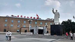
The mid-20th century was a period of intense geopolitical transition. In 1932, the region was incorporated into Manchukuo, a puppet state established by Japan, with Changchun (then known as Xinjing) serving as its capital. Following Japan's defeat in 1945, the Soviet Red Army captured Jilin during Operation August Storm. The region was subsequently ceded to the Communists, serving as a critical staging ground for the eventual victory of the Communist Party in the Chinese Civil War.
Geography and Climate
Jilin covers an area of approximately 191,126 square kilometers. The province is renowned for its vast mineral wealth, boasting 136 types of minerals, 70 of which have been actively extracted. It is also a sanctuary for Traditional Chinese medicine, hosting roughly 27,000 species of wild plants and 9,000 types of medicinal herbs.
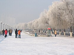
The region experiences a northerly continental monsoon climate. This results in long, harsh winters—with January temperatures often dipping between −20 and −14 °C—and short, warm summers. Annual rainfall typically ranges from 350 to 1,000 mm.
Administrative Structure and Urban Centers
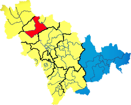
Jilin is organized into 9 prefectures, 60 counties, and 1,006 townships. The administrative heart is Changchun, located 113 km west of Jilin City. A notable division is the Yanbian Korean Autonomous Prefecture, which highlights the province's ethnic diversity.
| Division | Seat | Approx. Population (2010) |
|---|---|---|
| Changchun City | Nanguan District | 7,677,089 |
| Jilin City | Chuanying District | 4,414,681 |
| Siping City | Tiexi District | 3,386,325 |
| Songyuan City | Ningjiang District | 2,881,082 |
| Yanbian Korean AP | Yanji City | 2,271,600 |
Economy and Technological Development
Jilin's economy has shown strong growth, with a nominal GDP reaching US$ 210 billion by 2025. The province has strategically developed several Economic and Technological Development Zones (ETDZs) to foster innovation and trade.
Industrial Hubs
- Jilin New and Hi-tech Industry Development Zone: Focuses on new materials, bioengineering, electronics, and refined chemical products.
- Changchun Economic & Technological Development Zone (CETDZ): A state-level zone with significant foreign investment and high industrial output.
- Changchun High-Tech Industrial Development Area: Notable for being the first in Northeast China to achieve ISO14001 environmental certification.
- Hunchun Border Economic Cooperation Zone: Located at the junction of China, Russia, and North Korea, specializing in seafood processing and bio-pharmaceuticals.
Infrastructure and Connectivity
The province possesses an extensive transport network, including over 35,216 km of highways and 500 km of expressways. The rail network, with Changchun as the primary hub, is a cornerstone of regional logistics. A major milestone was the 2012 completion of the Harbin–Dalian High-Speed Railway, which allows trains to reach speeds of 350 km/h.
Education and Culture
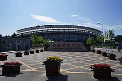
Jilin is a center for higher learning in the northeast, home to prestigious institutions such as Jilin University, Northeast Normal University, and Yanbian University. The province also maintains a vibrant sports culture, with professional teams like the Jilin Northeast Tigers (CBA) and Changchun Yatai (Chinese Super League).
Frequently Asked Questions
What is the meaning of the name "Jilin"?
The name Jilin is a transcription of the Manchu phrase "girin ula," which translates to "along the river."
Which is the largest city in Jilin Province?
Changchun is the capital and the largest city in the province.
What are the primary ethnic groups in Jilin?
The population is predominantly Han Chinese (91%), followed by Koreans (4%), Manchus (4%), Mongols (0.6%), and Hui (0.5%).
What is the climate like in Jilin?
Jilin has a northerly continental monsoon climate characterized by very cold, long winters and short, warm summers.
What is the significance of the Hunchun Border Economic Cooperation Zone?
It is a strategic national-level zone located where the borders of China, Russia, and North Korea meet, focusing on trade and industries like seafood processing and electronics.