Lake Pontchartrain: The Vital Estuary of Southeastern Louisiana
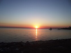
Located in southeastern Louisiana, Lake Pontchartrain is a massive, roughly oval body of water that serves as a critical geographic and ecological feature of the Gulf Coast. While commonly referred to as a lake, it is scientifically an estuary—a coastal body of water where freshwater from rivers mixes with saltwater from the open sea. Because its connection to the Gulf of Mexico is narrow, it retains a lake-like appearance while functioning as a saline lagoon.
The estuary is central to the identity and history of the region, forming the northern boundary of New Orleans. Its strategic location provided a vital portage between the lake and the Mississippi River, a factor that was instrumental in the founding of New Orleans in 1718.
Key Facts
- Type: Saline estuary.
- Surface Area: 630 square miles (1,600 km²).
- Dimensions: Approximately 40 miles long (east-west) and 24 miles wide (north-south).
- Average Depth: 12 to 14 feet (3.7 to 4.3 meters).
- Watershed: Part of the 10,000 square mile Pontchartrain Basin.
- Connectivity: Linked to the Gulf of Mexico via the Rigolets strait and Chef Menteur Pass.
Geography and Ecosystem
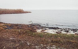
Lake Pontchartrain is a cornerstone of the North American Gulf Coast wetlands. It is fed by several major freshwater sources, including the Tangipahoa, Tchefuncte, Tickfaw, Amite, and Bogue Falaya rivers, as well as Bayou Lacombe and Bayou Chinchuba. This mixture of fresh and salt water creates a diverse environment comprising over 125,000 acres of wetlands.
These ecosystems include bottomland hardwoods, cypress swamps, and a variety of herbaceous marshes categorized as fresh, intermediate, or brackish. However, these habitats have faced significant stress over the decades due to pollution, saltwater intrusion, and the historical logging of cypress swamps.
The Pontchartrain Basin
The lake is the centerpiece of the larger Pontchartrain Basin, a vast watershed spanning 16 Louisiana parishes and 4 Mississippi counties. This system includes not only Lake Pontchartrain but also Lake Maurepas, the Rigolets, Lake Borgne, the Biloxi Marsh, and Chandeleur Sound.
Historical Development and Human Impact
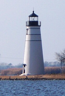
The estuary formed between 4,000 and 2,600 years ago through the accumulation of alluvial deposits from the evolving Mississippi River Delta. Human presence in the area dates back at least 3,500 years, with Indigenous peoples referring to the waters as Okwata, meaning "wide water."
In the modern era, the lake has seen significant industrial and infrastructural development. The 1920s saw the opening of the Industrial Canal, creating a navigable link between the Mississippi River and the lake. Later, in the 1950s and 1960s, the Lake Pontchartrain Causeway was constructed, creating a direct north-northeast transit line between New Orleans (via Metairie) and Mandeville.
Industrialization has not come without a cost. Decades of oil and gas drilling led to significant pollution, resulting in a state-enacted moratorium on drilling. Despite this, the Louisiana Department of Environmental Quality and the US Coast Guard continue to report frequent oil spills within the region's sensitive wetlands.
Hurricanes and Flood Management
Due to its low elevation and proximity to the Gulf, Lake Pontchartrain is a primary conduit for storm surges during hurricanes. When powerful storms push water into the estuary, it can overwhelm the levee systems designed to protect New Orleans and its suburbs.
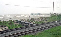
Historically, a 1947 hurricane flooded much of Metairie, leading to the construction of protection levees. Following Hurricane Betsy in 1965, these levees were raised to heights of 14 to 23 feet. However, these defenses were primarily designed to withstand a Category 3 hurricane, leaving the city vulnerable to more intense storms.
The Impact of Hurricane Katrina
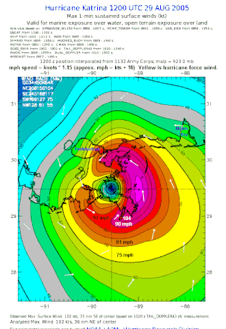
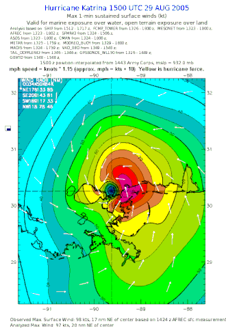
The vulnerability of the system was catastrophically demonstrated during Hurricane Katrina in August 2005. Although the storm weakened to Category 3 before landfall, the storm surge caused multiple levee and floodwall failures. Approximately 80% of New Orleans was flooded, with an estimated 25 billion gallons of water covering the city—roughly 2% of the lake's total volume.
In suburban areas like Metairie and Kenner, flooding occurred not just from overtopping, but because drainage pumping stations were abandoned, allowing lake water to flow backward into drainage canals.
Summary of Lake Characteristics
| Feature | Measurement/Detail |
|---|---|
| Max Length | 40 mi (64 km) |
| Max Width | 24 mi (39 km) |
| Surface Area | 630 sq mi (1,600 km²) |
| Average Depth | 12–14 ft (3.7–4.3 m) |
| Max Depth | 65 ft (20 m) |
| Surface Elevation | 1 ft (0.30 m) |
Frequently Asked Questions
Is Lake Pontchartrain actually a lake?
Technically, no. It is an estuary, which is a coastal body of water where freshwater from rivers meets saltwater from the ocean. It is called a lake because its connection to the Gulf of Mexico is narrow, giving it the appearance of a lake.
How did Hurricane Katrina affect the lake and the city?
Hurricane Katrina's storm surge caused widespread levee and floodwall failures along the lakefront, flooding 80% of New Orleans. Additionally, about 25 billion gallons of water covered the city, and the subsequent pumping of untreated water back into the lake raised environmental concerns.
What is the Lake Pontchartrain Causeway?
The Causeway is a major bridge constructed in the 1950s and 1960s that connects New Orleans (via Metairie) to Mandeville, bisecting the lake in a north-northeast direction.
What are the main environmental threats to the estuary?
The lake's ecosystems have been stressed by decades of oil and gas drilling, the logging of cypress swamps, pollution, and saltwater intrusion. These factors have degraded the surrounding wetlands and prompted ongoing restoration efforts.
What is the Pontchartrain Basin?
The Pontchartrain Basin is a 10,000 square mile watershed that includes Lake Pontchartrain, Lake Maurepas, the Rigolets, Lake Borgne, the Biloxi Marsh, and Chandeleur Sound, spanning parts of Louisiana and Mississippi.