Intracoastal Waterway: The 3,000-Mile Arterial Route of the US Coasts
The Intracoastal Waterway (ICW) is a massive 3,000-mile (4,800 km) inland navigation system that hugs the Atlantic and Gulf of Mexico coasts of the United States. Stretching from Massachusetts in the northeast to Brownsville, Texas, in the southwest, this network allows vessels to travel along the coast while avoiding the hazards of the open sea. The system is a hybrid of natural features—including saltwater rivers, bays, sounds, and inlets—and artificial canals engineered for transit.
Maintained and dredged by the United States Army Corps of Engineers (USACE), the ICW serves as a critical corridor for both commercial freight and recreational boating. It also forms the eastern leg of the Great Loop, a popular route that enables waterborne circumnavigation of the eastern continental United States with minimal ocean exposure.

Key Facts
- Total Length: Approximately 3,000 miles (4,800 km).
- Termini: Starts at the Annisquam River (Massachusetts) and ends in Brownsville, Texas.
- Completion Date: The system was officially completed on June 18, 1949.
- Management: Maintained and improved by the U.S. Army Corps of Engineers.
- Primary Use: Commercial barge transport (petroleum, food, building materials) and recreational boating.
- Funding: Supported partly by a commercial barge fuel tax via the Inland Waterways Trust Fund.
Historical Evolution
Early Visions and the Gallatin Plan
The concept of a protected inland route dates back to the early days of the United States. In 1808, Treasury Secretary Albert Gallatin proposed a comprehensive transportation plan to the Senate. He identified four critical "necks of land" that, if bridged by canals, would create a secure tide-water navigation system from Massachusetts to Georgia. While his full $20 million, 10-year plan was not immediately approved, the War of 1812 and subsequent British blockades underscored the strategic necessity of such a route.
19th Century Growth and Railroad Competition
Throughout the 1800s, the U.S. government began surveying and constructing segments of the waterway, starting with the General Survey Act of 1824. However, the rise of railroads after the Civil War diverted funding away from water transport. Despite this, the government continued to promote waterway competition to prevent railroad monopolies, leading to the River and Harbors Appropriations Acts of 1882 and 1884, which reaffirmed a policy of freedom from tolls.
20th Century Modernization
The transition from steam to diesel engines in the late 19th and early 20th centuries revolutionized waterway efficiency. The Rivers and Harbors Act of 1909 established the national policy for a route from Boston to the Rio Grande. The opening of the Panama Canal in 1914 further spurred interest by connecting coastal shipping to the West Coast. By 1942, the pressures of World War II—specifically the threat of German submarines—accelerated the completion of the channel between New Orleans and Corpus Christi to ensure the safe movement of bulk materials.
Route and Geography
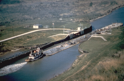
The ICW is divided into three non-contiguous segments. The first and second sections are known as the Gulf Intracoastal Waterway, running from Brownsville, Texas, to Carrabelle, Florida, and from Tarpon Springs to Fort Myers, Florida. The third section is the Atlantic Intracoastal Waterway (AIWW), extending from Key West, Florida, north to Portsmouth, Virginia.
While these segments were originally intended to be connected via the Cross Florida Barge Canal and other dredged routes, environmental concerns halted those projects. North of Portsmouth, the route continues through various canals and bays, eventually traversing the Cape Cod Canal and ending at the Annisquam River in Massachusetts.
The New Jersey Alternative
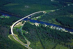
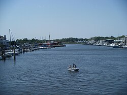
For vessels with a draft between 6 and 12 feet, the New Jersey Intracoastal Waterway offers an inland alternative. This 117.7-mile segment runs from Manasquan Inlet through the Point Pleasant Canal and Barnegat Bay to Cape May Harbor. Larger commercial vessels typically bypass this shallow-draft route in favor of offshore travel.
Commercial and Recreational Utility
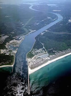
The waterway is a hub of economic activity. Commercial barges transport essential goods, including petroleum products, foodstuffs, and manufactured materials. It also connects to major inland ports via rivers such as the Mississippi, Hudson, Delaware, and Savannah. Through the Hudson River and Erie Canal, the ICW provides a link to the Great Lakes and the St. Lawrence Seaway.
Recreationally, the ICW is frequented by "snowbirds" who migrate between the north and south seasonally, as well as boaters seeking refuge when open ocean conditions are too rough for safe passage.
Waterway Specifications Summary
| Feature | Details |
|---|---|
| Total Length | 3,000 miles (4,800 km) |
| Official Termini | Annisquam River, MA to Brownsville, TX |
| Standard Depth | Minimum 12 feet (though some sections remain at 7-9 feet) |
| Major Components | Atlantic Intracoastal Waterway (AIWW) & Gulf Intracoastal Waterway |
| Key Artificial Links | Cape Cod Canal, Chesapeake and Delaware Canal |
Frequently Asked Questions
Is the Intracoastal Waterway one continuous channel?
No, it consists of three non-contiguous segments. The Gulf and Atlantic portions were intended to be connected by projects like the Cross Florida Barge Canal, but these were never completed due to environmental concerns.
Who is responsible for maintaining the ICW?
The United States Army Corps of Engineers (USACE) is responsible for the maintenance, improvement, and dredging of the waterway.
Are there tolls for using the Intracoastal Waterway?
No, there are no tolls for usage. However, since 1978, commercial barge users have paid a fuel tax to fund the maintenance and rehabilitation of the infrastructure via the Inland Waterways Trust Fund.
What is the difference between the AIWW and the Gulf Intracoastal Waterway?
The Atlantic Intracoastal Waterway (AIWW) covers the eastern seaboard from Florida to Virginia, while the Gulf Intracoastal Waterway covers the coast from Florida to Texas.
What is the "Great Loop"?
The Great Loop is a waterborne route that allows boaters to circumnavigate the eastern continental United States. The Intracoastal Waterway provides the essential eastern leg of this journey, minimizing the need for open-ocean travel.