Hatay Province: A Crossroads of History, Culture, and Resilience
Located at the southernmost tip of Turkey, Hatay Province is a region defined by its strategic position and a complex, multicultural heritage. Bordering Syria to the south and east, and stretching along the eastern coast of the Levantine Sea, Hatay serves as a bridge between Anatolia and the Levant. Its administrative capital, Antakya (ancient Antioch), is one of the few Turkish provinces not named after its capital city, reflecting a unique identity shaped by centuries of shifting empires and diverse populations.
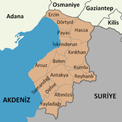
The province is characterized by its fertile lands, including parts of the Cilician Plain, and its major urban centers, Antakya and İskenderun (formerly Alexandretta). With a population of 1,686,043 as of 2022, Hatay remains a vital hub of trade, religion, and history.
Key Facts
- Administrative Center: Antakya (Ancient Antioch).
- Total Area: 5,524 km².
- Population: 1,686,043 (2022).
- Geography: Situated on the Levantine Sea coast, bordering Syria, Adana, Osmaniye, and Gaziantep.
- Major Cities: Antakya and İskenderun.
- Climate: Mediterranean, with significant annual precipitation (1,124.2 mm).
Historical Evolution and Political Transitions
The Sanjak of Alexandretta
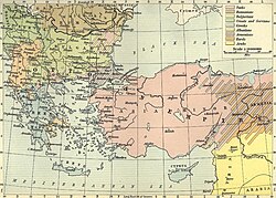
The modern history of Hatay is deeply intertwined with the Sanjak of Alexandretta. Following World War I, the region was awarded to Syria under a French mandate. However, the area possessed a diverse demographic mix. In 1936, French estimates indicated a population of 220,000 consisting of 46% Arabs (including Alawites, Sunnis, and Christians), 39% Turks, 11% Armenians, and 4% others, including Jews, Kurds, and Circassians.
The Transition to Turkish Sovereignty
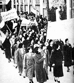
Tensions rose in the 1930s as Turkey, under Mustafa Kemal Atatürk, claimed the region as a Turkish homeland. This period saw the emergence of the Hatay State (Republic of Hatay), a transitional political entity that existed from September 7, 1938, to June 29, 1939. Following a controversial referendum in June 1939, the state was annexed by Turkey, officially becoming the 63rd Turkish province on July 7, 1939.
The Turkish–Syrian Dispute
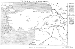
Syria has historically disputed the separation of Hatay, arguing that the annexation violated the French mandate's responsibility to maintain Syrian territorial unity. While Syria continued to show Hatay as part of its territory on maps into the 2010s, diplomatic relations thawed in the 2000s. This led to a period of strengthened ties and the opening of borders, although land ownership laws were later adjusted in 2006 to limit foreign ownership after a surge in property purchases by Syrian nationals.
Geography, Climate, and Demographics
Regional Geography
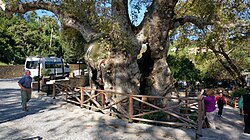
Hatay's landscape is a blend of coastal plains and rugged terrain. The province is divided into several districts, with Antakya and İskenderun being the most populous. The region is also home to significant natural landmarks, such as the Hıdırbey Musa Ağacı (Moses Tree) in Samandağ.
Climate Profile
The province experiences a Mediterranean climate with hot, dry summers and mild, wet winters. The highest recorded temperature reached 44.6°C, while the lowest dropped to -11.8°C.
| Month | Mean Max Temp (°C) | Mean Min Temp (°C) | Precipitation (mm) | Sunshine Hours (Daily Mean) |
|---|---|---|---|---|
| January | 12.5 | 5.0 | 179.5 | 3.4 |
| April | 23.0 | 12.6 | 108.4 | 7.3 |
| July | 31.6 | 24.4 | 8.1 | 11.0 |
| October | 28.2 | 16.2 | 56.0 | 7.0 |
Demographics and Language
Hatay is a mosaic of ethnic and religious groups. The population has grown steadily from approximately 246,000 in 1940 to over 1.6 million by 2022. The linguistic landscape includes Turkish and Arabic, with various religious affiliations including Sunni and Alawite Muslims, Christians, and historically, Jewish communities.
![Late 20th – early 21st century language distribution. • Turkish • Arabic speakers are shown by religious affiliation: Alawite (circle), Christian (triangle), Sunni (square), Bedouin Sunni (rectangle), Jewish (rhombus).[45][a]](/images/4b/1b/4b1b59b84b99b4dddc2a2488ddb0f0644aa3eb7f61ab21e77d2eb3557227e5ed.webp)
Culture and Landmarks
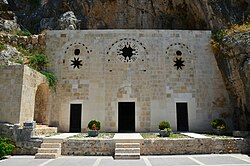
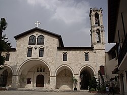
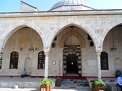
The province is renowned for its religious diversity and architectural heritage. Key sites include the Church of Saint Peter, St. Paul's Church, and the Habib-i Nejjar Mosque, often standing in close proximity as symbols of coexistence.
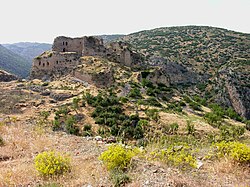
Military history is also evident in the region's numerous fortifications, such as the ruins at Bağras, Payas Castle, and Koz Castle.
The local cuisine is a highlight of the region, featuring traditional flavors such as muhammara (a walnut and spice paste) and Za'atar (a thyme and parsley paste).
The 2023 Earthquake Impact
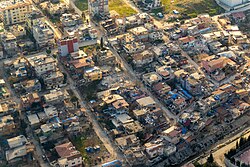
In 2023, Hatay was one of the regions most severely affected by the Turkey–Syria earthquakes. The devastation was catastrophic, with 23,065 fatalities and 30,762 injuries recorded in the province. Over 13,500 buildings collapsed, and tens of thousands more were heavily damaged. The districts of Antakya, Kırıkhan, and İskenderun suffered the most, while Erzin remained remarkably unaffected with no building collapses reported.
Frequently Asked Questions
Why is Hatay not named after its capital city?
Hatay is one of three Turkish provinces not named after its administrative capital. While its capital is Antakya, the province takes the name Hatay, which is linked to historical and nationalist theories regarding the region's ancient inhabitants.
What was the Hatay State?
The Hatay State was a transitional political entity that existed between September 1938 and June 1939. It served as a bridge between the French Mandate of Syria and the province's eventual annexation into Turkey.
Which areas of Hatay were most affected by the 2023 earthquake?
The most heavily impacted areas were Antakya, Kırıkhan, and İskenderun. Conversely, the district of Erzin did not experience any building collapses during the disaster.
What are some of the most famous foods from Hatay?
Hatay is well-known for its rich culinary traditions, specifically the spice and walnut paste known as muhammara and the herbal blend called Za'atar.
What is the demographic makeup of the region?
Hatay is highly diverse, with a population that includes Turks and Arabs (both Sunni and Alawite), as well as Armenian and other minority communities, reflecting its history as a crossroads of civilizations.