Han River: The Lifeline of Seoul and Symbol of Korean Growth
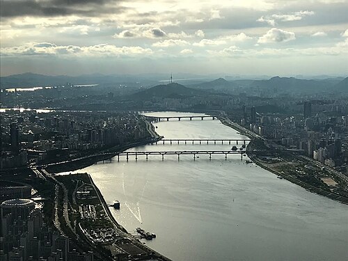
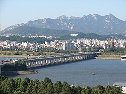
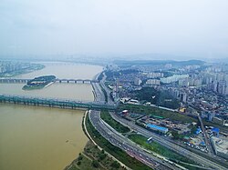
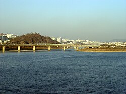
The Han River (Hangang) is more than just a body of water; it is the geographical and emotional heart of South Korea. Flowing through the center of Seoul, it is one of the few instances globally where a major metropolis is divided by a river of such immense width—approximately 1.2 kilometers across in the city center. The river is so central to the nation's identity that the phrase "Miracle on the Han River" has become the global shorthand for South Korea's rapid economic transformation.
From its origins in the Taebaek Mountains to its mouth at the Yellow Sea, the river has shaped the political, cultural, and ecological landscape of the Korean Peninsula for millennia.
Key Facts
- Total Length: Approximately 508 to 514 kilometers.
- Basin Size: 35,770 square kilometers.
- Source: Geumdae Peak in the Taebaek Mountains, Gangwon Province.
- Mouth: The Yellow Sea, at the northwestern tip of the Gimpo peninsula.
- Average Discharge: 613 cubic meters per second (measured at Hangang Bridge).
- Major City: Seoul, the capital of South Korea.
Etymology and Ancient Names
The name "Han River" is derived from the Old Korean word Hangaram, where han means "big" or "great" and garam means "river." Throughout history, the river has been known by various names reflecting the different eras of Korean civilization:
- Arisu: An archaic term meaning "big water," used during the Goguryeo period. Today, this name is used as the brand for Seoul's municipal tap water.
- Daesu: A name used until the early Three Kingdoms period.
- Ungniha: The name used by the kingdom of Baekje.
- Gyeonggang: A term used during the Joseon period to refer to the river near the capital.
Historical Significance
From Ancient Capitals to the Joseon Dynasty
The strategic importance of the Han River basin was recognized as early as the Goryeo Dynasty. In the 21st year of King Munjong's reign, Yangju (modern-day Seoul) was promoted to Namgyeong (Southern Capital). After several failed attempts to move the capital due to political unrest and geomantic beliefs, the relocation to Hanyang (Seoul) was finally solidified in 1394 by Yi Seong-gye, the founder of the Joseon Dynasty.
Modern Conflict and Recovery
The 20th century brought significant turmoil. During the first week of the Korean War, the South Korean Army destroyed the Hangang Bridge to slow the advance of North Korean forces.
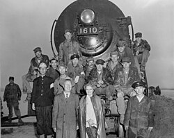
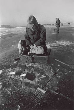
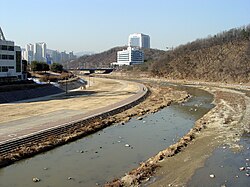
Following the war, the river suffered from severe pollution as rapid industrialization led to the dumping of urban and industrial waste. However, the 1988 Summer Olympics served as a catalyst for change, prompting government-led environmental efforts to clean the waterway for the Olympic rowing regatta.
Contemporary Developments
In recent years, the river has seen significant infrastructure growth. The 18-kilometer Ara Canal was completed in 2012, connecting the Han River near Gimpo to Incheon. More recently, on September 18, 2025, the Hangang Bus ferry service began operating across seven piers to improve urban mobility.
Geography and Urban Integration
The river's influence is visible in the very names of Seoul's neighborhoods. Many districts are named after former boat crossings (naru), such as Mapo, Ttukseom, and Noryangjin. Noryangjin, in particular, was a vital hub for grain and passenger transport, a legacy that continues today through the Noryangjin Fisheries Wholesale Market.
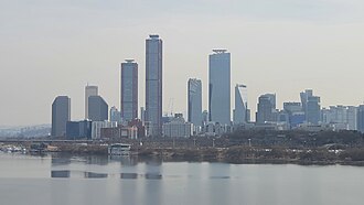
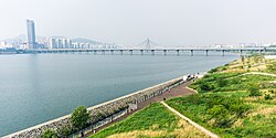
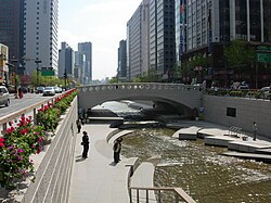
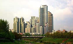
Today, the lower stretches of the river are a recreational paradise, featuring extensive pedestrian walkways, bicycle paths, and public parks. A 2011 survey ranked the river as the second most scenic location in Seoul, surpassed only by Namsan.
Major Crossings and Infrastructure
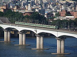
The Seoul National Capital Area is connected by 31 bridges crossing the Han River, including the Yanghwa, Dongho, and Jamsil bridges. Additionally, 11 subway lines cross the river, ensuring the seamless movement of millions of residents daily.
Ecology and Biodiversity
The Han River supports a diverse ecosystem. The riparian zones are dominated by willow and locust trees, with added species like poplar and birch through urban planting. As of 2022, 1,299 types of plant life have been recorded in the area.
The aquatic life is equally varied, with 69 fish species. Notable residents include the Korean endemic Gyeongmochi and Hwangbok. Among mammals, the river is home to water deer, raccoon dogs, and the legally protected otter, which serves as a key indicator of the ecosystem's health.
Summary of Han River Characteristics
| Feature | Detail |
|---|---|
| Source | Geumdae Peak, Taebaek Mountains |
| Mouth | Yellow Sea (Gimpo Peninsula) |
| Length | ~508–514 km |
| Max Width (Seoul) | Over 1 km |
| Key Tributaries | Bukhan River, Namhangang River, Jungnangcheon |
| Protected Species | Otters, Lynx |
Frequently Asked Questions
What does "Miracle on the Han River" mean?
It refers to the period of rapid economic growth and industrialization experienced by South Korea following the Korean War, transforming the nation from a war-torn economy into a global leader in technology and industry.
What is Arisu?
Arisu is an ancient name for the Han River meaning "big water." In modern times, it is the official brand name for the tap water provided by the Seoul Metropolitan Government.
How many bridges cross the Han River in the Seoul area?
There are a total of 31 bridges crossing the river within the Seoul National Capital Area, including various road and railway bridges.
Is the Han River used for transportation today?
While it no longer serves as a primary commercial artery, it is used for recreation and public transit, including the recently launched Hangang Bus ferry service and the Ara Canal for larger vessels.
What are the environmental challenges the river has faced?
The river suffered from heavy industrial pollution in the mid-20th century. It has also been the subject of environmental protests, such as those following the accidental dumping of formaldehyde by the US military in 2000.