Gangnam: The Evolution of Seoul's Most Affluent District
Gangnam, a name recognized globally through pop culture, is far more than a viral dance trend. Located south of the Han River in Seoul, South Korea, Gangnam has transformed from a rural periphery known as Yeongdong (meaning "East of Yeongdeungpo") into one of the most concentrated hubs of wealth, education, and corporate power in Asia. This metamorphosis was not accidental but the result of aggressive, state-led urban planning designed to reshape the capital city.
Historically, Seoul was concentrated north of the river. During the Joseon dynasty, the area south of the Han was largely undeveloped and outside the city's core boundaries.
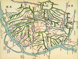
Key Facts
- Core Composition: Comprises the Gangnam, Seocho, and Songpa districts.
- Population: The total metropolitan area population reached 4,985,421 in 2020, with 1,553,172 in the core.
- Economic Status: Home to a vast majority of South Korea's top lawyers, doctors, and financial managers.
- Educational Hub: Contains over 32% of all hagwons (private tutoring centers) in Seoul.
- Rapid Growth: Land prices increased nearly 1,000 times between 1963 and 1979.
The Era of State-Led Development
The transformation of Gangnam began in the 1960s and 70s under the leadership of military dictator Park Chung Hee and Seoul mayor Kim Hyun-ok. The primary drivers were the need to combat urban sprawl in the north and a strategic desire to disperse the population away from the Korean Demilitarized Zone following a 1968 assassination attempt on Park by North Korean soldiers.
To incentivize migration south, the government implemented strict Gangbuk Suppression Policies, which limited the construction of new businesses and entertainment venues north of the river. Simultaneously, they invested heavily in infrastructure, including the opening of the Hannam Bridge in 1969 and the completion of the Gyeongbu Expressway in 1970, which linked Seoul to Busan.
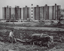
The Apartment Boom and Speculation
The government promoted the construction of high-rise apartments through tax exemptions and economic incentives. By 1985, 70% of Gangnam's housing consisted of apartments, compared to only 26.5% in the rest of Seoul. Many units were sold via a competitive lottery system restricted to the middle class. This led to the rise of the bok-buin ("Mrs. Realtor"), middle-class housewives who engaged in speculative real estate investment by reselling lottery tickets at market value.
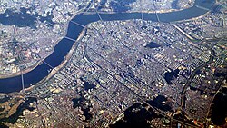
The Educational Mecca
One of the most effective strategies to attract affluent residents was the relocation of prestigious schools. The government provided subsidies and tax exemptions to institutions moving south. This was further accelerated by the High School Equalization Policy, which removed elite rankings, prompting schools to move to Gangnam to maintain their prestige.
Key relocations included Seoul National University in 1975 and Kyunggi High School in 1976. This established the region as an educational epicenter, specifically within the Eighth School District. Today, the Daechi neighborhood is the heart of this academic intensity, hosting over 900 hagwons.
Economic and Political Power
By the late 20th century, Gangnam had become the financial and legal heart of the city. In 1995, major judicial bodies, including the Supreme Court of Korea and the Supreme Prosecutor's Office, relocated to the Seocho neighborhood. This move triggered a massive concentration of law offices in the area.
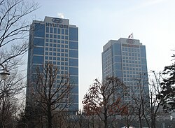
The wealth in Gangnam is staggering; as of 2021, more than 82,000 residents possessed a net worth exceeding 1 billion won. The region also holds significant political influence, with a high percentage of National Assembly members and top government officials residing there.
Culture and Global Recognition
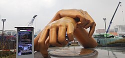
Gangnam's reputation for luxury and the "nouveau riche" lifestyle has made it a frequent subject of media. The 2012 global hit "Gangnam Style" by PSY parodied these class markers, while films like Gangnam Blues explored the region's gritty real estate history.
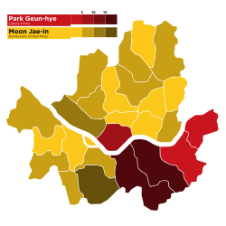
Politically, the region's voting patterns often reflect its socio-economic status, as seen in the 2012 Presidential election results.
| Category | Core Area (Gangnam, Seocho, Songpa) | Total Metropolitan Area |
|---|---|---|
| Area | 120.26 km² | 307.34 km² |
| Population (2020) | 1,553,172 | 4,985,421 |
| Key Infrastructure | Teheran Boulevard, Gyeongbu Expressway | Hannam Bridge, Jamsu Bridge |
Frequently Asked Questions
Why is Gangnam so expensive?
The high cost is a result of decades of state-led development, the forced relocation of prestigious schools and government institutions, and intense speculative investment in real estate starting in the 1970s.
What are hagwons and why are they concentrated in Gangnam?
Hagwons are private after-school tutoring centers. They are concentrated in Gangnam, particularly in Daechi-dong, because of the high density of elite schools and the intense competition among parents to secure admission to top universities like Seoul National University.
How did the government encourage people to move to Gangnam?
The government used a combination of "carrots" and "sticks": they provided tax exemptions and subsidies for schools and apartments (carrots) while restricting new business development in the northern part of the city (sticks).
What is the significance of the "Eighth School District"?
The Eighth School District is the administrative zone encompassing Gangnam's elite schools. It is widely regarded as the most competitive educational zone in South Korea, driving high residential demand and property values.
Is all of Gangnam just one district?
No. While often referred to as a single entity, the core of the region is split into three distinct districts: Gangnam District, Seocho District, and Songpa District.