Han River: The Lifeline of Seoul and South Korea's Economic Heart
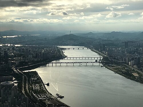
The Han River, known locally as Hangang, is more than just a body of water; it is the defining geographical feature of South Korea's capital, Seoul. As one of the few major metropolises in the world divided by a massive river—measuring approximately 1.2 kilometers wide in certain sections—it serves as a central artery for culture, ecology, and history. The river is so integral to the nation's identity that the term "Miracle on the Han River" is used globally to describe South Korea's rapid period of economic growth.
Key Facts
- Length: Approximately 508 km (316 mi).
- Source: Geumdae Peak in the Taebaek Mountains, Gangwon Province.
- Mouth: The Yellow Sea at the northwestern tip of the Gimpo peninsula.
- Major City: Flows through Seoul, the capital of South Korea.
- Economic Significance: Central to the "Miracle on the Han River" economic narrative.
Etymology and Ancient Names
The name Han River is rooted in the Old Korean word "Hangaram", where "han" signifies big or great, and "garam" means river. Throughout history, the river has been known by many names depending on the era and the kingdom in power.
In the early Three Kingdoms period, it was referred to as Daesu. On the Gwanggaeto Stele (414 AD), it is recorded as Arisu, an archaic term that once referred to both the Han and the Amnok rivers. In the kingdom of Baekje, it was called Ungniha. As interactions with China's Eastern Jin Dynasty increased, the name transitioned toward Hansu or Hangang. During the Goryeo period, it was known as Yeolsu, and during the Joseon period, it was often called Gyeonggang.
Historical Evolution
The Dynastic Transitions
The Han River basin has long been a strategic prize. During the Goryeo Dynasty, the importance of the region was so great that Yangju (modern-day Seoul) was promoted to Namgyeong (Southern Capital). While there were several attempts to move the capital to Hanyang (Seoul) during the late Goryeo period, political unrest and bad omens often forced the capital back to Gaeseong.
The permanent establishment of Seoul as the capital occurred in 1394, when Yi Seong-gye founded the Joseon Dynasty. This move solidified the river's role as the heart of Korean political life.
Modern Conflicts and Environmental Challenges
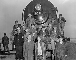
The 20th century brought significant hardship to the river. During the Korean War, the South Korean Army destroyed the Hangang Bridge to slow the advance of North Korean forces. In the decades following the war, rapid industrialization led to severe pollution as urban and industrial waste was frequently discharged into the water.
However, the river has seen a massive environmental recovery. Following the 1988 Summer Olympics in Seoul, where the river hosted the rowing regatta, the South Korean government launched major cleanup efforts. Today, the river is a recreational hub, featuring pedestrian walkways, bicycle paths, and public parks. In 2012, the completion of the 18-kilometer Ara Canal further connected the Han River near Gimpo to Incheon, facilitating larger vessel movement.
Geography and Tributaries
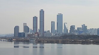
The Han River's watershed is vast, covering a basin of 35,770 km². While the river is not exceptionally long, its lower stretches are remarkably wide. The river is fed by numerous tributaries that shape the landscape of the surrounding provinces.
Major Tributaries
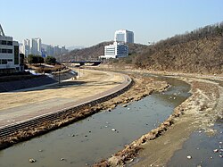
- Left Bank: Dalcheon, Cheongmicheon, Bokhacheon, Gyeongancheon, Anyangcheon, and the Ara Canal (a distributary).
- Right Bank: Seom River, Bukhan River, Jungnangcheon, Gongneungcheon, and Rimjin River.
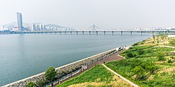
The river's banks are dotted with historical landmarks and modern infrastructure. Many locations in Seoul, such as Mapo and Yeongdeungpo, derive their names from former boat crossings (Naru), highlighting the river's historical importance for grain and passenger transport.
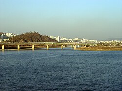
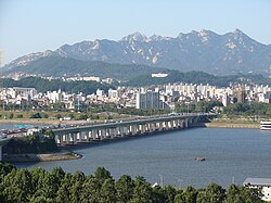
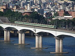
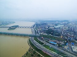
Spanning the river are 31 major bridges in the Seoul National Capital Area, including the Yanghwa Bridge, Mapo Bridge, and Jamsil Bridge. Additionally, 11 subway lines cross the river, integrating the waterway into the city's massive transit network.
Ecology and Biodiversity
Despite its urban setting, the Han River supports a diverse ecosystem. The riparian zones (the interface between land and river) are dominated by willow species, with various trees like poplar, birch, and metasequoia also present. In 2022, 1,299 types of plant life were recorded around the river.
The aquatic life includes 69 recorded fish species. Notable residents include the Gyeongmochi and Hwangbok, both of which are Korean endemics (species found only in Korea). Mammals such as water deer, raccoon dogs, and otters inhabit the area. The otter is particularly significant as a protected natural monument and an indicator species for the health of the ecosystem.
Summary of Physical Characteristics
| Feature | Details |
|---|---|
| Total Length | 508 km (316 mi) |
| Basin Size | 35,770 km² |
| Average Discharge | 613 m³/s (at Hangang Bridge) |
| Primary Source | Taebaek Mountains (Geumdae Peak) |
| Mouth | Yellow Sea |
Frequently Asked Questions
What does the term "Miracle on the Han River" mean?
It refers to the rapid economic growth and industrialization of South Korea that occurred in the decades following the Korean War.
Is the Han River used for drinking water?
Yes, the river serves as a vital drinking water source for approximately 12 million South Koreans.
How many bridges cross the Han River in the Seoul area?
There are a total of 31 bridges that cross the Han River within the Seoul National Capital Area.
What are some notable animals found in the Han River?
The river is home to various species including otters (a protected natural monument), water deer, raccoon dogs, and several endemic fish species like the Gyeongmochi.
Has the river's water quality improved over time?
Yes, after facing significant pollution from industrial and urban waste in the mid-20th century, government-sponsored environmental efforts since the 1988 Olympics have significantly improved its cleanliness.