Greater Syria: History, Geography, and Cultural Evolution
The region known as Greater Syria, also referred to as Syria-Palestine or Bilad al-Sham, is a historical and geographic area of immense significance. Spanning the eastern Mediterranean coast and extending toward the deserts of the interior, it encompasses territories that today comprise Syria, Lebanon, Jordan, Israel, Palestine, and parts of Turkey (specifically the Hatay Province and Southeastern Anatolia).
Unlike the modern nation-state of Syria, Greater Syria represents a broader cultural and political entity that has evolved over millennia, serving as a bridge between the Mediterranean world and the heart of Mesopotamia.
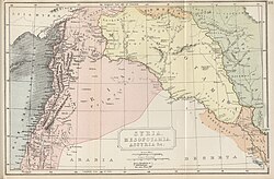
Key Facts
- Geographic Scope: Includes modern-day Syria, Lebanon, Jordan, Israel, Palestine, and parts of southern Turkey.
- Alternative Names: Historically known as Bilad al-Sham (Arabic) and the Levant.
- Roman Influence: Became a Roman province in 64 BC, later expanding to include the entire Levant and Western Mesopotamia.
- Modern Transition: The region transitioned from Ottoman rule to short-lived Arab sovereignty before being divided by French and British mandates after World War I.
- Religious Hub: Contains some of the most sacred sites for Judaism, Christianity, and Islam.
Etymology and Geographic Evolution
The term "Syria" has undergone significant shifts in meaning. In classical times, it was often a geographic expression rather than a fixed political border. The Arabic term Bilad al-Sham was the primary designation for the region during the Islamic era. While some early Arab geographers used "Suriyah" to describe a specific area around the Orontes River valley (near Homs and Hama), the broader term "Syria" was revived in the 19th century under Western influence to denote the entire region of Bilad al-Sham.
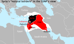
Some pan-Syrian nationalists, such as Antoun Saadeh, have proposed a "Natural Syria" based on the etymological link between "Syria" and "Assyria," suggesting a wider regional identity.
Major Urban Centers
The region has historically been anchored by prosperous trading hubs and political capitals. Today, the largest metropolitan areas in this historical zone include Amman, Tel Aviv, Damascus, Beirut, Aleppo, and Gaza City.
| City | Country | Metropolitan Population | City Population |
|---|---|---|---|
| Amman | Jordan | 4,642,000 | 4,061,150 |
| Tel Aviv | Israel | 3,954,500 | 438,818 |
| Damascus | Syria | 2,900,000 | 2,078,000 |
| Beirut | Lebanon | 2,200,000 | 361,366 |
| Aleppo | Syria | 2,098,210 | - |
| Gaza City | Palestine | 2,047,969 | 590,481 |
Historical Trajectory
The Roman and Byzantine Eras
In 64 BC, Pompey's conquest integrated Syria into the Roman Empire. The province was a strategic frontier, bordering Judea to the south and facing constant conflict with the Parthians to the east. By 135 AD, the province of Syria-Palaestina incorporated the entire Levant and Western Mesopotamia. Over time, the Romans subdivided the territory into smaller administrative units, including Coele-Syria, Phoenice, and later Euphratensis (with Hierapolis as its capital).
From Ottoman Rule to the Arab Kingdom
Following centuries of various rules, the region was part of the Ottoman Empire until the end of World War I. Between 1917 and 1920, the Occupied Enemy Territory Administration (OETA)—a joint British, French, and Arab military body—governed the area. This period saw a surge in Arab nationalism, culminating in the declaration of the Hashemite Arab Kingdom of Syria on March 8, 1920.
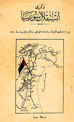
However, this state was short-lived. The San Remo conference in April 1920 established French and British mandates. In July 1920, French forces defeated the Arab kingdom and captured Damascus, effectively ending the first modern Arab state.
The French Mandate and Subdivision
Under General Henri Gouraud, the French Mandate for Syria was subdivided into six distinct states: Damascus, Aleppo, the Alawite State, Jabal Druze, the autonomous Sanjak of Alexandretta (now Hatay, Turkey), and Greater Lebanon, which eventually became the independent nation of Lebanon.
Cultural and Religious Significance
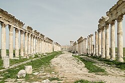
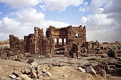
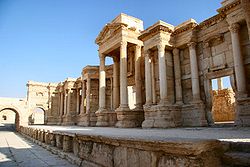
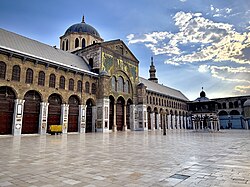
Greater Syria is a cornerstone of the Abrahamic religions, housing sites of profound spiritual importance. The region's architecture reflects this diversity, from the ruins of wealthy ancient cities like Palmyra to the enduring grandeur of the Umayyad Mosque.
Key religious sites include:
- Jerusalem: The holiest site in Judaism (Temple Mount) and the third-holiest city in Islam.
- Bethlehem and Hebron: Central sites for Christian and Jewish traditions.
- Damascus: Home to the Umayyad Mosque, one of the world's oldest and best-preserved mosques.
- Mount Gerizim: A sacred site for the Samaritans.
Frequently Asked Questions
What is the difference between Syria and Greater Syria?
Syria typically refers to the modern Arab Republic of Syria. Greater Syria (or Bilad al-Sham) is a historical and geographic term encompassing modern Syria, Lebanon, Jordan, Israel, Palestine, and parts of southern Turkey.
When was the Arab Kingdom of Syria established?
The Hashemite Arab Kingdom of Syria was proclaimed on March 8, 1920, though it was short-lived and defeated by French forces in July of the same year.
What was the role of the French Mandate in the region?
Following World War I, the French Mandate administered the region and subdivided it into several smaller states, including the states of Damascus, Aleppo, and Greater Lebanon, which shaped the modern borders of the Levant.
Why is the region significant to Abrahamic religions?
The region contains the holiest sites for Judaism, Christianity, and Islam, including the city of Jerusalem, the city of Bethlehem, and the Umayyad Mosque in Damascus, making it a global center of pilgrimage and faith.