Ewing Township, New Jersey
Located in the heart of Mercer County, Ewing Township is a vibrant community that blends historical significance with modern infrastructure. Bordered to the west by the Delaware River, the township serves as a key residential and administrative hub in New Jersey, balancing suburban living with essential state services.
From its early roots as a rural settlement to its current status as a developed municipality, Ewing has evolved while maintaining a connection to its natural landscape. Today, it is known for its strategic location, hosting critical transportation links and state government headquarters.

Key Facts
- Incorporation: February 22, 1834, named after Charles Ewing.
- Geography: Spans 15.56 square miles, with the Delaware River forming its western boundary.
- Population: 37,264 (2020 Census), with a 2023 estimate of 34,753.
- Government: Operates under the Faulkner Act (mayor-council form).
- Notable Infrastructure: Home to the New Jersey Department of Transportation headquarters and the Trenton–Mercer Airport.
Geography and Climate
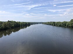
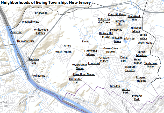
Ewing Township covers a total area of 15.56 square miles, consisting of 15.20 square miles of land and 0.35 square miles of water. The landscape is characterized by an average elevation of 128 feet. The township's western edge is defined by the Delaware River, providing a scenic and geographic boundary.
The region experiences a temperate climate with distinct seasonal variations. Annual precipitation averages 48.20 inches, distributed relatively evenly throughout the year. Summer temperatures can reach highs over 100°F, while winter lows have historically dropped as low as -9.4°F.
Government and Administration
The township is governed by a Faulkner Act charter, which establishes a mayor-council form of government. This system separates executive and legislative powers to ensure balanced municipal management. The current administration is led by Mayor Bert H. Steinmann, whose term extends through December 31, 2026, supported by Administrator Aaron T. Watson and Municipal Clerk Kim J. Macellaro.
Transportation and Infrastructure
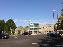
Ewing is a critical node for transportation in Mercer County. As of May 2010, the township maintained a network of 149.74 miles of roadways. While the municipality manages the majority of these roads, significant portions are maintained by Mercer County and the New Jersey Department of Transportation (NJDOT), which is headquartered within the township.
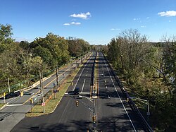
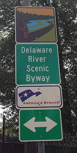
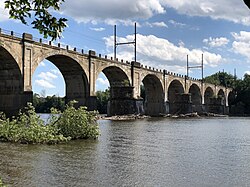
Key transit routes include Route 29, which features the Delaware River Scenic Byway, and Route 175. The area is also served by the West Trenton Railroad Bridge, facilitating rail connectivity across the Delaware River.
Community and Education
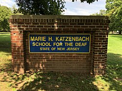
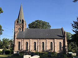
The township is home to diverse educational and social institutions. Notable among these is the Marie H. Katzenbach School for the Deaf, a specialized institution providing critical educational services. The community also features various historic and religious sites, such as the Ewing Covenant Presbyterian Church.
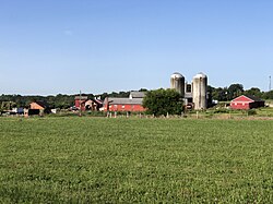
Historically, the township's agricultural roots were represented by the Jones Farm, operated by the New Jersey Department of Corrections. This site remained the last active farm in Ewing until its closure at the end of 2022.
Demographic Evolution
Ewing's population has seen significant growth over the last two centuries. From a small community of 1,017 residents in 1840, the population surged during the mid-20th century, peaking at over 37,000 by 2020. This growth reflects the township's transition from a rural area to a developed suburban center.
| Year | Population | Percentage Change |
|---|---|---|
| 1840 | 1,017 | — |
| 1900 | 1,333 | -57.4% |
| 1940 | 10,146 | +46.2% |
| 1970 | 32,831 | +23.3% |
| 2020 | 37,264 | +4.1% |
| 2023 (est.) | 34,753 | -6.7% |
Notable Residents
Ewing has been home to several distinguished individuals across sports, law, and the arts, including:
- Al Clark: Veteran professional baseball umpire.
- Hollis Copeland: Former New York Knicks basketball player.
- Dudley Dorival: Professional hurdler.
- Steve Shimko: NFL coach and former player.
- Glenn K. Rieth: Former Adjutant General of New Jersey.
Frequently Asked Questions
Who is the current mayor of Ewing Township?
The current mayor is Bert H. Steinmann, whose term is scheduled to end on December 31, 2026.
What is the primary form of government in Ewing?
Ewing Township operates under the Faulkner Act, utilizing a mayor-council form of government.
Which major state agency is headquartered in Ewing?
The New Jersey Department of Transportation (NJDOT) has its headquarters located in Ewing Township.
What is the significance of the Jones Farm?
The Jones Farm, operated by the New Jersey Department of Corrections, was the last remaining farm in the township before it shut down at the end of 2022.
What are the boundaries of Ewing Township?
The township is located in Mercer County, New Jersey, with the Delaware River serving as its western border.