Euphrates River: The Lifeline of West Asia
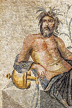
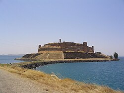
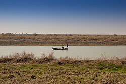
The Euphrates is the longest river in West Asia and the fifteenth-longest in Asia. Flowing through Turkey, Syria, and Iraq, it serves as a critical hydrological artery for the region. Its name is derived from the Greek Euphrates, which originates from the Sumerian Burannu. For millennia, this river has shaped the civilizations of Mesopotamia, providing the water necessary for agriculture and urban development in an otherwise arid landscape.
Key Facts
- Total Length: Approximately 2,780 to 3,000 kilometers (1,730 to 1,900 miles).
- Countries: Turkey, Syria, and Iraq.
- Primary Sources: The confluence of the Kara Su and Murat rivers in Turkey.
- Mouth: Joins the Tigris to form the Shatt al-Arab, emptying into the Persian Gulf.
- Basin Size: Estimated between 388,000 and 579,314 square kilometers.
Course and Geography
The Euphrates begins in the Armenian highlands of southeastern Turkey. It is formed by the confluence of two primary branches: the Kara Su (Western Euphrates), which is 450 kilometers long, and the Murat Su (Eastern Euphrates), which spans 650 kilometers. These two rivers meet approximately 10 kilometers upstream from the town of Keban.
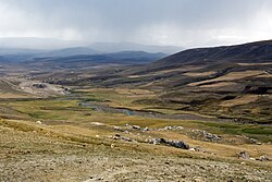
From its source, the river descends from high elevations—3,520 meters for the Murat and 3,290 meters for the Kara Su—down to 610 meters at the confluence in Keban. As it flows toward the Syrian-Turkish border, the river continues to drop, though the gradient becomes significantly shallower as it enters the Upper Mesopotamian plains. In its final stretch between Hīt and the Shatt al-Arab, the elevation drops by only 55 meters.
Regional Distribution
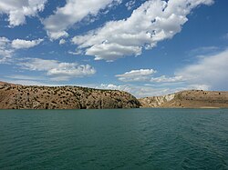
The river's path is divided among three nations. According to various estimates, the river spans roughly 1,230 kilometers in Turkey, 710 kilometers in Syria, and 1,060 kilometers in Iraq. The final segment, the Shatt al-Arab, connects the combined waters of the Euphrates and Tigris to the Persian Gulf over a distance of 145 to 195 kilometers.
Hydrology and Discharge
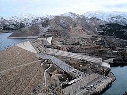
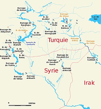
The discharge—the volume of water moving through the river channel—has been dramatically altered by human intervention. Since the 1970s, the construction of numerous dams and the increase in water withdrawal for irrigation have reduced the river's flow.
At Hīt, the average discharge after 1990 dropped to 356 cubic meters per second. The impact is most evident in the seasonal peaks; before 1990, peak volumes reached 7,510 cubic meters per second, but post-1990 peaks have fallen to 2,514 cubic meters per second. Interestingly, the minimum flow has remained relatively stable, hovering around 58 cubic meters per second.
Tributaries of the Euphrates
The river is supported by several key tributaries that contribute to its overall volume and basin size:
- Right Bank: The Sajur River (108 km).
- Left Bank: The Balikh River (100 km) and the Khabur River (486 km).
The Drainage Basin and Water Management
The Euphrates drainage basin is vast, though estimates vary. Recent data suggests a basin area between 388,000 and 579,314 square kilometers. The majority of this basin is shared between Turkey, Syria, and Iraq, with smaller portions extending into Saudi Arabia, Kuwait, and Jordan.
In Iraq, water management involves a complex network of canals and reservoirs, including Lake Habbaniyah and Lake Tharthar, used to store floodwaters. A significant engineering feat is the Main Outfall Drain (the "Third River"), a 565-kilometer canal built between 1953 and 1992. This canal prevents soil salinization—the buildup of salts in the soil—by draining the area between the Euphrates and Tigris south of Baghdad.
Environmental and Social Impact
The proliferation of dams and irrigation projects has led to several ecological challenges. Large reservoirs in high-temperature regions have increased evaporation rates, reducing the total water available. Annual evaporation is estimated at 2 cubic kilometers in Turkey, 1 cubic kilometer in Syria, and 5 cubic kilometers in Iraq.
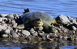
Furthermore, water quality in Iraq has declined. Irrigation runoff containing dissolved fertilizer chemicals from upstream in Turkey and Syria flows back into the river. This has increased salinity levels, making the water less suitable for drinking and damaging the fragile Mesopotamian Marshes and freshwater fish habitats.
Historical and Religious Significance
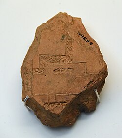
The Euphrates is deeply embedded in human history and spirituality. In the Christian Bible, it is mentioned in the Book of Revelation as a river that must dry up before the Second Coming. In Genesis, the river Phrath is identified as the Euphrates, described as one of the rivers of Paradise.
In the modern era, the river has been a point of geopolitical negotiation. The 1923 Treaty of Lausanne required Turkey, Syria (then a French mandate), and Iraq (then a UK mandate) to agree on water use. A 1946 agreement between Turkey and Iraq further stipulated that Turkey report hydraulic changes to Iraq.
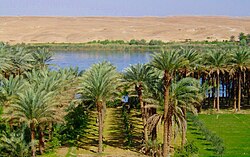
Summary of Euphrates River Characteristics
| Feature | Detail |
|---|---|
| Total Length | Approx. 2,780 – 3,000 km |
| Source Elevation | 3,290 m (Kara Su) / 3,520 m (Murat) |
| Mouth Elevation | 1 m (Shatt al-Arab) |
| Average Discharge (Hīt) | 356 m³/s (Post-1990) |
| Primary Tributaries | Khabur, Balikh, Sajur |
| Riparian States | Turkey, Syria, Iraq |
Frequently Asked Questions
Where does the Euphrates River begin?
The Euphrates begins in the Armenian highlands of Turkey at the confluence of the Kara Su and Murat rivers, approximately 10 kilometers upstream from the town of Keban.
How has the river's flow changed over time?
The discharge has decreased significantly since the 1970s due to the construction of numerous dams and increased water withdrawal for irrigation, particularly affecting peak seasonal volumes.
What is the Shatt al-Arab?
The Shatt al-Arab is the river formed by the confluence of the Euphrates and the Tigris, which then flows into the Persian Gulf.
What are the environmental consequences of the dams on the Euphrates?
Dams have led to increased water evaporation, higher salinity levels in Iraq, and the degradation of the Mesopotamian Marshes and freshwater fish habitats.
Which countries share the Euphrates basin?
The primary riparian states are Turkey, Syria, and Iraq, though small portions of the drainage basin also extend into Saudi Arabia, Kuwait, and Jordan.