Desert Climates: Analyzing Hot and Cold Arid Regions
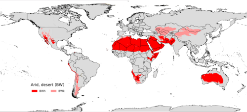
A desert climate, also known as an arid climate, is characterized by a severe imbalance where evaporation significantly exceeds precipitation. These regions are often defined by bald, rocky, or sandy landscapes that hold very little moisture, causing the minimal rainfall they do receive to evaporate rapidly. According to the Köppen climate classification system, these environments are categorized as BWh (hot desert) and BWk (cold desert).
The hot desert climate (BWh) is the most widespread of all Köppen climate types, covering approximately 14.2% of the Earth's total land area.
Key Facts
- Defining Characteristic: Evaporation rates are consistently higher than precipitation levels.
- Temperature Threshold: A mean annual temperature of 18 °C (64.4 °F) separates hot (BWh) from cold (BWk) deserts.
- Rainfall Range: Most arid climates receive between 25 and 200 mm (1 to 8 inches) of rain annually.
- Global Reach: Hot deserts exist on every continent except Antarctica.
- Extreme Heat: The highest recorded temperature on Earth, 56.7 °C (134.1 °F), occurred in Death Valley.
Classifying Arid Environments
To distinguish between the two primary subtypes of desert climates, scientists use an isotherm—a line on a map connecting points with the same temperature. If a location's mean annual temperature is above 18 °C (64.4 °F), it is classified as a hot arid subtype (BWh). If it falls below this mark, it is a cold arid subtype (BWk).
The Precipitation Threshold
Determining whether a region is truly arid involves calculating a precipitation threshold. This is done by multiplying the average annual temperature in °C by 20, then adding a value based on when the rain falls: 280 mm if 70% or more of rain falls in the high-sun summer, 140 mm if 30–70% falls then, or 0 mm if less than 30% falls during that period. A location is classified as a desert climate (BW) if its annual precipitation is less than 50% of this calculated threshold.
Hot Desert Climates (BWh)
Hot deserts are typically located under the subtropical ridge in the lower middle latitudes, generally between 20° and 33° north and south. In these zones, stable descending air and high pressure clear the skies of clouds, resulting in intense sunshine and extreme dryness.
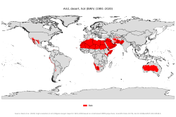
These climates are found across North Africa, West Asia, the Southwestern United States, northern Mexico, interior Australia, and the coasts of Peru and Chile. During the summer, average temperatures typically range between 29 and 35 °C (84 to 95 °F), with midday peaks often reaching 43–46 °C (109–115 °F).
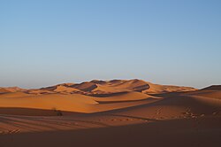
Some tropical deserts maintain extreme heat year-round. For example, Dallol, Ethiopia, sees annual average temperatures reaching nearly 35 °C (95 °F). Conversely, because clear skies allow for rapid radiation loss, nighttime temperatures can occasionally drop to freezing, though they rarely stay far below that point in the hot subtype.
Cold Desert Climates (BWk)
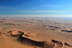
Cold desert climates are generally found in temperate zones (30s and 40s latitudes). They often occur in the leeward rain shadow of high mountains—areas where mountains block moisture-bearing winds, leaving the land behind them dry.
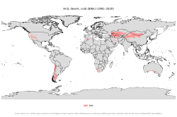
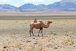
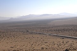
Notable examples include the Patagonian Desert in Argentina, which is bounded by the Andes, and the deserts of Central Asia, such as the Kyzyl Kum and Taklamakan. In North America, this climate is present in the Great Basin Desert and the Columbia Plateau. Other regions include the Hautes Plaines of Morocco and Algeria, and parts of southeastern Spain.
Polar Deserts
While distinct from the BWk classification, polar regions in the Arctic and Antarctic also exhibit desert-like features. Because cold, dry air freezes most precipitation, these areas are extremely barren. The McMurdo Dry Valleys of Antarctica feature hypersaline lakes and intermittent streams, yet they are classified as polar climates because their average summer temperatures remain below 10 °C (50 °F).
Summary of Desert Climate Types
| Feature | Hot Desert (BWh) | Cold Desert (BWk) |
|---|---|---|
| Mean Annual Temp | Above 18 °C (64.4 °F) | Below 18 °C (64.4 °F) |
| Typical Latitude | 20° to 33° N/S | 30s and 40s Latitudes |
| Primary Cause | Subtropical ridge / High pressure | Rain shadow / Continental interior |
| Example Regions | Sahara, Arabian Desert, Death Valley | Gobi, Patagonian, Great Basin |
Frequently Asked Questions
What is the driest place on Earth?
While various locations claim this title, the Atacama Desert in northern Chile recorded an average annual rainfall of only 5 mm (0.20 in) over 17 years. However, some spots in the Sahara, such as Kufra, Libya, have recorded even lower annual totals of 0.86 mm (0.034 in).
How is a "hot" desert different from a "cold" desert?
The primary distinction is the mean annual temperature. A location is classified as a hot desert (BWh) if its average annual temperature is above 18 °C (64.4 °F), and a cold desert (BWk) if it is below that threshold.
Why do some deserts have higher rainfall but are still called arid?
In regions like Central Australia or the Sahel, annual rainfall can be as high as 430 mm (17 inches). These are still classified as arid because of extreme potential evapotranspiration, meaning the heat causes water to evaporate faster than it can be used by the environment.
What is a rain shadow?
A rain shadow is a dry area on the leeward side of a mountainous area. The mountains act as a barrier, forcing moist air to rise and release its precipitation on the windward side, leaving the air dry by the time it reaches the other side.