County Limerick: The Heart of the Mid-West
Known affectionately as the Treaty County or Shannonside, County Limerick (Irish: Contae Luimnigh) is a region of profound historical significance and natural beauty. Located in the province of Munster in the Mid-West of Ireland, it serves as a vital hub of culture, commerce, and sport. From the bustling streets of Limerick City—Ireland's third-largest city—to the serene landscapes of the rural west, the county offers a diverse experience rooted in a legacy that spans millennia.
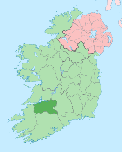
Geography and the Natural Landscape
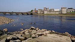
County Limerick is defined by its relationship with water and earth. The River Shannon, Ireland's longest river, flows through Limerick City before expanding into the Shannon Estuary, eventually meeting the Atlantic Ocean. Because the estuary is relatively shallow, the county's primary shipping hub is located at Foynes, several kilometers west of the city.
The name Luimneach is thought to mean "the flat area," a fitting description for much of the county, which consists of a fertile limestone plain. This region is ringed by several mountain ranges: the Slieve Felims to the northeast, the Galtees to the southeast, the Ballyhoura Mountains to the south, and the Mullaghareirk Mountains to the southwest and west. The highest point in the county is Galtymore, reaching an elevation of 918 meters on the border with County Tipperary.
The eastern portion of the county is part of the Golden Vale, a region world-renowned for its rich soil and high-quality dairy produce, characterized by rolling low hills. In contrast, the west is dominated by the Mullaghareirk Mountains, which provide expansive views across the county and into County Kerry.
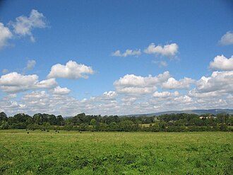
Hydrology and Geology
The county's drainage basin is fed by several tributaries of the Shannon, including the rivers Mulcair, Loobagh, Maigue, Camogue, Morning Star, Deel, and the Feale. Geologically, the area features significant volcanic rock deposits, particularly in Pallasgreen and Kilteely, which is considered one of the most complete carboniferous volcanic districts in Britain and Ireland.
A Journey Through History
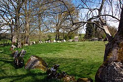
Human habitation in Limerick dates back to at least 3000 BC in the Lough Gur area, with megalithic remains at Duntryleague suggesting activity as early as 3500 BC.
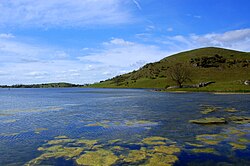
Around 400 BC, the arrival of the Celts led to the division of the land into túatha (petty kingdoms). For centuries, the Uí Fidgenti kingdom dominated much of the current county. Their capital, Dún Eochair, remains visible today near the town of Bruree.
The landscape changed significantly in the 10th century with the arrival of the Vikings, who established a town on an island in the River Shannon in 922 AD. By 1210, the County of Limerick was formally established under Norman rule, with lands granted to the Fitzgerald dynasty. This era saw the construction of King John's Castle, a symbol of Anglo-Norman power.
Conflict and the "Broken Treaty"
Limerick has often been a focal point of Irish conflict. The 16th century was marked by the Desmond Rebellions, a savage war that ended with the confiscation of vast estates. Later, during the Cromwellian conquest in the 1650s, the city endured a grueling twelve-month siege before surrendering in 1651.
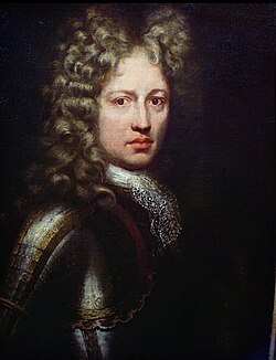
The county's nickname, the Treaty County, stems from the Williamite War (1689–1691). After two sieges, General Patrick Sarsfield negotiated the Treaty of Limerick. However, the English subsequently dishonored the terms, leading the city to be remembered as the "City of the Broken Treaty."
Governance and Modern Society
Today, the region is managed by the Limerick City and County Council, a unified local authority formed in 2014 through the merger of the separate city and county councils. The council oversees essential services, including planning, social housing, and local roads.
Politically, the area is divided into two Dáil Éireann (the lower house of the Irish parliament) constituencies: Limerick City and Limerick County. For European elections, it falls within the South constituency.
The Irish language remains a cherished part of the local identity. There are over 2,300 Irish speakers attending gaelscoileanna (Irish-language primary schools) and gaelcholáistí (Irish-language secondary schools) across the county.
Culture, Arts, and Entertainment
Limerick is a vibrant creative center. In 2014, it served as Ireland's first National City of Culture. The city is home to the Limerick City Gallery of Art and several prominent theaters, including the University Concert Hall and the Millennium Theatre. The region's musical legacy is equally strong, having produced the world-famous band The Cranberries.
The county is also associated with the "limerick"—a humorous five-line poem with an AABBA rhyme scheme. While the exact origin is debated, it is widely believed to be linked to the city or the Maigue Poets of Croom. In literature, the city provides the poignant setting for Frank McCourt's memoir, Angela's Ashes.
Infrastructure and Transport
Limerick is well-connected by land, sea, and air:
- Rail: Colbert Station serves as the primary hub, connecting the city to Dublin, Cork, and Galway.
- Road: The M7 motorway links Limerick to Dublin, while the N21 connects the city to Tralee via towns like Newcastle West and Abbeyfeale.
- Air: While the county has no commercial airport, Shannon Airport is located just 25 km across the border in County Clare. Historically, Foynes was a critical aviation hub, serving as one of Europe's largest civilian airports for transatlantic seaplanes during World War II.
- Sea: The Shannon Foynes Port Company operates the second-largest port facility in Ireland, handling over 10 million tonnes of cargo annually.
Sporting Excellence
Sport is a cornerstone of community life in Limerick. Rugby union is immensely popular, with Thomond Park serving as the home of the Munster Rugby team. The city also boasts historic clubs like Garryowen and Young Munster.
In the realm of the Gaelic Athletic Association (GAA), hurling is the dominant sport in the east, mid, and south, with the county team achieving significant success, including twelve All-Ireland Senior Hurling Championships. Gaelic football remains more prevalent in the west and along the Kerry border.
Other sporting achievements include Treaty United in soccer and the boxing success of Andy Lee, the first Irishman to win a world title on American soil since 1934.
County Limerick at a Glance
| Feature | Detail |
|---|---|
| Province | Munster |
| Population (2022) | 209,536 |
| Total Area | 2,756 km² |
| Highest Point | Galtymore (918 m) |
| County Towns | Limerick and Newcastle West |
| Established | 1210 |