Ciudad Madero: A History of Industry and Growth in Buenos Aires
Located within the expansive Greater Buenos Aires metropolitan area, Ciudad Madero (also known as Villa Eduardo Madero) is a city in the La Matanza Partido of the Buenos Aires Province, Argentina. With a rich history transitioning from indigenous lands to a bustling industrial hub, the city represents a unique intersection of land ownership, immigration, and railway development.
Key Facts
- Founded: 1908
- Location: La Matanza Partido, Buenos Aires Province, Argentina
- Population: 75,582 (2001 Census)
- Population Density: 8,400 per square kilometer
- Total Area: 9 square kilometers
- Elevation: 6 meters above sea level
From Indigenous Lands to Colonial Estates
Long before the formal establishment of the city, the region was populated by the Querandí people. The colonial transition began in 1615 when Governor Hernando Arias de Saavedra deeded a portion of the land to Pedro Gutiérrez. Over the next century, the land changed hands among prominent figures, becoming part of Martín José de Altolaguirre's holdings in 1775 before being purchased by Francisco Ramos Mejía in 1808.
The property eventually entered the Madero family lineage. Before her death in 1860, Mrs. Ramos Mejía bequeathed the land to her children. Her daughter, Marta, married Francisco Bernabé Madero, a family ally in the political struggles against Governor Juan Manuel de Rosas.
The Rise of the Industrial Settlement
While the Madero family resided in the rural Dolores Partido, they maintained the La Matanza property as a strategic investment, leasing parcels to tallow refiners. Following the death of Francisco Bernabé Madero in 1896, the land was subdivided for other manufacturers. This shift attracted a surge of immigrant laborers, leading to the creation of an informal settlement known as Villa Las Fabricas (Factory Town) by 1900.
The community began to formalize with the construction of its first school in 1905. However, the most significant catalyst for growth was the arrival of the Buenos Aires Western Railway in 1908, which led to the establishment of Villa Circunvalación.
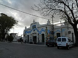
Villa Circunvalación was developed through the sale of lots by La Franco Argentina, a prominent developer in which both the Madero and Ramos Mejía families held shares. By 1913, the settlements of Circunvalación and Fabricas were unified under the name Villa Eduardo Madero. This name change coincided with the renaming of the local train station to honor Eduardo Madero, the nephew of the former landowner and the developer of Puerto Madero, Argentina's first maritime docks.
Modern Economy and Geography
Today, Ciudad Madero maintains a diversified economy. Its industrial strength is rooted in a manufacturing base that includes food processing plants and specialized tool and die makers.
| Attribute | Detail |
|---|---|
| Coordinates | 34°41′S 58°30′W |
| CPA Base | B 1768 |
| Area Code | +54 011 |
| Total Area | 9 km² (3.5 sq mi) |
| Elevation | 6 m (20 ft) |
Frequently Asked Questions
What is the other name for Ciudad Madero?
Ciudad Madero is also commonly referred to as Villa Eduardo Madero.
Who were the original inhabitants of the area?
The land was originally populated by the Querandí people.
How did the city get its current name?
The city became known as Villa Eduardo Madero in 1913 when the local train station was renamed in honor of Eduardo Madero, who developed the Puerto Madero maritime docks.
What drove the early growth of the city?
The growth was driven by the establishment of manufacturing plants (Villa Las Fabricas) and the arrival of the Buenos Aires Western Railway in 1908.
What are the primary industries in Ciudad Madero today?
The city's economy is diversified, with a manufacturing base focused on food processing and tool and die making.