Chubut Province
Located in the southern reaches of Argentina, Chubut is a region of striking contrasts, stretching from the rugged peaks of the Andes to the vast shores of the Atlantic Ocean. Its name is derived from the Tehuelche word chupat, meaning "transparent," a reference to the clear waters of the Chubut River. From its unique bilingual heritage to its critical role in Argentina's energy sector, Chubut is a province defined by resilience and natural beauty.
The province is bordered by Río Negro to the north, Santa Cruz to the south, Chile to the west, and the Atlantic Ocean to the east. While the administrative capital is Rawson, the largest urban center is Comodoro Rivadavia, a hub of industry and population in the south.
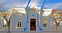
Key Facts
- Capital: Rawson
- Largest City: Comodoro Rivadavia
- Official Languages: Spanish and Welsh (co-official)
- Total Area: 224,686 km² (Ranked 3rd in Argentina)
- Population: 592,621 (2022 Census)
- GDP Per Capita: US$ 11,500
- HDI: 0.858 (Very High)
History and Cultural Heritage
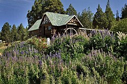
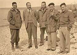
The history of Chubut is a tapestry of indigenous presence, colonial attempts, and immigrant ambition. In the 17th and 18th centuries, Spanish missionaries established the San José Fort on Península Valdés, though it was later destroyed by indigenous peoples. A pivotal shift occurred in 1865 when Welsh settlers arrived on the ship Mimosa, establishing a community in the Chubut Valley. This legacy persists today in the region known as Y Wladfa, with Gaiman serving as a primary cultural center for Welsh-Argentines.
The late 19th century saw the Conquista del Desierto (Conquest of the Desert), leading to the organization of the National Territory of Chubut in 1884. The early 20th century brought further diversity, with Boer settlers arriving after the Boer War and waves of Spanish, Italian, and Chilean immigrants settling in the lower Chubut valley. By 1955, Chubut transitioned from a military zone to a full province.
Geography and Environment
Chubut is divided into three distinct environmental zones: the Andes, the central plains, and the coastal regions.
The Andean Region
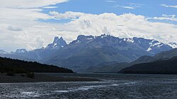
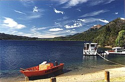
In the west, the Andes feature peaks averaging between 1,500 and 2,000 meters, with Cerro Dos Picos standing as the highest point at 2,515 meters. This region is characterized by deep transverse valleys and glacial lakes formed during the last ice age.
Climate and Weather Patterns
The province's climate is heavily influenced by the Andes, which act as a barrier to humid Pacific winds. This creates a stark divide: the Andean region is cold and wet, receiving between 700 mm and over 3,000 mm of precipitation annually. In contrast, the central plains are arid and windy, often receiving less than 200 mm of rain per year.
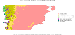
The coast offers a semi-arid transition zone with the mildest temperatures in the province. Across all regions, strong winds are a defining characteristic, increasing evapotranspiration and contributing to the overall dryness of the landscape.
Economy and Infrastructure
Chubut possesses one of the least diversified but most prosperous economies in Argentina. The province is a powerhouse in petroleum refining, contributing 13% of the nation's oil production, primarily centered around Comodoro Rivadavia. Recent developments include the discovery of unconventional oil and gas in the Golfo San Jorge basin.
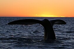
Beyond energy, the province is a leader in the maritime sector, producing 21% of Argentina's total fish catch. While sheep ranching was once a dominant industry, it declined following the rise of synthetic wool after World War II, though it has seen a modest recovery since 2002.
Transport and Connectivity
The province is linked by several major arteries. Ruta Nacional 3 is the primary north-south corridor connecting Buenos Aires to Tierra del Fuego. For east-west travel, Ruta Nacional 25 connects Trelew and Esquel. Air travel is facilitated through airports in Trelew, Comodoro Rivadavia, Rawson, and Esquel.
Administrative Overview
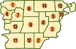
Chubut is organized into 15 departments and 47 municipalities and communes. The population is distributed unevenly, with high concentrations in urban centers and very low density (often less than 1 person per km²) in the rural interior.
| City | Population | Role/Significance |
|---|---|---|
| Comodoro Rivadavia | 199,369 | Largest city; Oil and Gas hub |
| Trelew | 104,657 | Major commercial center |
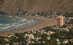
| Puerto Madryn | 97,625 | Tourism and Port center |
| Rawson | 27,157 | Administrative Capital |
| Esquel | 36,624 | Andean gateway |
Frequently Asked Questions
Why is Welsh spoken in Chubut?
Welsh is a co-official language because of the settlement of Welsh immigrants who arrived in 1865 on the ship Mimosa to establish a colony in the Chubut Valley, creating the cultural region known as Y Wladfa.
What is the primary economic driver of the province?
The economy is heavily driven by the mining and petroleum sectors, particularly oil production and refining in the Comodoro Rivadavia area, as well as a significant fishing industry.
How does the geography affect the climate?
The Andes mountains block moisture from the Pacific Ocean, causing heavy precipitation on the western slopes while leaving the central plains and coastal regions arid or semi-arid.
What is the highest point in Chubut?
The highest peak in the province is Cerro Dos Picos, which reaches an elevation of 2,515 meters and is located east of Lago Cholila.
Which city is the administrative capital?
Rawson is the administrative capital of the province, although Comodoro Rivadavia is the largest city by population.