Central Belt of Scotland: Population, Geography, and Urban Growth
The Central Belt is the most densely populated region of Scotland. While not geographically central in a strict sense, it forms the "waist" of the country on a map, situated between the Highlands to the north and the Southern Uplands to the south. This region serves as the nation's primary population heartland and industrial hub, encompassing several of Scotland's most significant urban centers.
Historically referred to as the Midlands or Scottish Midlands, the term "Central Belt" is now the standard designation used by non-governmental organizations, police, and local government bodies. The region is so densely inhabited that satellite imagery reveals a near-continuous band of light stretching across the landscape at night.
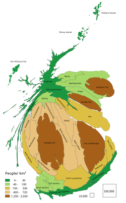
Key Facts
- Population: Ranges from 2.4 million to 4.2 million depending on the definition used.
- Major Cities: Includes Glasgow and Edinburgh, which are approximately 41 miles (66 km) apart.
- Geography: Positioned between the Highland Boundary Fault to the north and the Southern Uplands Fault to the south.
- Economic Hub: Contains the bulk of Scotland's industrial works.
- Urban Trend: Predictions suggest Glasgow and Edinburgh could eventually merge into a single megalopolis (a very large, densely populated urban area).
Defining the Central Belt
Because the Central Belt is not a formal administrative entity, its boundaries vary based on the definition applied. Geographers generally distinguish between a "smaller" and a "larger" version of the region.
The Smaller Central Belt (The Lowland Triangle)
The smaller definition focuses on the Lowland Triangle, an area defined by the M8, M80, and M9 motorways. This triangle stretches from Greenock and Glasgow in the west to Edinburgh in the east. It encompasses key towns such as Paisley, Cambuslang, Hamilton, Stirling, Falkirk, Cumbernauld, Livingston, and Bathgate. As of 2018, the population of the local authority areas wholly within this territory was approximately 2.39 million.
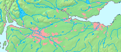
The Larger Central Belt
The larger definition views the region as a trapezoid. This area is bounded by the Highland Boundary Fault (stretching from Helensburgh to Montrose) and the Southern Uplands Fault (stretching from Girvan to Dunbar). This broader definition includes densely populated regions such as Ayrshire and East Lothian. It encompasses all of Scotland's major cities except for Aberdeen and Inverness. Including rural parts of the involved council areas, the total population was approximately 4.28 million in 2018.
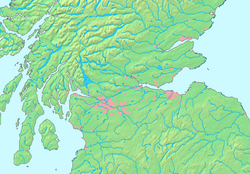
Regional Terminology and Distinctions
Several terms are often used interchangeably with the Central Belt, though they have distinct geological or topographical meanings:
- Central Lowlands: A geologically defined area that extends further northeast than the Central Belt.
- Midland Valley: A synonym for the Central Lowlands, though used less frequently.
- Scottish Lowlands: A broad topographical and cultural term covering all of Scotland outside the Highlands and Islands, including the Southern Uplands.
- Central Scotland: A general, less precise term that may refer to either the Central Lowlands or the Central Belt.
| Definition | Shape/Boundary | Key Areas Included | Approx. Population |
|---|---|---|---|
| Smaller Central Belt | Triangle (M8, M80, M9) | Glasgow, Edinburgh, Stirling, Falkirk | 2.39 Million |
| Larger Central Belt | Trapezoid (Fault Lines) | Ayrshire, East Lothian, all major cities except Aberdeen/Inverness | 4.28 Million |
Frequently Asked Questions
Is the Central Belt actually in the center of Scotland?
No. While it is located at the "waist" of the country on a map, the actual geographical center of Scotland lies much further north, with suggested locations near White Bridge or the village of Newtonmore.
What is the difference between the Central Belt and the Scottish Lowlands?
The Central Belt is a specific high-density population zone. The Scottish Lowlands is a much broader term that includes everything outside the Highlands and Islands, including the Southern Uplands.
Which major cities are located in the Central Belt?
The region includes Glasgow and Edinburgh, as well as other significant settlements like Ayr, Paisley, East Kilbride, Livingston, and Kilmarnock.
What is a megalopolis in the context of Scotland?
A megalopolis is a massive urban chain. In Scotland, some predictions suggest that the urban sprawl of Glasgow and Edinburgh may eventually merge due to economic migration, creating one continuous urban area.
What are the geological boundaries of the larger Central Belt?
The larger Central Belt is bounded by the Highland Boundary Fault to the north (Helensburgh to Montrose) and the Southern Uplands Fault to the south (Girvan to Dunbar).