Cape of Good Hope
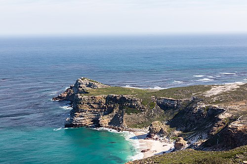
The Cape of Good Hope is a striking rocky headland located on the Atlantic coast of the Cape Peninsula in South Africa. Known for its rugged beauty and pivotal role in maritime history, it has long served as a landmark for sailors navigating the treacherous waters between the Atlantic and Indian Oceans.
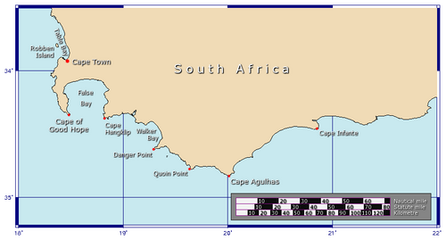
A frequent misconception is that the Cape of Good Hope represents the southernmost tip of Africa. In reality, the southernmost point is Cape Agulhas, situated approximately 150 kilometers (90 mi) to the east-southeast. The actual meeting point of the warm-water Agulhas current and the cold-water Benguela current fluctuates between Cape Agulhas and Cape Point, the latter being just 1.2 kilometers (0.75 mi) east of the Cape of Good Hope.
Key Facts
- Location: Cape Peninsula, South Africa.
- Southernmost Point: Cape Agulhas (not the Cape of Good Hope).
- First European Discovery: Bartolomeu Dias in 1488.
- Original Name: Cabo das Tormentas (Cape of Storms).
- Biodiversity: Home to the endangered Peninsula Sandstone Fynbos and Chacma baboons.
- Geology: Composed of sandstones from the Cape Supergroup.
Maritime History and Exploration
While the Portuguese are credited with the first modern rounding of the cape, historical accounts suggest earlier attempts. Around 600 BC, Pharaoh Necho II reportedly commissioned Phoenicians to circumnavigate Africa, a voyage described by Herodotus. Later, in 116 BCE, the Greek navigator Eudoxus of Cyzicus discovered a shipwreck from Roman Hispania in the Indian Ocean, suggesting a vessel had rounded the cape long before the Age of Discovery.
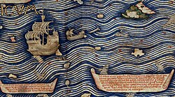
The 1450 Fra Mauro map further illustrates early knowledge of the region, depicting the Indian Ocean as connected to the Atlantic and mentioning a "Cape of Diab." By 1511, Portuguese records indicate that Javanese maritime pilots already possessed charts including the Cape of Good Hope.
The Portuguese Milestone
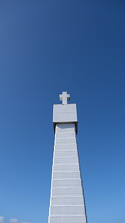
On March 12, 1488, Portuguese explorer Bartolomeu Dias became the first European to reach the headland. Due to the violent weather he encountered, he originally named it Cabo das Tormentas (Cape of Storms). However, King John II of Portugal later renamed it Cabo da Boa Esperança (Cape of Good Hope) to reflect the optimism of establishing a direct sea route to India and the Far East.
Colonial Evolution
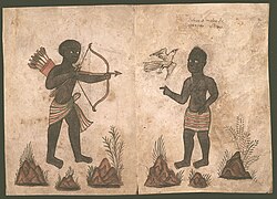
The region was inhabited by the Khoikhoi people for roughly 1,500 years before European settlement. In 1652, Jan van Riebeeck of the Dutch East India Company established a resupply camp in Table Bay, 50 kilometers north of the cape. This settlement grew into Cape Town, famously known as "The Tavern of the Seas" because of its vital role in providing fresh food to sailors.
The colony expanded further in 1687 with the arrival of Huguenots—French Protestants fleeing religious persecution. These skilled farmers helped the colony grow significantly over the next 150 years.
British and Dutch Transitions
The political control of the region shifted during the Napoleonic Wars. The British first occupied the Cape Colony in 1795, relinquished it in 1803, and reoccupied it in 1806 following the Battle of Blaauwberg. The territory was formally ceded to Britain in 1814 and remained a British colony until it became part of the Union of South Africa in 1910.
Geography and Natural Environment
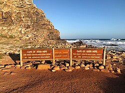
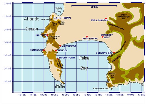
The Cape of Good Hope is situated at the southern tip of the Cape Peninsula, west of Cape Point. The area is characterized by the Cape Supergroup geology, consisting of the same sandstones found on Table Mountain. Today, the southernmost portion of the peninsula is a rugged, unspoiled national park.
Flora and the Cape Floristic Kingdom
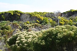
The region is a critical part of the Cape Floristic Kingdom, the smallest yet most diverse of the world's six floral kingdoms. It hosts 1,100 indigenous plant species, many of which are endemic. The dominant vegetation is fynbos ("fine bush"), specifically the endangered Peninsula Sandstone Fynbos, alongside Coastal Hangklip Sand Fynbos and Cape Flats Dune Strandveld.
Fauna and Wildlife
The Chacma baboon (Papio ursinus) is the most iconic mammal of the region. While the species is generally listed as "least concern" globally, the Cape Peninsula population is considered critically endangered due to habitat loss, genetic isolation, and human conflict. Within the safety of the national park, these baboons are known for their unique habit of eating shellfish and other marine invertebrates.

Summary of Regional Characteristics
| Feature | Cape of Good Hope | Cape Agulhas |
|---|---|---|
| Significance | Historical maritime landmark | True southernmost point of Africa |
| Oceanic Role | Point where ships turn eastward | Geographic divide of oceans |
| Location | Cape Peninsula | East-southeast of the Peninsula |
| Key Ecosystem | Peninsula Sandstone Fynbos | Coastal scrub/fynbos |
Frequently Asked Questions
Is the Cape of Good Hope the southernmost point of Africa?
No. The southernmost point of the African continent is Cape Agulhas, located about 150 kilometers (90 mi) east-southeast of the Cape of Good Hope.
Why was it renamed from the "Cape of Storms"?
King John II of Portugal renamed it the Cape of Good Hope to symbolize the optimism and potential of finding a sea route to India and the East.
What is fynbos?
Fynbos, meaning "fine bush," is a unique type of shrubland vegetation endemic to the Cape Floristic Kingdom, characterized by high biodiversity and many species found nowhere else on Earth.
Why are the Cape baboons considered critically endangered?
Despite the species being common elsewhere, the Cape Peninsula population suffers from genetic isolation, habitat loss, and conflicts with humans in nearby urban areas.
Who were the first Europeans to reach the Cape?
The Portuguese explorer Bartolomeu Dias was the first European to reach the cape on March 12, 1488.