Bouvet Island: The Most Remote Territory on Earth
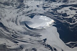
Located in the desolate reaches of the South Atlantic Ocean, Bouvet Island (known in Norwegian as Bouvetøya) holds the distinction of being the most remote island in the world. This uninhabited volcanic outpost is a dependent territory of Norway, serving as a stark, glaciated sentinel far from any permanent human settlement.
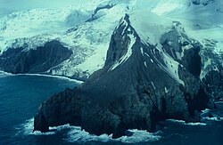
The island is a rugged landscape where fire and ice meet. It is essentially the peak of a shield volcano—a broad, gently sloping volcanic mountain—that rises from the ocean floor. Today, it exists as a strict nature reserve, protected for its unique wildlife and geological significance.
Key Facts
- Status: Dependent territory of Norway.
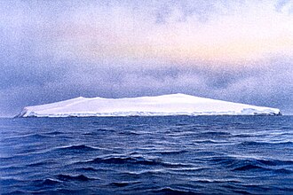
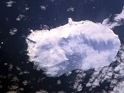
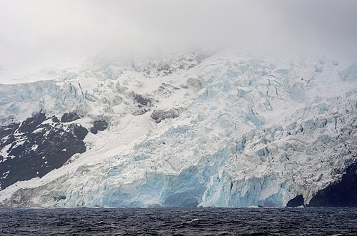
- Geography: 93% of its 49 km² area is covered by glaciers.
- Population: 0 permanent residents.
- Highest Point: 780 meters (2,560 feet).
- Governance: Administered by the Norwegian Ministry of Justice and Public Security.
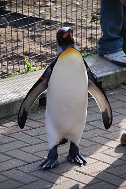
- Unique Honor: Maj. Gen. Sir Nils Olav III, a king penguin at Edinburgh Zoo, serves as the de jure Baron of the Bouvet Islands.
Geography and Geology
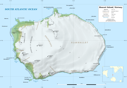
Bouvet Island is a volcanic landmass measuring 9.5 by 7 kilometers. Its center is dominated by the ice-filled crater of an inactive volcano. The island is surrounded by a treacherous coastline of 29.6 kilometers, characterized by steep cliffs and high seas, making landings exceptionally difficult.
The island's isolation is profound. Its nearest neighbor is Queen Maud Land in Antarctica, located 1,700 km to the south. Other nearby landmarks include Gough Island (1,845 km north) and the South Sandwich Islands (1,870 km east). The closest inhabited location is Tristan da Cunha, roughly 2,260 km to the northwest.
A significant geological feature is the Bouvet triple junction, located 275 km west of the island. This is a rare point where three tectonic plates—the South American, African, and Antarctic plates—meet, along with three distinct oceanic ridges.
Coastal Features and Access
Most of the island is inaccessible, but Nyrøysa, a rock-strewn terrace created by a landslide between 1955 and 1958, provides the only easy landing point. This area also hosts the island's automatic weather station. Other notable landmarks include Cape Valdivia, the northernmost point, and Svartstranda, a stretch of black volcanic sand.
History and Annexation
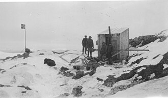
The island's modern history began in 1927 with the First Norvegia Expedition. Financed by philanthropist Lars Christensen and led by Harald Horntvedt, the expedition conducted oceanographic measurements and established a small hut at Ny Sandefjord. On December 1, 1927, the Norwegian flag was hoisted, claiming the island for Norway.
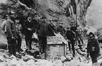
Following a dispute with the United Kingdom over claiming rights, the Norwegian Parliament passed the Dependency Act on February 27, 1930, officially establishing Bouvet Island as a Norwegian dependency. Early expeditions were perilous; the first hut was quickly washed away by the sea, leading the Third Norvegia Expedition in 1929 to build a more secure structure at Cape Circoncision.
The Vela Incident and Modern Era
In 1979, the region became the center of international intrigue during the Vela incident. On September 22, a U.S. satellite detected an unexplained double flash of light between Bouvet Island and the Prince Edward Islands. While some attributed it to a meteor or glitch, many independent assessments suggest it was an undeclared joint nuclear test by South Africa and Israel.
In more recent years, the island has attracted amateur radio enthusiasts. Because of its isolation, "DX-peditions" (expeditions to rare radio locations) are highly prized. However, these are often cut short by the island's brutal weather, as seen during the 3Y0J expedition in early 2023.
Climate and Nature
The climate of Bouvet Island is harsh and cold, with mean daily temperatures rarely rising far above freezing. The island is frequently surrounded by pack ice during the winter months.
Despite the conditions, the island supports a resilient ecosystem. It is a breeding ground for southern elephant seals and Antarctic fur seals. In the late 1990s, counts at Nyrøysa recorded 88 elephant seal pups and 13,000 fur seal pups. The surrounding waters are rich with marine life, including orcas, humpback whales, and various dolphin species.
| Metric | January (Summer) | July (Winter) | Annual Average |
|---|---|---|---|
| Mean Daily Max (°C) | 3.7 | -1.2 | 1.4 |
| Daily Mean (°C) | 1.7 | -3.3 | -0.7 |
| Mean Daily Min (°C) | -0.3 | -5.3 | -2.7 |
Norvegia Station
Since the 1970s, the Norwegian Polar Institute has maintained a presence on the island. In 1996, a research station made of shipping containers was established at Nyrøysa. However, the island's volatility remains a threat; in 2006, a magnitude 6.2 earthquake weakened the station's foundation, and a subsequent winter storm swept the facility into the sea.
Frequently Asked Questions
Who owns Bouvet Island?
Bouvet Island is a dependent territory of Norway, officially annexed in 1928 and declared a dependency in 1930.
Does anyone live on Bouvet Island?
No, the island has a permanent population of zero. It is visited only by scientists, researchers, and occasional expeditions.
Why is it called the most remote island in the world?
It is considered the most remote because of its extreme distance from any other landmass or inhabited place, with the nearest inhabited settlement, Tristan da Cunha, being over 2,200 km away.
What is the Vela incident?
The Vela incident refers to a mysterious double flash of light detected by a U.S. satellite in 1979 near the island, which is widely believed to have been a secret nuclear test.
What animals can be found on the island?
The island is primarily home to breeding colonies of southern elephant seals and Antarctic fur seals, as well as various species of seabirds.