Atlantic Ocean: Geography, Geology, and Global Impact
The Atlantic Ocean is the second largest of the world's five oceanic divisions, covering approximately 17% of Earth's total surface and 24% of its water surface area. Historically, it served as the vast divide between the "Old World" of Afro-Eurasia and the "New World" of the Americas during the Age of Discovery. Today, it remains a critical driver of global climate and a hub of international economic activity.
Including its marginal seas, the Atlantic spans 106,460,000 square kilometers (41,100,000 sq mi), representing 23.5% of the global ocean. It is divided into two primary basins: the North Atlantic, covering 41,490,000 square kilometers, and the South Atlantic, covering 40,270,000 square kilometers.
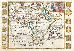
Key Facts
- Total Surface Area: Approximately 85,133,000 km² (excluding marginal seas).
- Average Depth: 3,646 meters (11,962 ft).
- Maximum Depth: 8,376 meters (27,480 ft) at the Milwaukee Deep in the Puerto Rico Trench.
- Total Volume: 310,410,900 km³ (including marginal seas).
- Shoreline Length: 111,866 km, including marginal seas.
Bathymetry and Geological Structure
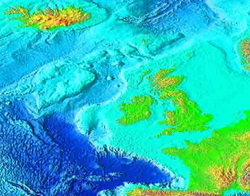
The bathymetry (the measurement of depth in oceans) of the Atlantic is dominated by the Mid-Atlantic Ridge (MAR), a massive submarine mountain range. The MAR extends from 300 km south of the North Pole down to Bouvet Island at 54°S.
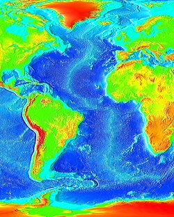
The Mid-Atlantic Ridge
The MAR rises 2–3 km above the surrounding ocean floor. It serves as a divergent plate boundary, where the North American and Eurasian plates separate in the north, and the South American and African plates separate in the south. This geological activity produces pillow lava on the ocean floor and basaltic volcanoes, such as Eyjafjallajökull in Iceland. While the apex of the ridge is typically shallower than 2,700 meters, the base of the ridge is three times deeper.
Water Characteristics and Circulation
The Atlantic is characterized by complex water masses categorized by temperature and salinity. These masses are distributed across upper waters (0–500 m), intermediate waters (500–1,500 m), and deep/abyssal waters (1,500 m to the bottom).
| Water Layer | Water Mass | Temperature Range | Salinity Range |
|---|---|---|---|
| Upper (0–500m) | Atlantic Subarctic Upper Water (ASUW) | 0.0–4.0 °C | 34.0–35.0 |
| Western North Atlantic Central Water (WNACW) | 7.0–20 °C | 35.0–36.7 | |
| Eastern North Atlantic Central Water (ENACW) | 8.0–18.0 °C | 35.2–36.7 | |
| South Atlantic Central Water (SACW) | 5.0–18.0 °C | 34.3–35.8 | |
| Intermediate (500–1,500m) | Western Atlantic Subarctic Intermediate Water (WASIW) | 3.0–9.0 °C | 34.0–35.1 |
| Eastern Atlantic Subarctic Intermediate Water (EASIW) | 3.0–9.0 °C | 34.4–35.3 | |
| Mediterranean Water (MW) | 2.6–11.0 °C | 35.0–36.2 | |
| Arctic Intermediate Water (AIW) | −1.5–3.0 °C | 34.7–34.9 | |
| Deep/Abyssal (1,500m+) | North Atlantic Deep Water (NADW) | 1.5–4.0 °C | 34.8–35.0 |
| Antarctic Bottom Water (AABW) | −0.9–1.7 °C | 34.6–34.7 | |
| Arctic Bottom Water (ABW) | −1.8 to −0.5 °C | 34.9–34.9 |
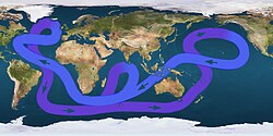
Ocean Gyres and Currents
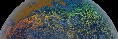
The Atlantic features major gyres—large systems of circulating ocean currents. In the North Atlantic, warm subtropical waters are transformed into colder subpolar and polar waters within the subpolar gyre. The Gulf Stream is a prominent current that transports warm water from the North American coast toward Western Europe, dropping in temperature by approximately 20 °C (36 °F) during its journey.
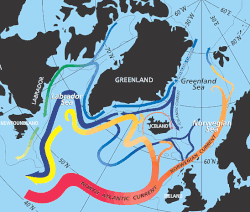
Climate and Natural Hazards
The Atlantic is a primary site for the formation of hurricanes. These are often triggered by instabilities in the atmosphere created by waves in the trade winds—areas where converging winds move along the same track as the prevailing wind.
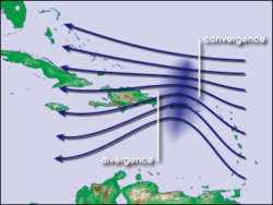
Human History and Economic Impact
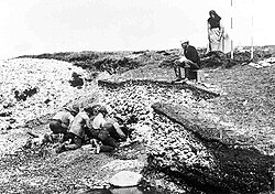
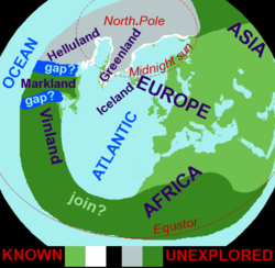
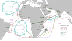
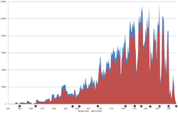
The Atlantic has been central to global history, from the limited Norse knowledge of the Americas described in the Íslendingasögur sagas to the Portuguese discoveries influenced by Atlantic gyres. However, this history also includes the Atlantic slave trade between 1525 and 1863.
Fisheries and Marine Resources
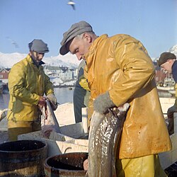
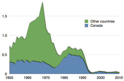
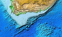
The ocean provides vast fishing grounds, particularly in the northeast and northwest Atlantic. In the southeast Atlantic, catches of horse mackerel and hake are most significant. While some regions saw declines—such as catches dropping from 3.3 million tons in the early 1970s to 1.3 million tons in 2013—regulations introduced in 2006 have helped recover deep-water and shallow-water hake to sustainable levels off South Africa and Namibia.
Environmental Challenges
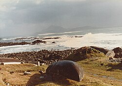
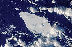
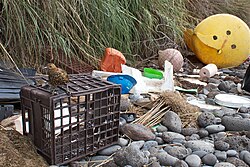
The Atlantic faces significant environmental threats, including marine debris and pollution. This is evident on remote locations such as the South Atlantic's Inaccessible Island, where waste often washes ashore.
Frequently Asked Questions
What is the deepest point of the Atlantic Ocean?
The deepest point is the Milwaukee Deep, located in the Puerto Rico Trench, reaching a depth of 8,376 meters (27,480 ft).
What is the Mid-Atlantic Ridge?
The Mid-Atlantic Ridge is a submarine mountain range that forms a divergent plate boundary, separating the Americas from Europe and Africa.
How does the Gulf Stream affect temperature?
The Gulf Stream carries warm water from the North American east coast to Western Europe, though its temperature drops by about 20 °C (36 °F) along the way.
What causes hurricanes in the Atlantic?
Hurricanes are often caused by atmospheric instabilities created by waves in the trade winds, where converging winds move along the same track as prevailing winds.
Are Atlantic fisheries sustainable?
Sustainability varies by region. While some areas experienced declines, regulations introduced in 2006 have helped recover hake populations to sustainable levels in the southeast Atlantic.