Aruba: A Comprehensive Overview of the Dutch Caribbean Island
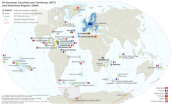
Aruba is a vibrant constituent country within the Kingdom of the Netherlands, located in the southern Caribbean. Known for its arid landscapes, white-sand beaches, and a rich multicultural heritage, the island operates as a devolved parliamentary representative democracy. From its early indigenous roots to its modern status as a tourism powerhouse, Aruba blends European influence with deep Caribbean traditions.
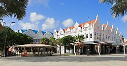
The island's capital and largest city, Oranjestad, serves as the administrative and economic hub, characterized by its ornate architecture and bustling port.
Key Facts
- Official Languages: Papiamento and Dutch.
- Government: Devolved parliamentary representative democracy under a constitutional monarchy.
- Capital: Oranjestad.
- Currency: Aruban florin (ƒ).
- Population: 108,880 (2025 census).
- Total Area: 180 km².
- Highest Point: 188 meters.
History and Cultural Evolution
Indigenous Roots and Early Migration
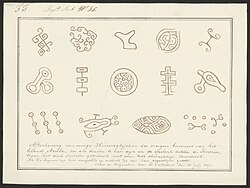
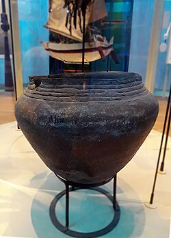
The earliest inhabitants of Aruba left behind evidence of their presence in the form of reddish ocre-like paint drawings on cave roofs. During the pre-ceramic age, early migrants utilized stone axe blades and hand axes for survival.
The island later became part of the Caquetío chiefdom, a Neo-Indian period society characterized by organized political units, extensive trade networks, and specific burial practices. The Caquetío maintained significant cultural and produce exchanges with other Caribbean inhabitants.
Colonial Transitions
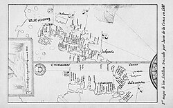
Following the indigenous era, Aruba entered the Spanish period, marked by early explorations and the establishment of Spanish ranches. Eventually, the Dutch gained control, initially driven by the lucrative salt trade. The island's history was further shaped by the era of slavery and a brief English interregnum that spurred economic development.
The Path to Autonomy
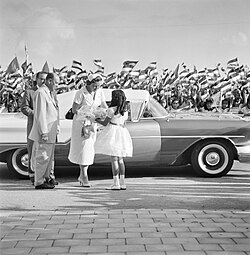
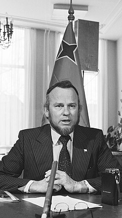
In the 20th century, Aruba sought greater self-governance. A pivotal figure in this movement was Betico Croes, who led the drive for autonomy during the 1970s and 80s. This effort culminated on January 1, 1986, when Aruba officially separated from the Netherlands Antilles to become a constituent country within the Kingdom of the Netherlands.
Geography and Environment
Regional Landscape
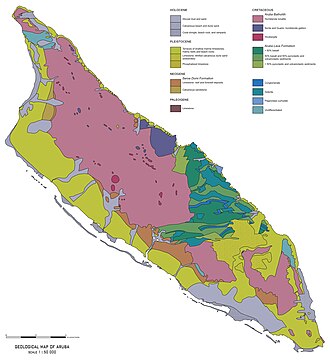
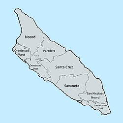
Aruba's terrain is predominantly arid, featuring rolling hills and rocky formations. The island is divided into several regions, with Santa Cruz being the largest by area. The highest elevation reaches 188 meters at Hooiberg.
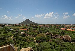
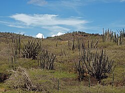
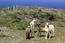
The Arikok National Park preserves much of the island's natural beauty, including its diverse cacti and wild goat populations.
Climate
The island experiences a tropical climate with consistently warm temperatures. Average maximums typically hover around 32°C (90°F), with minimal precipitation throughout the year, making it a semi-arid environment.
Demographics and Society
Population and Ethnicity
Aruba is a multicultural society. According to 2020 data, the population is predominantly Dutch (78.7%), with significant Colombian (6.6%), Venezuelan (5.5%), and Dominican (2.8%) minorities.
Language and Religion
Papiamento, a Spanish-based creole, is the most widely spoken language (63.3%), followed by Dutch (15%), Spanish (11.5%), and English (5%). Religiously, the majority of the population identifies as Roman Catholic (75.3%).
Economy and Infrastructure
Economic Drivers
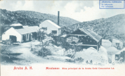
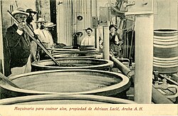
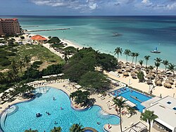
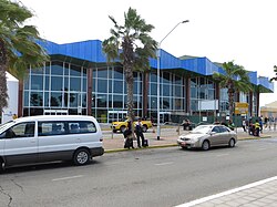
Aruba's economy has transitioned from early industries like gold mining and aloe production to a heavy reliance on tourism. Modern infrastructure, including luxury resorts and the Queen Beatrix International Airport, supports this industry.
Energy and Utilities
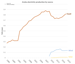
Electricity production is a critical component of the island's infrastructure, with a growing focus on diversifying energy sources to include wind and solar power to supplement traditional plants.
Summary of Aruba's Profile
| Category | Detail |
|---|---|
| Political Status | Constituent country of the Kingdom of the Netherlands |
| Capital | Oranjestad |
| GDP per Capita (PPP) | $51,352 (2023 estimate) |
| Main Languages | Papiamento, Dutch |
| Primary Industry | Tourism |
| Highest Point | Hooiberg (188m) |
Frequently Asked Questions
What is the political status of Aruba?
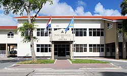
Aruba is a constituent country within the Kingdom of the Netherlands. It has its own government and parliament but remains part of the larger kingdom.
What languages are spoken in Aruba?
The official languages are Papiamento and Dutch. English and Spanish are also commonly spoken due to tourism and proximity to South America.
What is the primary economic activity on the island?
While the island previously relied on gold mining and aloe, the modern economy is primarily driven by tourism.
Who was Betico Croes?
Betico Croes was a pivotal political leader who championed Aruba's drive for greater autonomy from the Netherlands Antilles during the 1970s and 1980s.
What is the climate like in Aruba?
Aruba has a warm, semi-arid tropical climate with average high temperatures around 32°C and very low annual rainfall.