Turkey-Syria Earthquakes 2023: Analysis of the Kahramanmaraş Sequence
On February 6, 2023, a devastating seismic sequence struck southern Turkey and northern Syria, centered near Kahramanmaraş. This event consisted of two massive earthquakes that caused catastrophic loss of life and unprecedented infrastructure damage across the region. The sequence is characterized by its immense energy release and the complex interaction of tectonic plates in the Anatolian region.
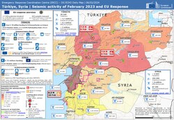
The first event, a magnitude 7.8 earthquake, occurred at 01:17:35 UTC, followed by a second magnitude 7.7 earthquake at 10:24:49 UTC. Together, these events triggered a humanitarian crisis that affected not only Turkey and Syria but was felt as far as Lebanon, Israel, Cyprus, Egypt, Iraq, Jordan, and Palestine.
Key Facts
- Mainshocks: Two major events with magnitudes of 7.8 and 7.7.
- Casualties: Estimated between 59,488 and 62,013 deaths.
- Economic Impact: Estimated total damage exceeding US $157.8 billion.
- Seismic Intensity: Reached a maximum of MMI XII (Extreme).
- Aftershocks: Over 30,000 recorded by May 2023, with more than 540 exceeding magnitude 4.0.
- Tectonic Mechanism: Strike-slip, supershear, doublet events.
Tectonic Setting and Seismology
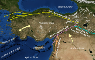
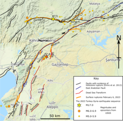
The earthquakes occurred within the complex tectonic environment of the Anatolian sub-plate. The primary rupture took place along the East Anatolian Fault and the Dead Sea Transform. These are strike-slip faults, where two blocks of the Earth's crust slide horizontally past one another.
The first mainshock (Mw 7.8) originated at a depth of 10.0 km, while the second (Mw 7.7) occurred at a depth of 7.4 km. The sequence is described as a doublet, meaning two large earthquakes of similar magnitude occurred in close proximity and time.
Geological Effects and Surface Rupture
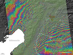
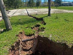
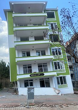
The immense power of the rupture led to significant geological alterations. Surface ruptures were observed across the affected provinces, creating visible cracks in the landscape. One of the most destructive phenomena observed was soil liquefaction—a process where saturated soil loses strength and behaves like a liquid during intense shaking, causing buildings to tilt or sink.
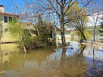
Additionally, lateral spreading led to subsidence at Lake Gölbaşı, resulting in floods along the shoreline. The seismic energy also triggered a small tsunami, with waves reaching approximately 40 cm (0.40 m) off the coast of Famagusta.
Impact on Infrastructure and Human Life
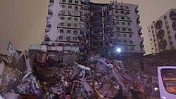
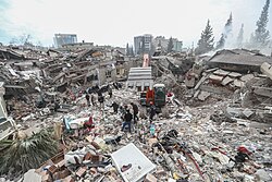
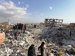
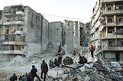
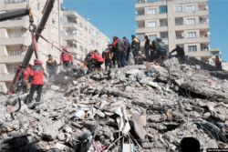
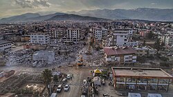
The destruction was widespread, with the highest intensity recorded in cities like Antakya, Gaziantep, and Kahramanmaraş. In Turkey, at least 53,537 people died, and over 107,000 were injured. Syria suffered similarly, with estimated deaths between 5,951 and 8,476.
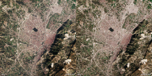
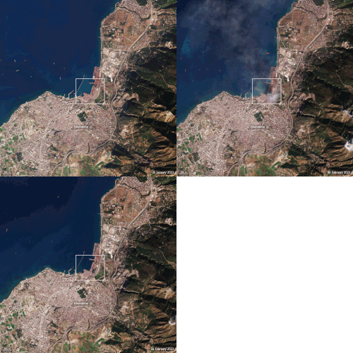
Infrastructure failure was catastrophic. In Turkey, over 164,000 buildings were either collapsed or severely damaged. Beyond residential losses, historic sites and ancient monuments in the "cradle of civilization" were destroyed. Industrial areas were also hit; for example, a major blaze broke out at the İskenderun port following the tremors.
International Response and Recovery
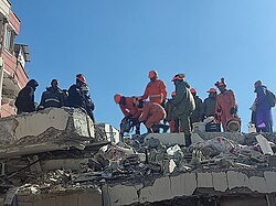
The scale of the disaster prompted a massive global humanitarian effort. Search and rescue operations were carried out by teams from numerous countries, including the NDRF from India (Operation Dost), as well as teams from China, Iran, and the United States via USAID.
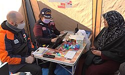
International organizations, including the European Union (EU), NATO, the United Nations (UN), and the World Bank, provided critical aid. This included the establishment of field hospitals, such as those provided by Japanese health teams, and the deployment of emergency shelter facilities.
Summary of Earthquake Sequence
| Feature | First Mainshock | Second Mainshock |
|---|---|---|
| Magnitude | 7.8 | 7.7 |
| UTC Time | 2023-02-06 01:17:35 | 2023-02-06 10:24:49 |
| Epicenter Fault | Çardak–Sürgü Fault | East Anatolian Fault |
| Depth | 10.0 km | 7.4 km |
| Duration | c. 80 seconds | Not specified |
Frequently Asked Questions
What caused the 2023 Turkey-Syria earthquakes?
The earthquakes were caused by the movement of the Anatolian sub-plate along the East Anatolian Fault and the Dead Sea Transform, resulting in strike-slip rupture events.
What is soil liquefaction and why did it happen?
Soil liquefaction occurs when water-saturated sediment loses its strength due to strong earthquake shaking, causing the ground to act like a liquid. This led to tilted buildings and subsidence in areas like Gölbaşı.
How many people were affected by the disaster?
The total death toll is estimated between 59,488 and 62,013, with over 121,000 injuries reported across Turkey and Syria.
Were there any tsunamis caused by these earthquakes?
Yes, small tsunamis were reported, with wave heights of approximately 40 cm observed off the coast of Famagusta.
What was the economic cost of the damage?
The estimated total damage is greater than US $157.8 billion, involving the collapse of over 164,000 buildings in Turkey alone.