Tropical Cyclone Eyes: The Calm Center of the Storm
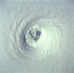
At the heart of a powerful tropical cyclone lies a paradoxical phenomenon: a region of relative tranquility known as the eye. While the surrounding storm may be unleashing catastrophic winds and torrential rain, the eye offers a brief, eerie respite of calm weather and clear skies. Understanding the mechanics of this central feature is essential for meteorologists and those living in the path of these massive weather systems.
The eye is typically a roughly circular area, ranging from 30 to 65 kilometers (19 to 40 miles) in diameter. It is defined by its low barometric pressure, which can be as much as 15 percent lower than the pressure outside the storm. This low-pressure center is the engine that drives the cyclone's rotation and intensity.
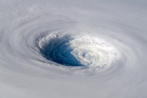
The Anatomy of a Cyclone
To understand the eye, one must understand its immediate neighbor: the eyewall. The eyewall is a ring of towering thunderstorms that encircles the eye. This is where the most severe weather, highest winds, and heaviest rainfall occur. The relationship between the eye and the eyewall is a fundamental aspect of tropical cyclone structure.
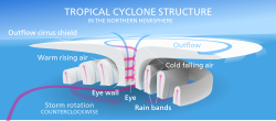
The appearance of an eye can vary significantly depending on the strength of the storm:
- Strong Cyclones: Characterized by light winds, clear skies, and a symmetric, towering eyewall.
- Weaker Cyclones: The eye may be less defined and often obscured by the central dense overcast (CDO)—a region of high, thick clouds visible on satellite imagery.
- Disorganized Storms: These may feature an incomplete eyewall, heavy rain within the eye, or may lack an eye entirely.
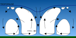
Variations in Eye Size and Appearance
Eyes are not uniform in size. They can range from massive structures, such as Typhoon Carmen with a diameter of 370 km (230 mi), to minuscule "pinhole" eyes like Hurricane Wilma, which measured just 3.7 km (2.3 mi) across.
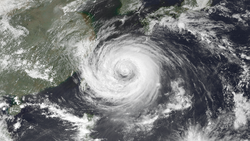
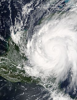
Some eyes are "clear," containing only spotty low clouds, while others are "filled" with low- and mid-level clouds. In certain intense storms, a phenomenon known as the stadium effect occurs, where the eyewall clouds slope outward with height, creating a bowl-like appearance.
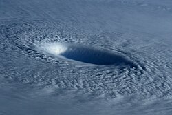
Eyewall Replacement Cycles
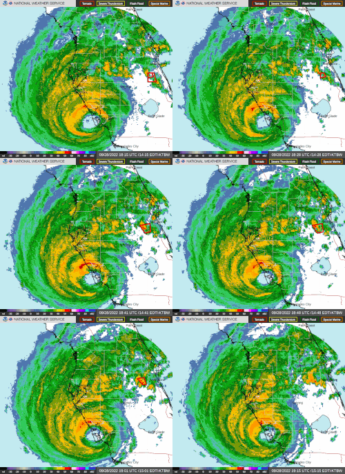
In intense tropical cyclones—typically those with winds exceeding 185 km/h (115 mph) or Category 3 and higher—a process called an eyewall replacement cycle (or concentric eyewall cycle) often occurs. This happens when a new, outer eyewall forms from the storm's rainbands and begins to move inward.
As this outer eyewall develops, it "chokes off" the inner eyewall by robbing it of moisture and angular momentum. During this phase, the storm usually weakens. However, once the inner eyewall dissipates and the outer eyewall contracts, the storm can re-intensify, often resulting in a larger, more stable eye.
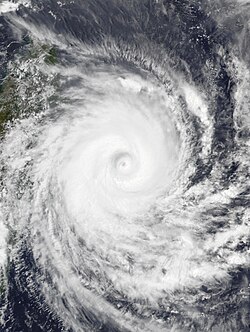
Research indicates that 53 percent of intense hurricanes undergo at least one of these cycles. Some storms, like Hurricane Juliette in 2001, have even been documented with triple eyewalls.
Associated Phenomena and Eye-Like Features
While the term "eye" is officially reserved for tropical cyclones, other weather systems exhibit similar characteristics:
- Polar Lows: Small, intense systems found near the poles that can feature a clear eye surrounded by an eyewall.
- Subtropical Cyclones: Low-pressure systems with mixed characteristics that may possess an eye.
- Extratropical Storms: Some intense winter storms, such as the North American blizzard of 2006, have shown eye-like structures.
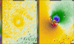
- Tornadoes: High-resolution Doppler radar has observed clearing zones near the mesocyclone of intense tornadoes.
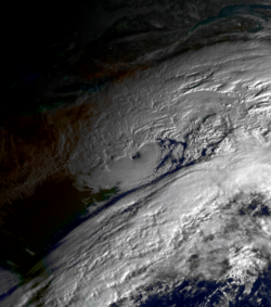
Even beyond Earth, eye-like structures have been observed. NASA's Cassini spacecraft identified a hurricane-like storm on Saturn with a clearly defined eyewall, and the Venus Express mission observed dipole eye structures on Venus.

Mesovortices and Turbulence
Within the eye of some hurricanes, small-scale swirling motions known as mesovortices can be observed. These can add complexity to the storm's internal dynamics.
Key Facts
- Lowest Pressure: The eye contains the storm's lowest barometric pressure.
- Eye Size Range: Can vary from 3.7 km (Hurricane Wilma) to 370 km (Typhoon Carmen).
- Eyewall Intensity: The most violent winds and rain are located in the eyewall, not the eye.
- Replacement Cycles: 53% of intense hurricanes undergo eyewall replacement cycles.
- Ocean Hazards: The eye can cause waves to converge from all directions, potentially creating rogue waves.
Summary of Storm Structures
| Feature | Weather Conditions | Wind/Pressure Characteristics |
|---|---|---|
| Eye | Calm, clear skies, or light clouds | Lowest barometric pressure; light winds |
| Eyewall | Severe thunderstorms, heavy rain | Highest wind speeds and most intense weather |
| Outer Rainbands | Intermittent heavy rain and wind | Variable intensity |
Frequently Asked Questions
Is it safe to go outside when the eye passes over?
No. While the eye is calm, it is a dangerous mistake to exit your home to inspect damage. The violent winds of the opposite eyewall will return suddenly and with extreme force once the eye passes.
What causes the eye to be warmer than the surroundings?
Due to the mechanics of the tropical cyclone, the air in the eye and the air directly above it are warmer than the surrounding environment.
How can meteorologists detect an eye?
Eyes are typically easy to spot using weather radar. Additionally, microwave satellite imagery is highly effective at seeing eye-like features that might be obscured on visible or infrared wavelengths.
What is an eyewall replacement cycle?
It is a process where an outer ring of thunderstorms forms around the inner eyewall, eventually replacing it. This typically causes the storm to temporarily weaken before it potentially re-strengthens.
Can non-tropical storms have eyes?
Yes. While the official term is for tropical cyclones, polar lows, subtropical cyclones, and even some extratropical storms can exhibit eye-like structures.