Silesia: A Historical and Cultural Journey Through Central Europe
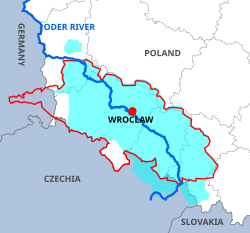
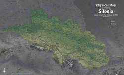
Silesia is a storied historical region of Central Europe, characterized by its rich mineral deposits, complex political heritage, and a diverse cultural tapestry. Spanning approximately 40,000 square kilometers, the region is today primarily located within Poland, with smaller portions extending into the Czech Republic and Germany. With an estimated population of 8 million people, Silesia is traditionally divided into two primary subregions: Lower Silesia in the west and Upper Silesia in the east.
From its early days under Great Moravia to its industrial peak as a global coal producer, Silesia has served as a strategic crossroads for empires and dynasties. Its history is one of constant transition, shifting between Polish, Bohemian, Austrian, and Prussian rule.
Key Facts

- Total Area: Approximately 40,000 km².
- Current Distribution: Mostly Poland, with parts in the Czech Republic and Germany.
- Major Cities: Wrocław (largest), Katowice, and Ostrava.
- Primary Resources: Bituminous coal, lignite, copper, and zinc.
- Historical Divisions: Split into Lower Silesia (west) and Upper Silesia (east).
A Timeline of Political Sovereignty

Early Statehood and the Piast Dynasty
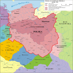
The region was first held by Great Moravia in the late 9th century and Bohemia in the early 10th century. By the 10th century, Mieszko I of the Piast dynasty incorporated Silesia into the emerging Polish state. A pivotal moment occurred in 1000 with the establishment of the Diocese of Wrocław, the region's oldest Catholic diocese.
Bohemian and Habsburg Rule
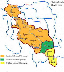
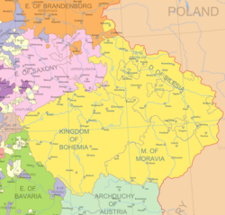
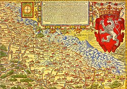
Following the fragmentation of Poland in the 12th century, Silesia evolved into the Duchy of Silesia and later split into various smaller duchies. By the 14th century, the region became part of the Bohemian Crown Lands under the Holy Roman Empire. In 1526, this authority passed to the Austrian Habsburg Monarchy, though several duchies remained under Polish dukes as formal Bohemian fiefdoms.
The Prussian Era and the German Empire
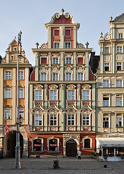
The geopolitical landscape shifted dramatically in 1742 when King Frederick II of Prussia seized most of Silesia during the War of the Austrian Succession. By 1815, it was established as the Prussian Province of Silesia, and in 1871, it became part of the German Empire. During this era, the capital city of Breslau (now Wrocław) emerged as a major German center for science, industry, and Jewish life.
Post-War Transitions and Modern Borders
After World War I, Upper Silesia became a point of contention between Germany and the Second Polish Republic. A 1921 plebiscite showed 60% support for Germany and 40% for Poland; however, following the third Silesian uprising, the easternmost portion (including Katowice) was awarded to Poland. Meanwhile, Austrian Silesia was largely transferred to the newly formed Czechoslovakia.
Ethnic and Religious Composition

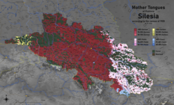
Silesia has historically been a melting pot of ethnicities. In the early 19th century, the Prussian portion of the region was predominantly German-speaking (roughly 70-75%), with a significant Polish-speaking minority (roughly 21-27%). Other groups included Sorbs, Czechs, Moravians, and Jews.
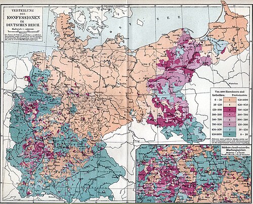
Religious divisions were also prominent. Lower Silesia was largely Protestant, while Upper Silesia and the Glatz (Kłodzko) region remained predominantly Catholic.
The end of World War II brought drastic demographic changes. Between 1945 and 1947, approximately 1.77 million Germans were expelled from Lower Silesia and 310,000 from Upper Silesia, with many relocating to the Ruhr area of Germany.
Geography and Industrial Power

Silesia is renowned for its vast natural resources, particularly coal. Mining began in the mid-18th century and reached its zenith in the 1970s under the People's Republic of Poland, making the region one of the world's largest coal producers.
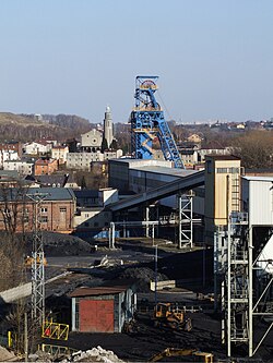
The Upper Silesian Coal Basin, covering about 4,500 km², remains the heart of the region's industry. While some Lower Silesian mines closed in 2000 due to profitability issues, massive lignite reserves (estimated at 35 billion tonnes) were discovered near Legnica in 2008.
Mineral Production Summary
| Mineral Name | Production (Tonnes) |
|---|---|
| Bituminous coal | 95,000,000 |
| Copper | 571,000 |
| Zinc | 160,000 |
| Lead | 70,000 |
| Silver | 1,200 |
| Cadmium | 500 |
Major Urban Centers

The region is highly urbanized, with Wrocław serving as the primary hub in Lower Silesia. In Upper Silesia, cities like Katowice and Gliwice form a dense industrial and residential network.
Frequently Asked Questions


What are the two main subregions of Silesia?
Silesia is divided into Lower Silesia in the west and Upper Silesia in the east.
Which countries currently share the territory of Silesia?
The region lies mostly within Poland, with smaller portions located in the Czech Republic and Germany.
What is the primary industrial resource of the region?
Coal is the most significant resource, particularly within the Upper Silesian Coal Basin, though the region also produces copper, zinc, and silver.
Who were the Piasts?
The Piasts were the first historical ruling dynasty of Poland who incorporated Silesia into the Polish state during the 10th century.
What happened to the German population after World War II?
The majority of Germans were either fled or expelled from the Polish and Czech parts of Silesia between 1945 and 1947, with millions relocating to the Federal Republic of Germany.