Saronida: A Coastal Gem of the Attica Peninsula
Nestled along the scenic shores of the Saronic Gulf, Saronida is a serene destination located in the southeastern region of the Attica peninsula. Positioned at the western foot of the Olympos hill, this town offers a blend of coastal beauty and strategic accessibility within the Greek landscape.
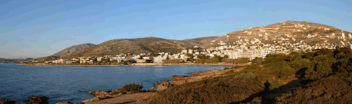
Geographic Location and Surroundings
Saronida is situated in a prime location that balances seclusion with proximity to major hubs. It serves as a quiet retreat while remaining well-connected to other significant settlements in the Attica region.
The town is located 2 km northwest of Anavyssos and 10 km south of Kalyvia Thorikou. For those traveling from the capital, Saronida is positioned 31 km southeast of the Athens city centre, making it an accessible getaway for city dwellers.
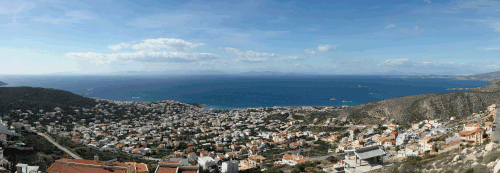
Transportation and Accessibility
Getting to and from Saronida is straightforward due to its placement along major transit routes. The town is traversed by Greek National Road 91, the primary artery connecting Athens to Sounio.
In addition to road travel, Saronida is integrated into the regional transport network via regular bus services that connect the town directly to Athens.
Key Facts
- Location: Southeastern Attica peninsula, Saronic Gulf coast.
- Landmark: Situated at the western foot of Olympos hill.
- Distance to Athens: 31 km southeast of the city centre.
- Nearby Towns: 2 km from Anavyssos and 10 km from Kalyvia Thorikou.
- Main Road: Greek National Road 91 (Athens - Sounio).
- Public Transit: Accessible via bus services from Athens.
| Destination | Distance/Route |
|---|---|
| Anavyssos | 2 km (Southeast) |
| Kalyvia Thorikou | 10 km (North) |
| Athens City Centre | 31 km (Northwest) |
| Main Access Road | National Road 91 |
Frequently Asked Questions
Where exactly is Saronida located?
Saronida is located on the coast of the Saronic Gulf in the southeastern part of the Attica peninsula, specifically at the western foot of Olympos hill.
How far is Saronida from Athens?
Saronida is situated 31 km southeast of the Athens city centre.
What is the primary road used to reach Saronida?
The town is accessed via Greek National Road 91, which connects Athens to Sounio.
Are there public transportation options to Saronida?
Yes, Saronida is connected to Athens through available bus services.
Which other towns are near Saronida?
Saronida is located 2 km northwest of Anavyssos and 10 km south of Kalyvia Thorikou.