Route 141: A Comprehensive Journey Through Western Massachusetts
Route 141 serves as a vital artery connecting several key municipalities in Western Massachusetts. Stretching from the heart of Easthampton to the outskirts of Springfield, this route traverses a diverse landscape of industrial hubs, residential neighborhoods, and natural landmarks, including the scenic slopes of Mount Tom and the banks of the Connecticut and Chicopee Rivers.
Route 141 Path and Progression
Easthampton and the Ascent to Mount Tom
The journey begins at the intersection of Route 10 (Main Street) just north of Park Street in Easthampton. Heading south along Union Street, the route cuts through the downtown district, crossing a rail trail near Railroad Street. After passing a strip mall, Route 141 transitions onto Payson Avenue and becomes Cottage Street, where it passes an old factory and the shores of Nashawannuck Pond.
As the route turns south onto Holyoke Street, it maintains a parallel course with Nashawannuck Pond, passing through residential areas. At the junction with Hendrick Street, the road transforms into Mountain Road, winding along the side of Mount Tom before crossing the county line from Hampshire into Hampden County.
Navigating Holyoke and the Canal Systems
Upon entering Holyoke, the road is known as Easthampton Road. It passes through the Rock Valley section, skirting the Whiting Reservoir and Wyckoff Country Club before entering Smiths Valley. Here, the route provides access to Interstate 91 southbound via exit 17 and connects to I-91 northbound through a trumpet interchange.
In downtown Holyoke, Route 141 operates as a one-way couplet (a pair of one-way streets that function as a divided highway). Eastbound traffic flows along Dwight Street, while westbound traffic uses Hampden Street. These segments intersect with US 5 and US 202 (Northampton Street) before merging again at Pleasant Street in the Oakdale neighborhood.
Continuing southeast along Appleton Street, the route crosses the First and Second Level Canals. It then turns southwest onto Race Street and east onto Cabot Street, where it becomes concurrent with Route 116. Together, these routes cross the Third Level Canal and several railroad tracks.
Crossing into Chicopee and Springfield
Route 141 and Route 116 cross the Connecticut River to enter Chicopee via Chicopee Street. After passing under I-391, Route 141 diverges east onto Grattan Street, passing through the Aldenville neighborhood and under the Mass Pike (I-90). In the Sandy Hill neighborhood, the route turns east along the Chicopee River to meet Route 33 (Memorial Drive).
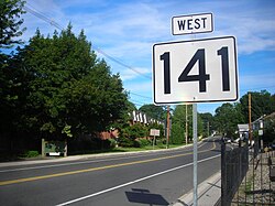
The route then turns south along Bridge Street, crosses the river, and follows East Main Street through the Chicopee Falls neighborhood. After intersecting Carew Street, it utilizes the American Legion Memorial Bridge to access I-291 exit 6. From there, it becomes Worcester Street as it enters Springfield.
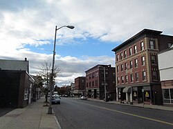
In the Indian Orchard neighborhood, Route 141 parallels US 20 and the Chicopee River, passing a large industrial plant. The route eventually turns onto Front Street and then Main Street, eventually meeting Route 21 (Parker Street). The two routes run concurrently south as a four-lane road, passing Hubbard Park, until they reach the eastern terminus of Route 141 at the junction with US 20 (Boston Road).
Key Facts
- Termini: Starts at Route 10 in Easthampton and ends at US 20 in Springfield.
- Counties: Traverses both Hampshire and Hampden Counties.
- Major Waterways: Crosses the Connecticut River and the Chicopee River, and passes three levels of canals in Holyoke.
- Interstate Access: Provides connections to I-91, I-391, I-90 (Mass Pike), and I-291.
- Concurrent Routes: Shares segments with Route 116 and Route 21.
Route 141 Summary Table
| City/Town | Key Landmarks/Roads | Major Intersections |
|---|---|---|
| Easthampton | Nashawannuck Pond, Mount Tom | Route 10 |
| Holyoke | Rock Valley, Oakdale, Three-Level Canals | I-91, US 5, US 202, Route 116 |
| Chicopee | Aldenville, Sandy Hill, Chicopee Falls | I-391, I-90, Route 33, I-291 |
| Springfield | Indian Orchard, Hubbard Park | Route 21, US 20 |
Frequently Asked Questions
Where does Route 141 begin and end?
Route 141 begins at the intersection of Route 10 (Main Street) in Easthampton and reaches its eastern terminus at the junction with US 20 (Boston Road) in Springfield.
Which rivers does Route 141 cross?
The route crosses both the Connecticut River and the Chicopee River during its course through the region.
What is the "one-way couplet" in Holyoke?
In downtown Holyoke, Route 141 splits into two separate one-way streets: Dwight Street for eastbound traffic and Hampden Street for westbound traffic.
Does Route 141 provide access to the Mass Pike?
Yes, Route 141 (as Grattan Street) passes under the Mass Pike (I-90) in the Sandy Hill neighborhood of Chicopee.
Which other state routes share the road with Route 141?
Route 141 runs concurrently with Route 116 through Holyoke and Chicopee, and with Route 21 in the Springfield area.