Ravines: Formation, Characteristics, and Environmental Impact
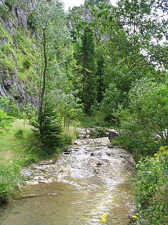
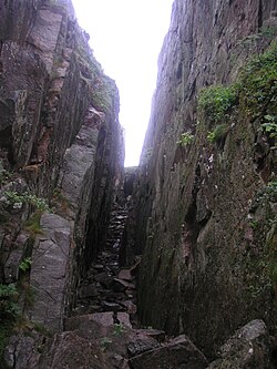
A ravine is a distinct landform characterized by its narrow width and steep sides. Often the result of streambank erosion—the wearing away of banks by the force of flowing water—ravines occupy a specific niche in geological scale. They are larger than gullies but smaller than canyons or valleys.
Depending on the region and language, these landforms are known by various names. In South Africa, they are called kloofs; on the Isle of Wight, they are referred to as chines. Other regional terms include cleuch, dell, ghout, gill, ghyll, glen, goyle, or gorge.
Key Facts
- Scale: Larger than a gully, smaller than a canyon.
- Gradient: Typically feature steep cross-sectional sides ranging from 20% to 70%.
- Formation: Created by fluvial (water-based) erosion, often as the final stage of gully erosion.
- Water Flow: May contain active streams, though many are characterized by intermittent flow.
- Depth Threshold: A gully is generally classified as a ravine once it exceeds a depth of 5 meters (16 ft).
The Science of Ravine Formation
Ravines are primarily fluvial slope landforms. Their creation begins in hilly or mountainous regions where water runoff is guided downhill by steep slopes. Over time, this runoff erodes the landscape, creating gullies. When this erosion becomes severe enough to cut deep into the earth, a ravine is formed.
While some ravines have perennial streams, many are intermittent. This is because the geographic scale of a ravine may not be large enough to support a constant, year-round flow of water.
Environmental Impact and Land Loss
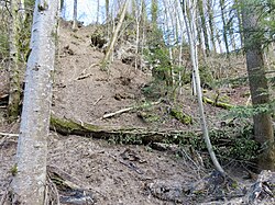
The process of ravine erosion has significant global consequences, particularly regarding the loss of agricultural land. When soil is stripped away, it leads to increased pollution, more frequent flooding, and the sedimentation of waterways.
Human activity can accelerate this process. Deforestation and overgrazing remove the protective vegetation that holds soil in place, speeding up the formation of ravine lands. In the Indian badlands, for example, soil erosion is estimated to exceed 40 tonnes per hectare annually.
Regional Examples and Case Studies
The Volcanic Ravines of Hawaii
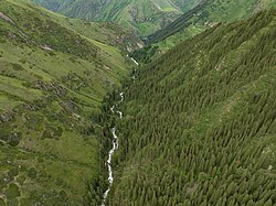
In Hawaii, the distribution of ravines is heavily influenced by shield volcanoes, specifically Mauna Loa and Mauna Kea. V-shaped ravines appear on the flanks of these volcanoes specifically where they have been covered by Pahala ash. Because Mauna Kea is the older of the two, its ravines show more pronounced dissection.
The process begins with rainfall and infiltration capacity initiating valleys. As streams incise the land, they form V-shaped ravines. Over time, these systems deepen, eventually exposing groundwater activity. The deepest of these incisions evolve into U-shaped, theatre-headed valleys.
Notable Ravines Worldwide
Ravines are found across every continent, serving as both geological landmarks and environmental challenges. Notable examples include:
- North America: Toronto ravine system (Canada) and Ravenna Park (United States).
- Europe: Babi Yar (Ukraine), Gravina Ravine (Italy), Barranco de Badajoz and Barranco del Infierno (Spain), and Rauðfeldsgjá and Stuðlagil (Iceland).
- Asia: Taishaku Valley (Japan) and Moola Chotok (Pakistan).
- Africa: Bam Bam Amphitheaters (Gabon).
Summary of Landform Classifications
| Landform | Relative Scale | Primary Characteristic |
|---|---|---|
| Gully | Smallest | Initial deep channel from runoff |
| Ravine | Intermediate | Steep sides (20-70%), depth > 5m |
| Canyon/Valley | Largest | Large-scale incision, often perennial |
Frequently Asked Questions
What is the difference between a gully and a ravine?
While some languages use the terms interchangeably, a ravine is generally larger and deeper than a gully. Specifically, a gully is often reclassified as a ravine once it reaches a depth exceeding 5 meters (16 ft).
How steep are the sides of a typical ravine?
Ravines are characterized by relatively steep cross-sectional sides, typically with a gradient ranging from 20% to 70%.
Do ravines always have water flowing through them?
Not necessarily. While they are formed by water, many ravines feature intermittent streams because their scale is often too small to support a perennial (year-round) stream.
What human activities accelerate ravine formation?
Deforestation and overgrazing are the primary human activities that speed up ravine erosion by removing the vegetation that stabilizes the soil.
What shape do ravines typically take on volcanic slopes?
On the flanks of Hawaiian shield volcanoes, they typically begin as V-shaped ravines, though the deepest incisions can eventually become U-shaped, theatre-headed valleys.