Metropolitan Statistical Areas: Defining Urban Regions in the United States
In the United States, a Metropolitan Statistical Area (MSA) is a geographical region characterized by a high population density at its core and strong economic ties throughout the surrounding area. Unlike cities or towns, MSAs are not legally incorporated entities, nor are they administrative divisions like counties or states. Because they are statistical tools rather than legal boundaries, precise definitions can sometimes vary between different data sources.
Modern metropolitan areas are often polycentric due to suburbanization, meaning they are no longer exclusively centered around a single historic core city. While some are defined by one major hub, others encompass multiple large cities. Notable examples include the Dallas–Fort Worth metroplex, the Twin Cities (Minneapolis–Saint Paul), the Inland Empire (Riverside–San Bernardino), and Hampton Roads (Virginia Beach–Norfolk–Newport News).
These areas are defined by the Office of Management and Budget (OMB), a part of the Executive Office of the President. The U.S. Census Bureau and other federal agencies utilize these delineations for critical statistical and planning purposes.
![An enlargeable map of the 935 core-based statistical areas (CBSAs) of the United States and Puerto Rico as of 2023; the 393 MSAs are shown in green.[6]](/images/ea/a9/eaa97211e2352815bf22519a433c849eecea2531497364820658ed436a44e8d8.jpg)
Key Facts
- Defining Body: The Office of Management and Budget (OMB) establishes the boundaries.
- MSA Threshold: An MSA must be formed around an urban area with at least 50,000 people.
- Micropolitan Area: A CBSA with an urban core of at least 10,000 but fewer than 50,000 people.
- Composition: MSAs are composed of counties or county equivalents.
- Economic Ties: Outlying counties are included if 25% of workers commute to the central county or 25% of employment is held by residents of the central county.
How Statistical Areas are Defined
The OMB uses a hierarchy of Core-Based Statistical Areas (CBSAs) to organize the country's population centers. A CBSA is built around an urban area—a contiguous region of high population density.
Central and Outlying Counties
The counties that contain the core urban area are designated as central counties. To qualify, at least 50% of the county's population must live in an urban area of 10,000 people or more. Surrounding outlying counties are added to the CBSA if they demonstrate strong social and economic integration, specifically measured by commuting and employment patterns.
Combining and Subdividing Areas
When the central counties of one CBSA qualify as outlying counties for another, the two are merged. Furthermore, multiple CBSAs can be grouped into a Combined Statistical Area (CSA) if the Employment Interchange Measure (EIM) reaches 15% or higher. For very large MSAs with populations exceeding 2.5 million, the OMB may further divide them into metropolitan divisions.
While there was a proposal in 2021 to raise the minimum population for an MSA from 50,000 to 100,000, the OMB ultimately maintained the 50,000 threshold for the 2020 cycle.
Evolution of Urban Classification
The process of classifying urban centers has evolved significantly since the early 20th century. The Census Bureau first introduced the "metropolitan district" for the 1910 census with a population threshold of 200,000. This threshold was lowered to 100,000 in 1930 and further to 50,000 in 1940.
By 1950, these were replaced by Standard Metropolitan Areas (SMAs), which became Standard Metropolitan Statistical Areas (SMSAs) in 1959. The current MSA framework was established in 1983 to account for a surge in eligible markets. The CBSA concept was later introduced in 2000 and fully defined in 2003, creating the distinction between metropolitan and micropolitan areas.
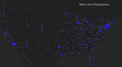
Regional Data: Puerto Rico
Puerto Rico contains six designated Metropolitan Statistical Areas. Recent data shows a general trend of population decline across these regions between the 2020 census and 2025 estimates.
| Rank | Metropolitan Statistical Area | 2025 Estimate | 2020 Census | Change | Encompassing CSA |
|---|---|---|---|---|---|
| 1 | San Juan–Bayamón–Caguas | 2,024,195 | 2,081,265 | −2.74% | San Juan–Bayamón |
| 2 | Ponce | 262,792 | 278,477 | −5.63% | Ponce–Coamo |
| 3 | Aguadilla | 250,088 | 253,768 | −1.45% | Mayagüez–Aguadilla |
| 4 | Mayagüez | 206,355 | 213,831 | −3.50% | Mayagüez–Aguadilla |
| 5 | Arecibo | 179,229 | 182,705 | −1.90% | San Juan–Bayamón |
| 6 | Guayama | 63,864 | 68,442 | −6.69% | San Juan–Bayamón |
Frequently Asked Questions
What is the difference between an MSA and a city?
A city is a legally incorporated municipality with its own government and defined boundaries. An MSA is a statistical region defined by the OMB that includes the core city and surrounding counties with strong economic ties, regardless of legal city limits.
What is a Micropolitan Statistical Area?
A Micropolitan Statistical Area (μSA) is a Core-Based Statistical Area that has an urban core population of at least 10,000 but less than 50,000 people.
How are outlying counties added to an MSA?
Outlying counties are included if there is a strong commuting relationship: either 25% of the county's workers commute to the central county, or 25% of the jobs in the county are filled by people living in the central county.
What is a Combined Statistical Area (CSA)?
A CSA is a larger statistical entity formed by grouping adjacent CBSAs together when their Employment Interchange Measure (EIM) is 15% or higher.
Who is responsible for updating MSA boundaries?
The Office of Management and Budget (OMB) is responsible for defining and revising the delineations of MSAs, micropolitan areas, and combined statistical areas.