Maribyrnong River: Course, Geography, and Ecology
The Maribyrnong River is a significant waterway in central Victoria, carving a path from the highlands of the Great Dividing Range to the urban heart of Melbourne. Spanning 40 kilometres (25 mi), the river descends 42 metres (138 ft) as it travels southward, eventually merging with the Yarra River at Yarraville before emptying into Port Phillip.
Key Facts
- Total Length: 40 kilometres (25 mi).
- Total Descent: 42 metres (138 ft).
- Primary Tributaries: Jackson Creek and Deep Creek.
- Source Region: Macedon Ranges, Great Dividing Range.
- Termination: Confluence with the Yarra River at Yarraville.
The Headwaters and Upper Reaches
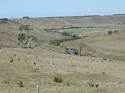
The journey of the Maribyrnong begins in the Macedon Ranges, approximately 60 kilometres (37 mi) northwest of the Melbourne City Centre. The catchment area is fed by various creeks in the southern Mount Macedon region that flow into Riddells Creek, which then feeds into Jackson Creek. Jackson Creek originates northwest of Gisborne, roughly 50 kilometres (31 mi) north of the CBD.
Parallel to this is Deep Creek, another major tributary originating in the northern and eastern Macedon Ranges. Deep Creek is notable for cutting a deep valley through the surrounding basalt plains, particularly as it passes through Bulla and Konagaderra. The Maribyrnong River officially forms west of Melbourne Airport, where the waters of Jackson Creek and Deep Creek converge.
Near the Calder Freeway, the Organ Pipes National Park sits adjacent to Jackson Creek. This park is famous for its basaltic columns—geological formations that resemble the pipes of a church organ. While swimming occurs in these upper reaches, it is not recommended.
The Middle Reaches
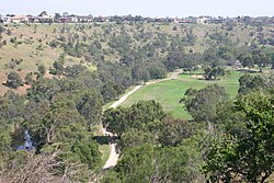
As the river flows south and west, it exhibits dramatic geographical shifts. At Keilor, the river forms a massive horseshoe bend before winding south again toward Brimbank Park. In this section, the river flows 55 metres (180 ft) below the level of the western plains.
Brimbank Park serves as a natural amphitheatre, offering visitors walking and cycling trails, picnic areas, and a café. The area is a haven for native fauna and birdlife. From here, the Maribyrnong River Trail begins, a shared path that follows the river's edge toward Footscray. In areas like Essendon West and Avondale Heights, the valley provides a clear vista of the Melbourne CBD skyline.
Geologically, the Maribyrnong is one of the few large basaltic streams (rivers flowing over basalt rock) in Victoria. It remains a freshwater river until it reaches Solomon's Ford in Avondale Heights. Note that swimming is prohibited downstream of the Canning Street bridge in Avondale Heights.
The Lower Reaches and Estuary
Upon reaching Avondale Heights, the river becomes estuarine, meaning it is a tidal area where freshwater meets the salty water of the sea. In the suburb of Maribyrnong, the Living Museum of the West provides historical insights into the river's role in early industrial development.
The lower reaches are home to diverse wildlife; water birds are common at Burndap Park, and dolphins are occasionally sighted. The river meanders past Pipemakers Park, Burndap Park, and Footscray Park—located opposite the Flemington Racecourse—before reaching its final juncture with the Yarra River at Yarraville.

Despite the wildlife, the water quality in these estuarine sections is poor. Sediments contain significant pollution resulting from 20th-century sewage discharge and industrial activities. Consequently, swimming is not recommended due to the risk of exposure to untreated sewage in urban run-off.
River Summary
| Feature | Details |
|---|---|
| Source | Confluence of Jackson Creek and Deep Creek |
| Total Length | 40 km (25 mi) |
| Elevation Drop | 42 m (138 ft) |
| Key Geological Feature | Basaltic columns (Organ Pipes) |
| Water Type | Freshwater (Upper/Middle), Estuarine (Lower) |
| End Point | Yarra River at Yarraville |
Frequently Asked Questions
Where does the Maribyrnong River start?
The river is formed by the confluence of Jackson Creek and Deep Creek, both of which draw their headwaters from the Macedon Ranges in the Great Dividing Range.
What are the Organ Pipes?
The Organ Pipes are a geological formation of basaltic columns located in the Organ Pipes National Park, adjacent to Jackson Creek.
Is swimming allowed in the Maribyrnong River?
Swimming is not recommended in the upper reaches and is strictly prohibited downstream of the Canning Street bridge in Avondale Heights. In the lower estuarine reaches, swimming is not recommended due to poor water quality and untreated sewage run-off.
Where does the river end?
The Maribyrnong River ends at Yarraville, where it joins the Yarra River before flowing into Port Phillip.
What wildlife can be found in the river?
The river is rich in birdlife and native fauna, particularly at Brimbank Park. In the lower reaches, dolphins are occasionally sighted.