Li River: A Journey Through China's Iconic Karst Landscapes
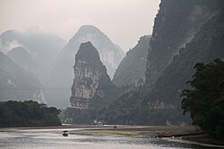
The Li River (Lí Jiāng) is one of China's most breathtaking natural wonders. Located in the Guangxi subdivision, this river forms the upper reaches of the Gui River and serves as a vital part of the Xijiang River system within the Pearl River basin. Stretching 164 kilometers (102 miles) from Xing'an County to Pingle County, the river winds through a landscape so iconic that its imagery is featured on the Chinese 20 yuan banknote.
As the river flows generally southward from the Mao'er Mountains, it passes through the famous regions of Guilin and Yangshuo. This journey offers travelers a front-row seat to some of the most unique geological formations on Earth.
Key Facts
- Location: Guangxi, China
- Length: 164 km (102 mi)
- Source: Mao'er Mountains, Xing'an County
- Mouth: Gui River, Pingle County
- Geology: Devonian and Carboniferous limestone karst
- Primary Landscapes: Fengcong and Fenglin karst
The Geological Marvel of Karst Terrain
The dramatic scenery of the Li River is the result of millions of years of geological evolution. The area is defined by karst terrain—a landscape formed from the dissolution of soluble rocks, such as limestone. Within the Guilin basin, 2,600 meters of Devonian and Carboniferous limestone have been shaped by tectonic uplift and erosion over the last 10 to 20 million years.
Fengcong Karst: Peak Cluster Depressions
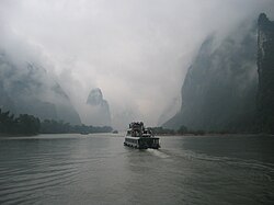
Dominating much of the Li River's course is the Fengcong karst. This type of terrain is characterized by groups of limestone hills that share a common base, separated by deep depressions known as dolines. This "peak cluster depression" landscape is home to hundreds of caves; notably, 23 of these caves feature passages exceeding 1 kilometer in length. The most extensive is the Guanyan Cave System, which stretches from Caoping to Nanxu.
Fenglin Karst: The Tower Karst of Yangshuo
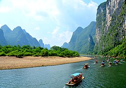
As the river approaches Yangshuo, the landscape shifts to Fenglin karst. Often described as a "peak forest plain," Fenglin consists of isolated limestone hills rising from a flat surface covered in loose sediments. The famous tower karst around Yangshuo features massive limestone pillars with near-vertical sides. While these towers typically range from 30 to 80 meters in height, they can reach up to 300 meters near the Fengcong regions.
Historical Significance and Waterways
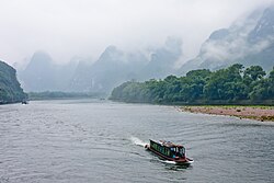
Beyond its beauty, the Li River has played a crucial role in Chinese history. The upper course is connected to the Xiang River via the Lingqu Canal. Dug in 214 BC, the Lingqu Canal is one of ancient China's three major water conservation projects and stands as the oldest existing canal in the world. Historically, this connection allowed the Li and Gui Rivers to serve as a vital waterway linking the Yangtze River valley with the Pearl River delta.
Notable Attractions and Cultural Icons
The region surrounding the Li River is packed with natural and man-made wonders:
- Elephant-Trunk Hill: A hill shaped like a giant elephant drinking water, serving as the symbol of Guilin.
- Reed Flute Cave: A limestone cave renowned for its spectacular stalactites, stalagmites, and cave corals.
- Seven-Star Park: The largest park located in Guilin.
- Cormorant Fishing: A traditional fishing method frequently associated with the Lijiang waters.
- Mountain of Splendid Hues: A mountain distinguished by its many layers of variously colored rocks.
| Feature | Detail |
|---|---|
| Total Length | 164 km (102 mi) |
| Average Discharge | 215 m³/s (at Guilin) |
| Elevation (Guilin) | 141 meters |
| Elevation (Yangshuo) | 103 meters |
| Primary Basin | Pearl River Basin (via Xijiang) |
Frequently Asked Questions
What is the difference between Fengcong and Fenglin karst?
Fengcong refers to clusters of limestone hills sharing a common base with deep depressions between them, while Fenglin consists of isolated limestone towers rising from a flat, sediment-covered plain.
Where does the Li River flow into?
In Pingle County, the Li River merges with the Lipu and Gongcheng rivers to become the Gui River, which eventually flows into the Xijiang River.
Is the Lingqu Canal still significant?
Yes, it is historically significant as one of ancient China's three great water conservation projects and is recognized as the oldest existing canal in the world.
What is the most famous symbol of Guilin?
Elephant-Trunk Hill, a natural formation that resembles an elephant drinking water, is the official symbol of the city of Guilin.
What kind of rock forms the Li River landscape?
The dramatic landscape is formed primarily from Devonian and Carboniferous limestone.