Understanding Erosion: The Forces Shaping Our Planet
The Earth's surface is in a constant state of flux, sculpted by invisible and visible forces that reshape landscapes over millions of years. At the heart of this transformation is erosion, the process by which surface agents—such as water, wind, and ice—remove soil, rock, or dissolved materials from one location and transport them to another, where they are eventually deposited. It is important to distinguish erosion from weathering; while weathering breaks down rock in place, erosion involves the actual movement of that material.
Erosion is generally categorized into two types: physical (mechanical) erosion, which involves the removal of rock or soil as clastic sediment (broken fragments), and chemical erosion, where material is removed through dissolution, meaning it is dissolved into a liquid solution.
Key Facts
- Human Impact: Human activities have increased global soil erosion rates by 10 to 40 times the natural rate.
- Land Degradation: Water and wind erosion combined are responsible for approximately 84% of globally degraded land.
- Glacial Influence: Glaciers can act as a "buzzsaw," limiting the maximum height of mountain ranges.
- Wind Dynamics: Saltation (particles bouncing) accounts for 50% to 70% of all wind-driven erosion.
- Time Scales: It can take over 450 million years for a mountain mass like the Himalayas to erode into a peneplain (an almost-flat plain).
The Primary Agents of Erosion
Water and Rainfall
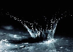
Water is one of the most powerful erosive forces on Earth. It begins with splash erosion, where the impact of a single raindrop creates a small crater, ejecting soil particles up to 0.6 meters vertically and 1.5 meters horizontally on level ground.
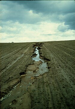
As water accumulates, it forms surface runoff. In agricultural areas, poor practices—such as ploughing in the direction of a slope rather than following contour lines—can lead to the formation of rills, which are small, shallow channels that accelerate soil loss.
Rivers and Streams
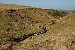
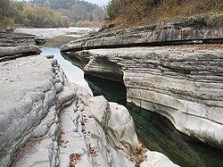
Rivers erode the landscape through bedrock wear and the transport of sediment. In colder regions, thermal erosion occurs when moving water melts and weakens permafrost (permanently frozen ground). This process is highly evident along the Lena River in Siberia and the Beaufort Sea shoreline, where annual erosion rates have averaged 5.6 meters per year between 1955 and 2002.
Coastal Erosion
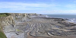
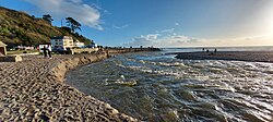
The sea and its waves relentlessly attack coastlines, creating distinct features such as wave-cut platforms. Heavy rainfall and flooding can also cause sudden, significant erosion of beaches, often leaving behind tall sand banks.
Glacial Processes
Glaciers reshape the land through three main mechanisms: abrasion (where debris in the ice scrapes the bedrock like sandpaper), plucking (where bedrock cracks and is pulled away), and ice thrusting (where the glacier moves large sheets of frozen sediment). Over approximately 100,000 years, these processes can carve deep, U-shaped parabolic valleys.
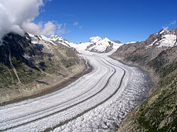
Interestingly, glaciers exhibit a dual nature. While the "glacial buzzsaw" effect limits mountain heights by eroding peaks faster than tectonic uplift can raise them, some ice can act as glacial armor, protecting steep alpine lands from further erosion depending on the temperature and regime of the ice.
Wind Erosion
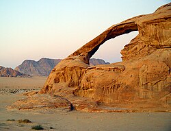
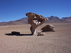
Wind erosion is most severe in arid regions and during droughts. In the Great Plains, soil loss during drought years can be 6,100 times greater than in wet years. Wind erosion occurs via two methods: abrasion (wearing down surfaces with airborne particles) and deflation (carrying away loose particles). Deflation is further divided into:
- Surface creep: Heavier particles sliding or rolling.
- Saltation: Particles bouncing across the surface (the most common form).
- Suspension: Light particles lifted and carried over long distances.
Gravity and Submarine Flows
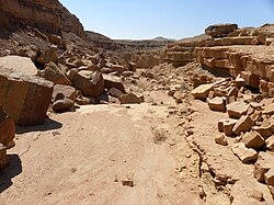
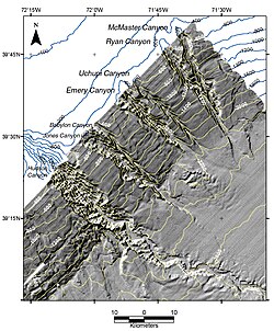
Mass wasting refers to the movement of rock and soil down slopes due to gravity. This includes rapid landslides and surface creep, a slow, often imperceptible movement of debris. In the deep ocean, submarine sediment gravity flows carve massive canyons into the continental slope.
Chemical Erosion and Karst Landscapes
Unlike mechanical processes, chemical erosion removes matter in the form of solutes. This is most evident in karst topography, where the dissolution of soluble rocks leads to the formation of sinkholes and complex underground drainage systems. This process is typically measured by analyzing the solutes present in streams.
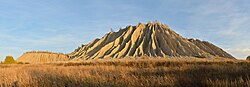
![The Devil's Nest (Pirunpesä), the deepest ground erosion in Europe,[34] located in Jalasjärvi, Kurikka, Finland](/images/48/d6/48d63ca626622e8a10953c24e311d4a613d55cb232603d41eccde46216520666.jpg)
Human Impact and Environmental Consequences
While erosion is a natural cycle, human intervention has accelerated it to dangerous levels. In the Appalachian Mountains, intensive farming has pushed erosion rates to 100 times the natural level. This acceleration creates two types of problems:
- On-site impacts: The loss of nutrient-rich upper soil layers leads to decreased agricultural productivity and ecological collapse, which can eventually result in desertification (the process by which fertile land becomes desert).
- Off-site impacts: Eroded sediment clogs waterways (sedimentation) and leads to eutrophication—a process where excess nutrients cause algae blooms that deplete oxygen in water bodies. Sediment can also cause physical damage to roads and housing.
Factors Influencing Erosion Rates
Several variables determine how quickly a landscape erodes:
- Climate: In Western Europe, the total amount of rainfall is more critical than its intensity. Conversely, in Taiwan, an increase in typhoon frequency has directly increased sediment loads in rivers.
- Topography: Steeply sloping surfaces generally experience faster physical erosion.
- Vegetative Cover: Plants act as a shield, reducing the impact of rain and anchoring soil with roots.
- Tectonics: The uplift of mountains provides the raw material for erosion to act upon.
| Agent | Primary Process | Key Characteristic/Result |
|---|---|---|
| Water (Rain) | Splash & Surface Runoff | Rills and gullies; soil particle ejection |
| Rivers | Bedrock wear & Thermal erosion | U-shaped valleys; permafrost melting |
| Glaciers | Abrasion, Plucking, Thrusting | Glacial buzzsaw; U-shaped valleys |
| Wind | Deflation & Abrasion | Saltation; severe in arid regions |
| Gravity | Mass Wasting | Landslides; surface creep |
| Chemical | Dissolution | Karst topography; sinkholes |
Frequently Asked Questions
What is the difference between erosion and weathering?
Weathering is the chemical or physical breakdown of rocks into smaller pieces while they remain in place. Erosion is the subsequent process of picking up those pieces and transporting them to a new location.
How do humans accelerate soil erosion?
Humans accelerate erosion primarily through intensive farming practices, such as ploughing in the direction of slopes, and the removal of natural vegetative cover, which normally protects the soil from wind and rain.
What is the "glacial buzzsaw" effect?
The glacial buzzsaw is a phenomenon where glacial erosion effectively limits the maximum height of mountain ranges. As mountains grow higher, they experience more glacial activity, which erodes the peaks faster than tectonic forces can lift them.
Which type of wind erosion is most common?
Saltation is the most common form of wind erosion, accounting for 50% to 70% of the process. It occurs when soil particles are lifted slightly and then bounce across the surface.
What are the "off-site" effects of erosion?
Off-site effects occur away from the source of erosion and include the sedimentation of rivers and lakes, the eutrophication of water bodies due to nutrient runoff, and damage to human infrastructure like roads and houses.
How long does it take for a mountain range to erode?
On a massive scale, it can take hundreds of millions of years. For example, it is estimated that a mountain mass similar to the Himalayas would take more than 450 million years to erode into an almost-flat peneplain, assuming no significant sea-level changes.