Inca Road System: The Engineering Marvel of the Qhapaq Ñan
Long before the advent of modern highways, the Inca Empire constructed one of the most sophisticated transportation networks in human history. Known in Quechua as the Qhapaq Ñan (meaning "royal road"), this vast system served as the circulatory system of the Tawantinsuyu, the Inca Empire. Spanning approximately 40,000 kilometers (25,000 miles), it connected a diverse landscape of coastal deserts, high mountain peaks, and lush jungles.
Unlike the roads of the Roman Empire, which were designed for wheeled vehicles, the Qhapaq Ñan was engineered for foot traffic and pack animals. This network allowed the Inca state to manage a territory of nearly 2,000,000 square kilometers and a population of roughly 12 million people with remarkable efficiency.
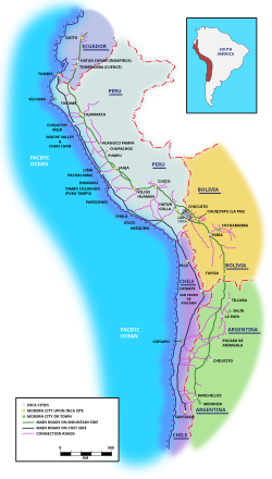
Key Facts
- Total Length: Approximately 40,000 km (25,000 mi).
- Official Name: Qhapaq Ñan, Andean Road System.
- UNESCO Status: Inscribed as a World Heritage Site in 2014.
- Primary Hub: The capital city of Cusco, Peru.
- Transport Method: Human foot traffic and llama caravans (no wheels used).
- Geographic Reach: Modern-day Peru, Ecuador, Colombia, Chile, and Argentina.
The Extent and Layout of the Network
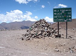
The road system was anchored by two primary north-south arteries. The first followed the coastal plains, hugging the foothills to avoid the harshest deserts. The second, and more critical route, traversed the mountains through the puna (high-altitude grassland) at elevations often exceeding 4,000 meters (13,000 ft).
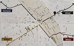
From these two main spines, more than twenty transversal routes branched off, connecting administrative centers, mining zones, and sacred ceremonial sites. The network stretched from the region of Los Pastos in Colombia in the north, down to the Maipo River in Chile and the Mendoza lands in Argentina to the south.
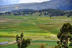
Regional Connectivity
The system was designed to funnel all power and information toward the capital, Cusco. In the north, the road passed through key cities like Quito and Tumebamba. In the south, it reached Chucuito and Paria. The sheer scale of the project is evident in the fact that it covered about 5,000 kilometers of the 7,000-kilometer span of the Andean mountains.
Purpose and Strategic Utility
The Qhapaq Ñan was more than just a path; it was a tool for imperial expansion and control. By building roads first, the Incas could rapidly deploy soldiers and officials to newly annexed territories. The state often preferred the high Altiplano for these routes to maintain a straight, fast line of communication while avoiding the denser populations living in the valleys.
A critical component of this infrastructure was the collca—long-term storage houses used for grains and maize. These facilities, such as those at Huánuco Pampa (which featured 497 collcas), ensured that the army and administration were well-supplied during conflicts or crop failures.
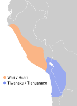
Transportation and Trade
Without horses or wheels, the Incas relied on the llama. These nimble animals were ideal for the steep Andean terrain due to their soft, padded hooves, which provided excellent traction and caused minimal damage to the road surface. A typical short-haired llama (Q'ara race) could carry about 30 kilograms (66 lb) for 20 kilometers per day, though they could carry up to 45 kilograms (99 lb) for shorter distances.
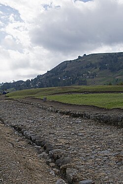
Religious Significance
The road system also served a spiritual purpose. The Incas worshipped apus (mountain deities), and the roads provided the only means to reach high-altitude shrines. Some ritual paths climbed to staggering heights, such as the road to the summit of Mount Chañi, which reaches 5,949 meters (19,518 ft) above sea level.
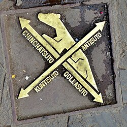
Engineering and Architecture
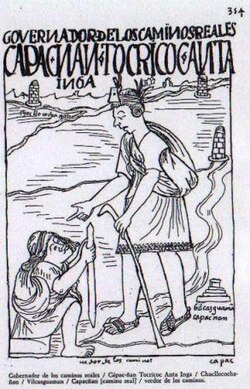
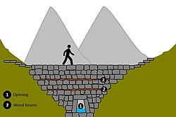
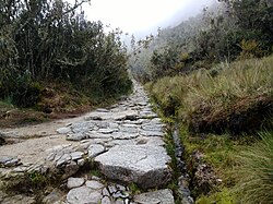
The construction of the Qhapaq Ñan required immense labor and precise engineering. The roads were carefully planned and maintained, featuring paving in wet areas, retaining walls to prevent landslides, and sophisticated water drainage systems to protect the road from erosion.
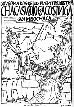
Road Specifications
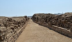
The width of the roads varied based on their importance. While many were between 1 and 4 meters wide, major arteries like the route from Cusco to Quito often exceeded 4 meters. Some exceptional sections, such as the road leading to Huánuco Pampa, reached widths of 25 meters, and the north coastal road reached a maximum of 35 meters.
Bridges and Crossings
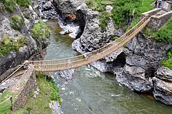
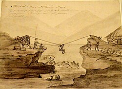
To conquer the fragmented Andean geography, the Incas developed various bridge types. These included rumichaka (stone bridges) and the famous catenary suspension bridges made of woven grass fibers. For smaller river crossings, they utilized oroyas (baskets) to transport people across the water.
Legacy and Modern Impact
The influence of the Inca road system persists centuries after the fall of the empire. A 2021 study revealed that modern communities located within 20 kilometers of the ancient road system still exhibit higher wages, better nutrition, and higher school completion levels than similar communities further away.
| Feature | Details |
|---|---|
| Total Length | ~40,000 km (25,000 mi) |
| Primary Animals | Llamas (Q'ara race) |
| Max Elevation | Over 5,000 meters (16,000 ft) |
| Key Infrastructure | Collcas (storage), Suspension Bridges, Paved Roadways |
| Modern Reach | Colombia, Ecuador, Peru, Bolivia, Chile, Argentina |
Frequently Asked Questions
Did the Incas use wheels on their roads?
No, the Inca road system was designed specifically for pedestrians and pack animals. They did not use wheeled vehicles for transportation.
What were collcas and why were they important?
Collcas were long-term storage houses used primarily for grains and maize. They were strategically placed along the road system to support the army and the population during times of war or famine.
How did the Incas cross deep rivers and canyons?
The Incas used a variety of engineering solutions, including stone bridges (rumichaka), woven grass suspension bridges, and baskets (oroyas) for river crossings.
Which animals were used to transport goods?
Llamas were the primary pack animals. They were chosen for their agility and their padded hooves, which were well-suited for the steep and rocky Andean terrain.
Is the Inca road system still visible today?
Yes, many segments are preserved and some are still used. The system is recognized as a UNESCO World Heritage Site, and parts of it, such as the Inca Trail to Machu Picchu, remain popular with visitors.