Ice Pellets: The Science and Characteristics of Sleet
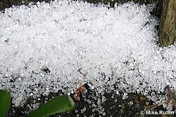
When winter weather rolls in, precipitation can take many forms, from soft snowflakes to heavy hail. Among the most distinct is ice pellets—small, hard, translucent balls of ice that bounce when they strike a surface. While they may look similar to other forms of frozen precipitation, their unique formation process and physical properties set them apart from snow, rain, or even graupel.
Key Facts
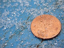
- Appearance: Small, hard, and translucent ice balls.
- Terminology: Known as "sleet" in the United States, but "ice pellets" in most Commonwealth countries like Canada.
- Acoustics: They produce a high-pitched "tap" upon impact, unlike the dull splat of raindrops.
- METAR Code: Identified by the code PL (previously PE before November 1998).
- Weight: An equal volume of ice pellets is significantly heavier than an equal volume of snow.
Understanding the Terminology
One of the most confusing aspects of winter weather is the linguistic divide regarding this phenomenon. In the United States, the National Weather Service officially uses the term sleet. However, in many Commonwealth nations, including Canada, "sleet" refers to a slushy mixture of rain and snow.
To avoid confusion, Environment Canada avoids the word "sleet" entirely, opting for "ice pellets" or "wet snow." This distinction is vital for accurate weather reporting and public safety.
How Ice Pellets Form
The formation of ice pellets is a delicate atmospheric balancing act involving specific temperature layers. For ice pellets to develop, a layer of above-freezing air must exist between 1,500 and 3,000 meters (5,000 to 10,000 feet) above the ground. This warm layer is sandwiched between sub-freezing air both above it and below it near the surface.
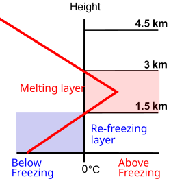
As snowflakes fall from the upper freezing layer, they enter the warm layer and undergo partial or complete melting. This process is reflected in the French term for sleet, neige fondue, which literally translates to "melted snow." As these liquid droplets continue their descent into the sub-freezing layer near the ground, they re-freeze into solid ice pellets before impact.
Ice Pellets vs. Freezing Rain
The thickness of the lower freezing layer determines the final state of the precipitation. If the sub-freezing layer beneath the warm air is too thin, the droplets will not have sufficient time to re-freeze before hitting the ground. In such cases, the precipitation becomes freezing rain, which freezes instantly upon contact with solid surfaces rather than falling as individual pellets.
Comparing Precipitation Types
It is easy to mistake ice pellets for other frozen phenomena. However, they differ significantly from graupel (often called "soft hail"), which consists of opaque, frosty white rime, and from a simple mixture of rain and snow, which remains a semi-solid slush.
| Type | Appearance | Physical Characteristic |
|---|---|---|
| Ice Pellets | Translucent balls | Hard, bounces on impact |
| Graupel | Opaque, white | Soft, rime-like texture |
| Snow/Rain Mix | Slushy | Semi-solid or liquid mixture |
Impact and Accumulation
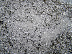
In most regions, ice pellets occur briefly and do not cause major disruptions. However, in the eastern United States and southeastern Canada, large-scale storm systems can push warm air from the Gulf of Mexico over cold, dense surface air for hundreds of miles. In these scenarios, accumulations of 2–5 cm (0.8–2.0 in) can occur.
While the effects of ice pellet accumulation are similar to snow, there are two critical differences. First, because ice pellets are denser, an equal volume of pellets is significantly heavier than snow, making them more difficult to clear. Second, because they have less surface area relative to their mass, ice pellets take much longer to melt than fresh snowfall.
Frequently Asked Questions
Do ice pellets freeze into solid masses?
Generally, ice pellets do not freeze into solid masses unless they are mixed with freezing rain.
What is the difference between sleet and ice pellets?
The difference is primarily regional: "sleet" is the standard term in the U.S., while "ice pellets" is the preferred term in Canada and other Commonwealth countries to avoid confusion with rain-snow mixtures.
Why are ice pellets harder to clear than snow?
Ice pellets are much heavier than snow for the same volume, requiring more effort to remove from surfaces.
How can I tell if it is ice pellets or freezing rain?
Ice pellets are individual hard balls that bounce when they hit surfaces, whereas freezing rain is a liquid that freezes upon contact with objects.
What atmospheric conditions cause ice pellets?
They require a warm layer of air (above freezing) located between 1,500 and 3,000 meters, with freezing air present both above and below that warm layer.