High Atlas Mountains: Morocco's Majestic Peaks and Diverse Landscapes
Rising prominently in central Morocco, the High Atlas—also known as the Grand Atlas—stands as the highest segment of the vast Atlas Mountain system. This impressive range serves as a critical natural barrier, separating the Sahara Desert from the Mediterranean and continental zones to the north and west. From the Atlantic Ocean in the west to the Moroccan-Algerian border in the east, the High Atlas offers a dramatic landscape of snow-capped peaks, deep valleys, and ancient geological formations.
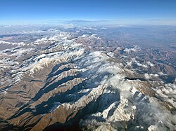
Key Facts
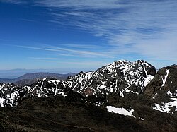
- Highest Peak: Jbel Toubkal (4,167 m / 13,671 ft)
- Location: Central Morocco, North Africa
- National Park: Toubkal National Park (established 1942)
- Primary Inhabitants: Berber communities
- Climate Types: Mediterranean and Continental semi-arid (steppe)
- Notable Wildlife: Barbary macaque (Macaca sylvanus)
Geography and Climate
The topography of the High Atlas is characterized by sharp transitions. In the southwest, the range drops abruptly toward the Atlantic and the Anti-Atlas range, while the descent toward Marrakesh in the north is more gradual. The mountains act as a massive weather system barrier, influencing precipitation patterns across the region.
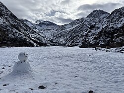
Climatic Zones
The range experiences two distinct types of Alpine climates:
- Mediterranean Climate: Dominating the north and south of the Western High Atlas and parts of the Central High Atlas, this zone is relatively humid. Annual rainfall ranges between 600 and 1,000 mm, though summer droughts can be intense. Snow typically falls between November and April, though it can persist on high peaks from September through June.
- Continental Semi-Arid (Steppe) Climate: Found in the southern Central High Atlas and the entire Oriental High Atlas, this zone features significant temperature variations and much lower precipitation. The landscape here transitions into rocky desert, resembling the Rocky Mountains of the United States.
Water Systems and Agriculture
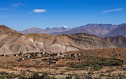
The High Atlas forms the basins for numerous river systems. Most year-round rivers flow north, supporting local settlements, while various wadis (seasonal riverbeds) terminate in the southern deserts or eastern plateaux. The indigenous Berber people have developed highly efficient agricultural techniques to manage the semi-arid environment. They transform these lands into fertile valleys known locally as Agdal (the Berber word for garden), a system that has drawn significant interest from international scientists.
Regional Subdivisions
The High Atlas is divided into three distinct geographical segments:
Western High Atlas
The oldest portion of the range, the Western High Atlas, features Jurassic and Cretaceous formations carved by deep erosion. It is home to the Ourika Valley, the only location in the High Atlas where the endangered Barbary macaque can be found. This region also contains Oukaïmeden, one of Morocco's three main ski stations.
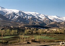
Central High Atlas
This area is characterized by a massive chalk formation with high plateaux reaching 2,500 m. The landscape is a mix of gorges, box canyons, and splintered peaks, reminiscent of the terrain in Colorado. The highest peak in this section is Jbel Mgoun, standing at 4,068 m.
Eastern High Atlas
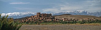
The eastern section consists of vast high-altitude plateaux that serve as the headwaters for the Moulouya River. This region is world-renowned among paleontologists due to the discovery of the Atlasaurus (also known as Tazoudasaurus), a 15-meter-long dinosaur that lived approximately 180 million years ago.
Geology and Paleontology
The mountains were formed by the tectonic convergence between the African and Eurasian plates. The geological history is complex, involving a transition from Triassic rift basins with basaltic lava flows to Jurassic marine environments characterized by carbonate platforms.
The region is a treasure trove of fossils. Beyond the famous sauropod dinosaurs, researchers recently discovered Strophodus atlasensis, a fossil of a hybodontiform shark from the Bajocian deposits, marking one of the oldest Gondwanan specimens of its genus.
Summary of High Atlas Features
| Region | Key Peak | Primary Characteristics |
|---|---|---|
| Western High Atlas | Jbel Toubkal (4,167 m) | Oldest formations, Ourika Valley, Barbary macaques |
| Central High Atlas | Jbel Mgoun (4,068 m) | Chalk mass, gorges, and high plateaux |
| Eastern High Atlas | Jbel Ayachi (3,747 m) | Moulouya River headwaters, paleontological sites |
Frequently Asked Questions
What is the highest point in the High Atlas?
The highest point is Jbel Toubkal, which reaches an elevation of 4,167 meters (13,671 feet) and is located within Toubkal National Park.
What kind of animals live in the High Atlas?
The range is home to the endangered Barbary macaque, particularly in the Ourika Valley. The region is also known for its diverse flora and prehistoric fossil remains.
Can you go skiing in the High Atlas?
Yes, the Western High Atlas features Oukaïmeden, which is one of the three main ski stations in Morocco.
What is the significance of the Atlasaurus dinosaur?
The Atlasaurus (or Tazoudasaurus) was a 15-meter-long dinosaur discovered in the region. It is considered a potential ancestor to the sauropods found in America, reflecting the historical connection between the African and American continents.
Who are the traditional inhabitants of the mountains?
The mountains are inhabited by Berber communities who practice agriculture and pastoralism, utilizing advanced irrigation and land management techniques like the Agdal system.