Gustnadoes: The Science Behind These Brief Storm Vortices
During a severe thunderstorm, the sky often produces dramatic wind events that can be easily mistaken for tornadoes. One such phenomenon is the gustnado—a brief, shallow surface-based vortex that forms within a downburst. While they may look like miniature tornadoes as they loft debris or form condensation clouds, their origin and structure are fundamentally different from the classic tornadoes associated with rotating supercells.
Key Facts
- Formation: Occurs within the gust front (the leading edge of a storm's outflow) of a thunderstorm.
- Duration: Typically lasts from a few seconds to a few minutes.
- Wind Speeds: Often equivalent to F0 or F1 tornadoes, reaching up to 180 km/h (110 mph).
- Structure: Unlike true tornadoes, they rarely connect the ground to the cloud base.
- Classification: Generally viewed as minor whirlwinds rather than true tornadoes.
What Exactly is a Gustnado?
The term "gustnado" is a portmanteau of "gust front tornado." It describes a rotating column of air created by non-tornadic, straight-line wind features found in a storm's downdraft. These vortices are primarily driven by the wind itself, and they become visible only when they pick up enough dust and debris or create a visible condensation cloud.
The primary distinction between a gustnado and a tornado lies in their vertical development. A classic tornado is associated with a mesocyclone (a rotating updraft) and extends from the cloud base to the surface. In contrast, a gustnado is a shallow feature that almost never connects to the cloud base. Because of this, most meteorologists do not include them in official tornado statistics.
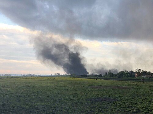
How Gustnadoes Form
Gustnadoes typically emerge along the gust front of severe thunderstorms, which are defined as storms with wind speeds of at least 93 km/h (58 mph). They are especially common along the rear-flank gust front of supercell storms.
The Role of Wind Shear
The formation of a gustnado is driven by shear instability, which occurs when there is strong horizontal shear (a change in wind speed or direction over a short distance). For this instability to trigger a vortex, a relative maximum in vertical vorticity—the measure of the air's rotation around a vertical axis—must exist.
Dynamical Origins
Meteorologists believe this vertical vorticity can originate in two ways: it may already exist in the ambient environment before the storm arrives, or it may be created by the tilting of horizontal vorticity into a vertical position. In supercell storms, this tilting often happens within descending air due to baroclinity (the state where pressure and density gradients are not aligned).
Impacts and Safety
While gustnadoes are generally short-lived and less intense than major tornadoes, they can still be dangerous. Stronger vortices can cause localized structural damage and pose significant risks to drivers on the road.
For instance, a gustnado confirmed by the National Weather Service near Swan Quarter, North Carolina, on April 26, 2019, reached estimated maximum wind speeds of 130 km/h (80 mph) and damaged buildings, though no injuries were reported. It is important to distinguish these events from structural failures; for example, a 2011 stage collapse at the Indiana State Fair was initially attributed to a gustnado, but an engineering probe later determined the collapse was due to the structure's inability to handle standard wind loads.
Comparison: Gustnadoes vs. Tornadoes
| Feature | Gustnado | Classic Tornado |
|---|---|---|
| Origin | Outflow (Downburst/Gust Front) | Inflow (Mesocyclone/Updraft) |
| Vertical Reach | Shallow; rarely reaches cloud base | Extends from cloud base to surface |
| Lifespan | Seconds to minutes | Minutes to hours |
| Wind Speed | Up to 180 km/h (110 mph) | Can exceed 400 km/h |
| Classification | Minor whirlwind | True tornado |
Frequently Asked Questions
Is a gustnado the same as a tornado?
No. While they both involve rotating air, a gustnado is a shallow vortex that forms in the storm's outflow and rarely connects to the cloud base, whereas a tornado is a deep vortex connected to the cloud base and associated with the storm's updraft.
What is a "spin-up tornado"?
The term "spin-up tornado" is sometimes used interchangeably with gustnado, but it more accurately describes a rare case where a gustnado actually connects to the cloud base, or a brief tornado associated with a mesovortex.
How long does a gustnado typically last?
Most gustnadoes are very brief, lasting only a few seconds to a few minutes, though they can sometimes appear in simultaneous swarms or successive generations.
Can a gustnado cause significant damage?
Yes, although injuries and deaths are uncommon. Strong gustnadoes can reach speeds of 180 km/h (110 mph), which is enough to cause localized damage to buildings and create hazards for motorists.
What happens if a gustnado connects to the cloud base?
If a gustnado manages to connect the surface to the ambient cloud base, it is no longer considered a gustnado and is instead classified as a landspout.