Great Lakesfreshwater lakesLake SuperiorLake MichiganLake Huron

Great Lakes of North America: A Comprehensive Overview of the World's Largest Freshwater System

Great Lakes of North America: A Comprehensive Overview of the World's Largest Freshwater System The Great Lakes represent the largest group of freshwater lakes on Earth by total surface a...

Great Lakes of North America: A Comprehensive Overview of the World's Largest Freshwater System

The Great Lakes represent the largest group of freshwater lakes on Earth by total surface area and the second-largest by total volume. Containing more than 20% of the world's surface fresh water by volume, this massive system is often referred to as "inland seas" due to its sea-like characteristics, including rolling waves, sustained winds, strong currents, and vast, distant horizons.
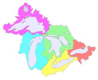
A map of the Great Lakes Basin showing the five sub-basins. Left to right they are: Superior (magenta); Michigan (cyan); Huron (green); Erie (yellow); Ontario (red).
: A map of the Great Lakes Basin showing the five sub-basins. Left to right they are: Superior (magenta); Michigan (cyan); Huron (green); Erie (yellow); Ontario (red).

Spanning across the borders of Canada and the United States, the Great Lakes Basin is a vital ecological and economic engine for North America. Whether viewed through the lens of geography, history, or biology, these interconnected bodies of water offer a unique glimpse into the natural and human history of the continent.

Key Facts
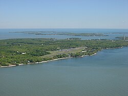
South Bass Island in Lake Erie
  • Total Surface Area: 94,250 square miles (244,106 km²).
  • Total Water Volume: 5,439 cubic miles (22,671 km³).
  • Freshwater Contribution: Holds over 20% of the world's surface fresh water.
  • Primary Outflow: The St. Lawrence River, which leads to the Atlantic Ocean.
  • Major Lakes: Superior, Michigan, Huron, Erie, and Ontario.

Geography and Physical Characteristics
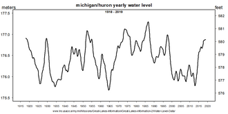
Water levels of Lakes Michigan and Huron in the United States, 1918 to 2019

The Great Lakes are a group of interconnected freshwater lakes located in eastern North America. The system is fed by various inflows, including precipitation, meltwater, rivers, and groundwater springs. The primary outflow for the entire system is the St. Lawrence River, which connects the lakes to the Atlantic Ocean.
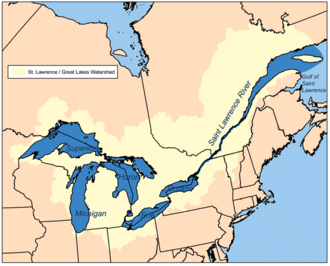
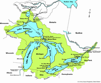
Great Lakes/St. Lawrence River watershed
: Great Lakes/St. Lawrence River watershed

Depending on the measurement criteria, the lakes hold significant global rankings. Lake Michigan is the largest lake entirely contained within a single country (the United States). When considering the combined surface area of Lake Michigan and Lake Huron, they represent one of the largest freshwater bodies in the world.
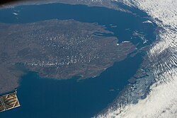
Lake Michigan–Huron with north oriented to the right; taken on April 14, 2022, during Expedition 67 of the International Space Station. Green Bay is at the upper right and Saginaw Bay is on the left.
: Lake Michigan–Huron with north oriented to the right; taken on April 14, 2022, during Expedition 67 of the International Space Station. Green Bay is at the upper right and Saginaw Bay is on the left.

Individual Lake Profiles

Each of the five lakes possesses distinct dimensions and depths. Lake Superior is the largest by surface area and volume, while Lake Erie is notably shallower.

Comparison of the Five Great Lakes
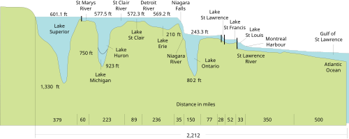
Lake Name Surface Area (sq mi) Water Volume (cu mi) Max Depth (ft)
Superior 31,700 2,900 1,333
Michigan 22,300 1,180 925
Huron 23,000 850 748
Erie 9,910 116 210
Ontario 7,340 393 804
System profile of the Great Lakes
: System profile of the Great Lakes

Geology and Formation

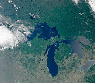
Lakes Superior, Michigan, Huron, and Erie, photographed from the Sentinel-3B satellite in June 2022, Lake Ontario is not visible in this image.

The formation of the Great Lakes is deeply tied to geological history and glacial activity. The landscape was significantly shaped by the movement of glaciers, which carved out the basins that now hold these massive volumes of water.
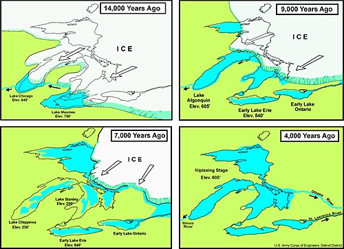
A diagram of the formation of the Great Lakes
: A diagram of the formation of the Great Lakes

Evidence of past environmental states can be seen in features like the clay plains along the Ottawa and St. Lawrence Rivers, which serve as remnants of the former Champlain Sea.

The Champlain Sea – The best evidence of this former sea is the vast clay plain deposited along the Ottawa and St. Lawrence Rivers.[57]
: The Champlain Sea – The best evidence of this former sea is the vast clay plain deposited along the Ottawa and St. Lawrence Rivers.

Ecology and Biodiversity

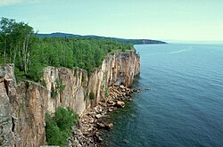
Cliffs at Palisade Head on Lake Superior in Minnesota near Silver Bay.

The Great Lakes ecosystem is incredibly diverse, supporting a wide range of flora and fauna. Native habitats include various forest types, such as the Laurentian Mixed Forest Province, and unique environments like alvar and boreal rich fens.
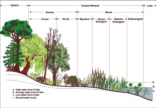
Generalized schematic of Great Lakes waterline ecosystem
: Generalized schematic of Great Lakes waterline ecosystem

Fauna and Microbiology

The lakes are home to numerous species, including the Lake sturgeon, which is the largest native fish in the system. However, many species face challenges; the sturgeon is currently listed as a threatened species. The lakes also host a massive microbial population. While a single drop of water can contain millions of bacteria and viruses, scientists have only been conducting long-term studies of these microorganisms since 2012, discovering over 160 new species between 2012 and 2019.

Lake sturgeon, the largest native fish in the Great Lakes and the subject of extensive commercial fishing in the 19th and 20th centuries is listed as a threatened species[64]
: Lake sturgeon, the largest native fish in the Great Lakes and the subject of extensive commercial fishing in the 19th and 20th centuries is listed as a threatened species
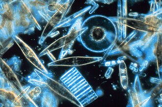
Diatoms of different sizes seen through the microscope. These minuscule phytoplankton are encased within a silicate cell wall.
: Diatoms of different sizes seen through the microscope. These minuscule phytoplankton are encased within a silicate cell wall.

Environmental Challenges

The ecosystem faces several modern pressures, including invasive species, such as the zebra mussel, and the impacts of pollution like microplastics and mercury. Additionally, climate change affects water chemistry and algae growth through processes involving CO2 and H2O.
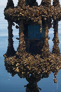
A zebra mussel–encrusted vector-averaging current meter from Lake Michigan.
: A zebra mussel–encrusted vector-averaging current meter from Lake Michigan.

Human History and Economy

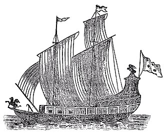
A woodcut of Le Griffon

Human interaction with the Great Lakes dates back thousands of years. Historically, the lakes have been vital for trade, transportation, and fishing. Early maps, such as those from 1675, show how European explorers named and mapped the region, sometimes using different names like Lake Illinois for Lake Michigan.

1675 French map, published shortly before the voyage of Le Griffon. Lake Michigan is named Lake Illinois (the name change is first recorded in 1681[44]), and Lake Ontario is named Lake Frontenac, after the then-governor of New France.
: 1675 French map, published shortly before the voyage of Le Griffon. Lake Michigan is named Lake Illinois (the name change is first recorded in 1681[44]), and Lake Ontario is named Lake Frontenac, after the then-governor of New France.

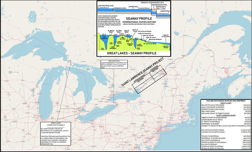
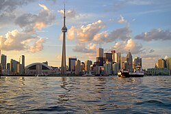
The development of shipping routes, including the St. Lawrence Seaway, has allowed the lakes to serve as a major corridor for global commerce. Major cities like Chicago, Toronto, and Detroit have grown around these waterways, forming a significant "megalopolis" of economic activity.
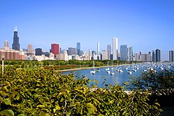
Chicago on Lake Michigan is in the western part of the lakes megalopolis and the site of the waterway linking the lakes to the Mississippi River valley
: Chicago on Lake Michigan is in the western part of the lakes megalopolis and the site of the waterway linking the lakes to the Mississippi River valley
Toronto on Lake Ontario is in the eastern section of the Great Lakes Megalopolis
: Toronto on Lake Ontario is in the eastern section of the Great Lakes Megalopolis
Map of the Great Lakes, Great Lakes Waterway, St. Lawrence Seaway depicting the entire length.
: Map of the Great Lakes, Great Lakes Waterway, St. Lawrence Seaway depicting the entire length.

Frequently Asked Questions

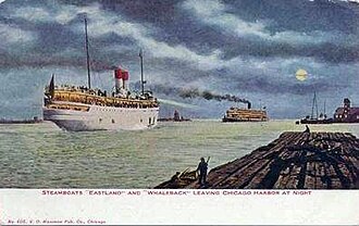
The passenger ship SS Eastland (foreground) leaving Chicago, c. 1909
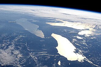
Photograph of, closest to farthest, Lakes Ontario, Erie and Huron (North is to the right) plus the Finger Lakes of upstate New York, near Lake Ontario, June 14, 2012, taken aboard the International Space Station, with lake names added
Escanaba's Ludington Park in Michigan
Various national, state, provincial, and municipal jurisdictions govern the Great Lakes

How much of the world's fresh water is in the Great Lakes?

The Great Lakes contain more than 20% of the world's surface fresh water by volume.

Which Great Lake is the largest?

Lake Superior is the largest by surface area and volume. However, Lake Michigan is the largest lake located entirely within the United States.

What causes the "lake effect" weather?

The lake effect refers to weather patterns, such as snow bands, that occur when cold air moves over the warmer waters of the lakes.
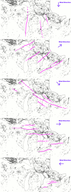
The location of common lake effect bands on the Great Lakes
: The location of common lake effect bands on the Great Lakes

Are the Great Lakes connected to the ocean?

Yes, the lakes are connected to the Atlantic Ocean via the St. Lawrence River.

What are the main threats to the Great Lakes ecosystem?

Key threats include invasive species, pollution (including plastics and sewage), and the impacts of climate change on water levels and algae.

References

  1. "Great Lakes". U.S. Environmental Protection Agency. June 28, 2006. Archived from the original on June 11, 2004. Retrieved February 19, 2011.
  2. "LUHNA Chapter 6: Historical Landcover Changes in the Great Lakes Region". USGS: Ecosystems. November 20, 2003. Archived from the original on January 11, 2012. Retrieved February 19, 2011.
  3. Ghassemi, Fereidoun (2007). Inter-basin water transfer. Cambridge: Cambridge University Press. ISBN 978-0-521-86969-0.
  4. "Great Lakes: Basic Information: Physical Facts". U.S. Environmental Protection Agency. May 25, 2011. Archived from the original on May 29, 2012. Retrieved November 9, 2011.
  5. Williamson, James (2007). The inland seas of North America: and the natural and industrial productions ... John Duff Montreal Hew Ramsay Toronto AH Armour and Co. ISBN 9780665341281. Retrieved January 5, 2014.