Great Dividing Range: Australia's Massive Eastern Highlands
The Great Dividing Range, also known as the East Australian Cordillera or the Eastern Highlands, is the most significant topographic feature of mainland Australia. This expansive cordillera—a complex system of mountain ranges, plateaus, and rolling hills—runs roughly parallel to the east coast, serving as the continent's definitive watershed.
Stretching over 3,500 kilometres (2,175 miles), it is the fifth-longest land-based mountain chain in the world and the longest mountain chain located entirely within a single country. From the northern tip of the Cape York Peninsula to the rolling hills of the Wimmera plains in Victoria, the range shapes the landscape, climate, and water systems of eastern Australia.
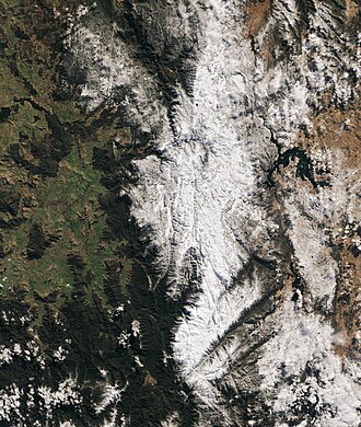
Key Facts
- Total Length: Over 3,500 km (2,200 mi)
- Highest Point: Mount Kosciuszko (2,228 m / 7,310 ft)
- Geological Age: Formed during the Carboniferous period (over 300 million years ago)
- Primary Function: Acts as the main watershed for eastern Australian river systems
- World Heritage Sites: Includes the Greater Blue Mountains, Gondwana Rainforests, and Wet Tropics of Queensland
Geography and Geological Origins
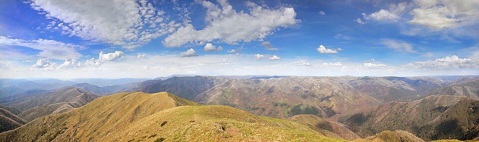
The Great Dividing Range is not a single, continuous chain of mountains. Instead, it is a complex collection of diverse landforms, including escarpments, plateaus, and upland areas. The terrain varies significantly; while some areas consist of relatively flat, low hills, other sections feature rugged mountains and high plateaus composed of limestone, sandstone, quartzite, schists, and dolomite.
Geologically, the range was formed during the Carboniferous period when Australia collided with parts of South America and New Zealand. Since its formation, significant erosion has shaped the landscape, resulting in mountains that are generally not extremely steep. This allows most peaks to be reached without specialized mountaineering equipment.
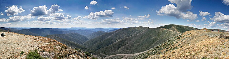
The Watershed Boundary
The crest of the range is defined by the watershed—the line that divides drainage basins. Water falling on the eastern (rainward) side flows toward the coast and into the Pacific Ocean, Tasman Sea, or Bass Strait. Conversely, water on the western (leeward) side flows inland toward the interior plains, feeding systems like the Murray–Darling basin.
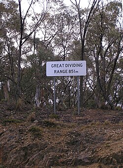
Climate and Natural Landscapes
The range plays a critical role in local climates. The high elevations create significant barriers to weather systems, often resulting in lush, well-watered environments on the eastern slopes and drier conditions in the rain shadows of the western plains.
The highlands are home to diverse ecosystems. Some areas, such as the Atherton Tableland and Darling Downs, are used for agriculture and pastoralism due to their fertile land. Other more rugged regions are preserved as National Parks or used for forestry. The southern portion of the range contains all of mainland Australia's alpine areas, including the Australian Alps and the Snowy Mountains.
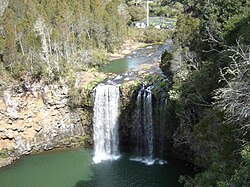
Notable Features and Peaks
The range is dotted with hundreds of significant peaks and smaller spurs. Notable components include:
- Mount Kosciuszko: The highest point in Australia, located in the Snowy Mountains.
- Blue Mountains: A famous section in New South Wales.
- Dandenong Ranges: Located in Victoria.
- Bunya Mountains: Located in Queensland.
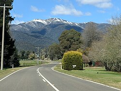
Human Interaction: Transport and Infrastructure
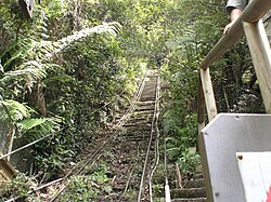
Historically, the range presented a major obstacle to European settlement. In the early days of British colonisation, the rugged terrain of the Blue Mountains was particularly difficult to navigate. As settlement expanded, engineers worked to establish vital road and rail links through the mountains.
Railways were constructed by finding low-gradient paths and suitable passes. Notable rail crossings include the Brisbane–Toowoomba line and the Sydney–Lithgow line. Today, while many areas remain remote, the range is connected by major routes such as the Great Alpine Road in eastern Victoria.
Summary of Regional Data
| Feature | Details |
|---|---|
| Highest Elevation | 2,228 m (Mount Kosciuszko) |
| Total Length | 3,500 km |
| States Covered | QLD, NSW, ACT, VIC |
| Rock Types | Sandstone, Limestone, Quartzite, Schist, Dolomite |
| Primary Function | Continental Watershed |
Frequently Asked Questions
What is the highest point in the Great Dividing Range?
The highest point is Mount Kosciuszko, which reaches an elevation of 2,228 metres (7,310 feet) and is located within the Snowy Mountains.
How does the range affect Australia's water systems?
The range acts as a watershed. It divides the continent into two main drainage areas: one that flows east into the Pacific Ocean and one that flows west into the inland Murray–Darling basin.
Is the Great Dividing Range a single mountain chain?
No, it is a cordillera, which is a complex system consisting of multiple mountain ranges, plateaus, hills, and escarpments.
What is the geological age of the range?
The range was formed during the Carboniferous period, more than 300 million years ago, following the collision of Australia with parts of South America and New Zealand.
Are the mountains in the range difficult to climb?
Because of the range's ancient age and significant erosion, most mountains are not extremely steep. Virtually all peaks can be reached without the need for specialized mountaineering equipment.