Continental Europe: Defining the Mainland and Its Boundaries
While the term "Europe" often refers to the entire continent, the phrase Continental Europe—also known as mainland Europe—carries a more specific geographical meaning. It refers to the contiguous landmass of the European continent, excluding its various surrounding islands. Depending on the context, the term can be used to distinguish the mainland from island nations or to describe the central landmass of the continent.
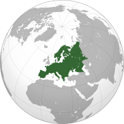
The concept of a unified continental territory has historical roots, such as the land held by the Carolingian Empire. In the 1950s, these historical connections were invoked as a foundation for European integration, the process of increasing political and economic cooperation among European nations.
Key Facts
- Mainland Europe refers to the contiguous landmass, excluding islands like Great Britain, Ireland, and Iceland.
- The Channel Tunnel, opened in 1994, provided the first physical land connection between Britain and the mainland in 8,000 years.
- The Scandinavian Peninsula is geographically attached to the mainland but is often treated as a separate entity due to historical maritime connections.
- In many island nations, such as Greece or Italy, "the Continent" refers to the mainland portion of their own country.
Geographical Boundaries and Exclusions
The most common definition of mainland Europe excludes several major island groups and oceanic territories. These include:
- Mediterranean Islands: Cyprus, Malta, Sicily, Sardinia, Corsica, and the Balearic Islands.
- Northern and Atlantic Islands: Iceland, the Faroe Islands, Svalbard, the Canary Islands, Madeira, and the Azores.
- Other territories: Great Britain, Ireland, Novaya Zemlya, and the Nordic archipelago.
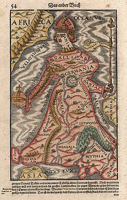
The Case of Great Britain and Ireland
Great Britain is the largest island in Europe by both area and population. Located just 34 kilometres (21 miles) from the mainland at the narrowest point of the Strait of Dover, it remains geographically distinct. In both the United Kingdom and the Republic of Ireland, the term "the Continent" is standard usage to refer to mainland Europe.
Cultural differences have historically reinforced this distinction. These include variations in social practices, fashion, and even technical standards such as electrical plugs and the use of left-hand traffic. While the United Kingdom still uses certain imperial units, most of continental Europe has transitioned to the metric system.
Scandinavia and the Peninsula
The Scandinavian Peninsula is physically attached to the mainland, but the land route to the rest of Europe requires traveling far north to the 66th parallel before heading south. Because of this, historical connections were primarily made via the North Sea or the Baltic Sea, making the region function effectively as an island.
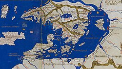
In many contexts, including within the European Union, a distinction is made between Scandinavia and mainland Europe. In Swedish and Norwegian, the term Kontinenten (the Continent) specifically refers to mainland Europe while excluding Sweden, Norway, and Finland. Physical connections to the mainland were significantly improved with the opening of the Great Belt Bridge and the Øresund Bridge in 1998 and 2000, respectively.
Regional Perspectives and Nicknames
The term "the Continent" is often used subjectively by residents of island territories to describe the mainland portion of their own nations or the broader European landmass. This has led to several descriptive nicknames for continental regions:
- France: Often called l'Hexagone (the Hexagon) due to its approximate shape.
- Italy: Known as lo Stivale (the Boot) because of its distinctive shape.
- Spain: The mainland portion is frequently referred to as peninsular Spain.
Summary of Continental Definitions
| Region/Country | Common Term for Mainland | Key Distinctions |
|---|---|---|
| United Kingdom/Ireland | The Continent | Separated by the English Channel |
| Scandinavia | Kontinenten | Excludes Sweden, Norway, and Finland |
| France | L'Hexagone | Refers to the hexagonal shape of the mainland |
| Italy | Lo Stivale | Refers to the "boot" shape of the mainland |
| Spain | Peninsular Spain | Excludes the Balearic and Canary Islands |
Frequently Asked Questions
Is Great Britain part of continental Europe?
Geographically, Great Britain is an island and is excluded from the definition of mainland (continental) Europe. However, it is physically connected to the mainland via the Channel Tunnel.
Why is Scandinavia sometimes excluded from the mainland?
Although the Scandinavian Peninsula is attached to the continent, historical travel and trade relied on sea routes across the North and Baltic Seas rather than long land routes, leading to a functional distinction.
What is the difference between Europe and Continental Europe?
Europe refers to the entire continent, including all islands (like Iceland and Great Britain). Continental Europe refers specifically to the contiguous mainland landmass.
Does the term "the Continent" apply to countries like Greece or Portugal?
Yes. Residents of island territories within those countries, such as Crete in Greece or the Azores in Portugal, often use "the Continent" to refer to the mainland portion of their own nation.
How did the Channel Tunnel change the connection to the mainland?
Opened in 1994, the undersea Channel Tunnel provided the first physical land connection between Great Britain and mainland Europe since the island was separated 8,000 years ago.