Colorado Geography: From Rugged Rocky Mountains to Vast High Plains
The landscape of Colorado is a study in dramatic contrasts. As a landlocked state, its territory encompasses everything from rugged mountainous terrain and high-altitude basins to vast plains, desert canyons, and mesas. This diverse geography is defined by extreme elevations and unique climatic patterns that shape both the natural ecosystems and human settlement.
State Boundaries and the Four Corners
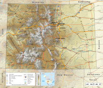
While many assume Colorado is a simple rectangle, its official borders are far more complex. Originally defined by Congress in 1861 using lines of latitude and longitude, subsequent surveys revealed deviations from these straight lines. In 1925, the U.S. Supreme Court affirmed these earlier demarcations as the official boundaries. Today, Colorado's borders are defined by 697 boundary markers, forming a geometric shape known as a hexahectaenneacontakaiheptagon. Colorado, Wyoming, and Utah are unique in that their borders consist entirely of straight lines without any natural features.
A significant geographic landmark is the Four Corners Monument in the southwest corner of the state. Located at 36°59'56"N, 109°2'43"W, it is the only location in the United States where four states—Colorado, New Mexico, Arizona, and Utah—meet.
Extreme Elevations and Mountainous Terrain
Colorado is defined by its verticality. The state's highest point is the summit of Mount Elbert, which reaches 14,440 feet (4,401.2 m) in Lake County, making it the highest peak in the North American Rocky Mountains. Conversely, the state's lowest point is 3,317 feet (1,011 m) in Yuma County, where the Arikaree River enters from Kansas. Notably, Colorado and Wyoming are the only two U.S. states that lie entirely above 3,000 feet (1,000 m) in elevation.
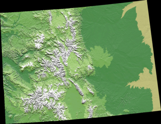
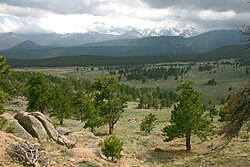
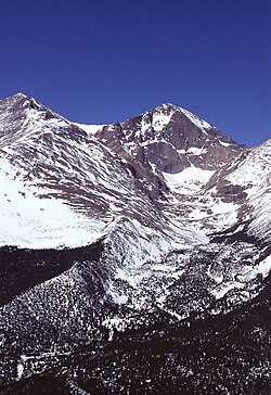
The Rocky Mountains are a central feature of the state, containing approximately 550 peaks that exceed 10,000 feet. Among these, 54 peaks reach 14,000 feet or higher, a distinction known as fourteeners. The mountains are characterized by conifer and aspen forests that extend to the tree line—roughly 12,000 feet in southern Colorado and 10,500 feet in the north. Above this line, only alpine vegetation can survive.
The Continental Divide and Regional Basins
The Continental Divide runs along the crest of the Rocky Mountains, acting as a major hydrological divider. Water to the west of the divide drains into the Pacific Ocean via the Colorado River, while water to the east flows toward the Atlantic or Arctic Oceans. Within the mountains, several large high-altitude basins exist, including North Park, Middle Park, South Park, and the San Luis Valley. The San Luis Valley is particularly notable for sitting along the Rio Grande Rift, a significant tectonic feature.
Regional Landscapes
The Eastern Plains and Front Range
To the east of the mountains lie the Colorado Eastern Plains (or High Plains), with elevations between 3,500 and 7,000 feet. This region is characterized by meager rainfall, averaging about 15 inches annually, and is primarily used for ranching or dryland farming, with winter wheat being a common crop. Most of the state's population is concentrated in the Front Range Urban Corridor, located along the eastern edge of the mountains.
The Western Slope and Colorado Plateau
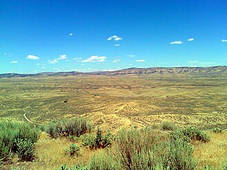
The Western Slope is characterized by mountains, mesas, and desert lands. It is largely drained by the Colorado River. In the south, the rugged San Juan Mountains dominate, while the western edge features the Colorado Plateau, a high desert region. Notable landmarks include Grand Mesa, a large flat-topped desert mountain, and various ski resort communities such as Aspen and Vail.
Climate and Weather Patterns
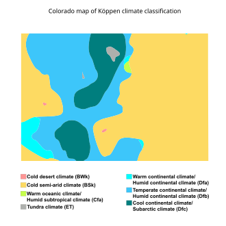
Weather in Colorado is heavily influenced by orography—the effect of mountain topography on air movement. This leads to various microclimates throughout the state. Notable atmospheric phenomena include the Denver Convergence Vorticity Zone (DCVZ) and the "Colorado low," a weather system induced by the Rocky Mountains.
| Metric | Denver (DIA) | Grand Junction |
|---|---|---|
| Mean Annual Precipitation | 14.48 inches | 9.06 inches |
| Mean Annual Maximum Temp | 100.6 °F | 102.5 °F |
| Mean Annual Minimum Temp | -11.0 °F | -1.3 °F |
| Average Annual Sunshine | 3,106.6 hours | 3,203.6 hours |
Key Facts
- Highest Point: Mount Elbert (14,440 ft).
- Lowest Point: Yuma County (3,317 ft).
- Four Corners: The only place in the U.S. where Colorado, New Mexico, Arizona, and Utah meet.
- Fourteeners: Colorado has 54 mountain peaks exceeding 14,000 feet.
- Boundary Shape: A hexahectaenneacontakaiheptagon (697-sided polygon).
- Elevation: Colorado and Wyoming are the only states entirely above 3,000 feet.
Frequently Asked Questions
What is the highest mountain in the Rocky Mountains?
Mount Elbert is the highest peak in the Rocky Mountains of North America, standing at 14,440 feet (4,401.2 m).
Why is Colorado's border not a perfect rectangle?
While originally intended to be defined by latitude and longitude, official surveys starting in 1868 resulted in deviations. The U.S. Supreme Court affirmed these surveyed boundaries in 1925.
What defines the "Western Slope" of Colorado?
The Western Slope refers to the area west of the Continental Divide. It is characterized by mountains, mesas, and desert lands, and its waters generally drain into the Pacific Ocean via the Colorado River.
What are "fourteeners"?
In Colorado, "fourteeners" is the term used to describe mountain peaks that reach an elevation of 14,000 feet (4,300 m) or higher. There are 54 such peaks in the state.
How does the climate vary across the state?
Climate varies significantly due to orography. The eastern plains are drier and flatter, while the mountains experience higher precipitation and much colder temperatures. The Western Slope features high desert environments and mesas.