Bariloche: The Queen of Patagonia
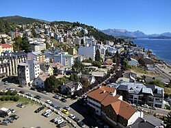
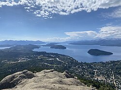
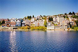
Nestled in the foothills of the Patagonian Andes on the southern shore of the stunning Nahuel Huapi Lake, San Carlos de Bariloche is a city of breathtaking landscapes and rich history. Known as "The Queen of Patagonia," it serves as the largest city in Argentina's Río Negro Province and a vital regional hub. Its name is derived from the Mapuche word Vuriloche, which translates to "people from the other side of the mountain."
With a population of 135,755 as of the 2022 census, Bariloche blends a low-density urban layout—stretching approximately 50 kilometers from east to west—with the rugged beauty of the surrounding wilderness. From its origins as a remote trading post to its current status as a world-class destination, Bariloche offers a unique intersection of science, nature, and cosmopolitan architecture.
Key Facts
- Location: Río Negro Province, Argentina, situated near the Chilean border.
- Nickname: The Queen of Patagonia.
- Population: 135,755 (2022 Census).
- Elevation: 893 meters (2,930 feet).
- Primary Lake: Nahuel Huapi Lake.
- Climate: Cool temperate (Csb), characterized by a dry season and alpine traits.
The History of a Patagonian Hub
Early Settlement and Trade
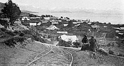
The modern foundation of Bariloche began in the summer of 1894-1895 when Carlos Wiederhold, a German-Chilean, crossed the Andes from Osorno, Chile. Aided by guides Antonio Millaqueo and Daniel Márquez, Wiederhold established a small shop called La Alemana (The German) in 1895. This modest business became the seed from which the city grew.
By the early 1900s, Chilean merchants dominated the trade routes between the Pacific port of Puerto Montt and the inland Nahuel Huapi area. Despite temporary tensions caused by war scares between Chile and Argentina, a 1902 boundary arbitration increased trust and stabilized the international border, allowing trade to flourish through the 1910s.
Architectural Evolution and Tourism
Bariloche transitioned from a cattle-trading center into a sophisticated retreat for the Argentine elite. This shift brought a cosmopolitan architectural style to the region. The tourism boom became evident in the 1930s; hotel occupancy surged from 1,550 tourists in 1934 to 4,000 by 1940.
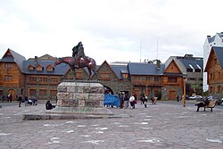
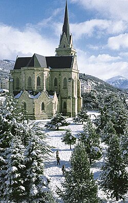
Notable landmarks from this era include the Civic Centre, which opened in 1940 and was later declared a national monument in 1987, and the Neo-Gothic Cathedral of San Carlos de Bariloche, completed in 1947.
Geography and Natural Wonders
The Landscape
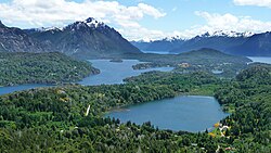
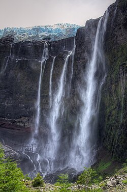
The city is surrounded by the Nahuel Huapi National Park, featuring a dramatic terrain of glacial lakes and towering peaks. One of the most striking features is Cerro Tronador, where the Glacier Castaño Overo spills ice and water over massive cliffs.
Climate and Weather Patterns
Bariloche experiences a transition between a cool Mediterranean climate (Csb) and an Oceanic climate (Cfb). It is characterized by high thermal amplitude—meaning wide temperature variations—and a distinct dry season. Precipitation varies wildly based on geography, ranging from 4,000 mm in the Andean peaks to just 600 mm near the Limay River.
In the city center, the mean annual temperature is approximately 8.4°C (47°F). Summers (January) are mild, with daytime temperatures typically between 20°C and 28°C. Winters are cold, with temperatures often dropping to or below freezing, bringing the snowfall that fuels the region's famous ski industry.
Flora of the Region
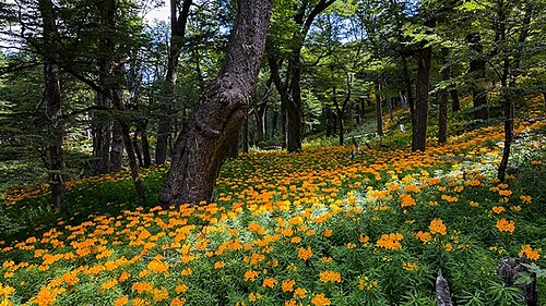
The diverse environment supports a rich array of native plant species, including several types of Nothofagus (Southern Beech) such as Lenga, Coihue, and Ñire. Other notable flora include the Alerce (Fitzroya cupressoides), the Araucaria, and the vibrant Notro (Embothrium coccineum).
Modern Bariloche: Science, Sport, and Travel
Science and Research
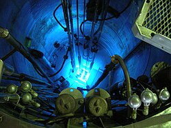
Beyond tourism, Bariloche is a center for scientific advancement. The Centro Atómico Bariloche is home to the RA-6 Training and Research Reactor, highlighting the city's role in nuclear research and education.
Outdoor Recreation
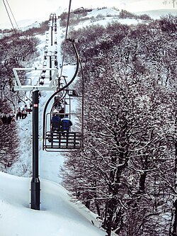
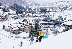
The city is a premier destination for adventure sports. Cerro Catedral is one of the most prominent ski resorts in South America, drawing thousands of visitors during the winter months of June through August.
Transportation and Access
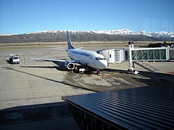
Bariloche is accessible via the San Carlos de Bariloche Airport and a network of national routes. RN 40 connects the city to Villa La Angostura, San Martín de los Andes, and Mendoza, while RN 237 provides a link to Neuquén and Buenos Aires.
City Overview Summary
| Attribute | Detail |
|---|---|
| Established | May 3, 1902 (as Nahuel Huapi Agricultural Colony) |
| Area | 220.27 km² (85.05 sq mi) |
| Population | 135,755 (2022 Census) |
| Mean Annual Temp | 8.4°C (City Centre) |
| Key Economy | Tourism, Science, Trade |
Frequently Asked Questions
What is the best time to visit Bariloche for skiing?
The best time for skiing is during the Southern Hemisphere winter, specifically from June to August, when snowfall is most frequent and temperatures are lowest.
What does the name "Bariloche" mean?
The name comes from the Mapuche word Vuriloche, which means "people from the other side of the mountain."
How did the city of Bariloche begin?
The modern settlement developed from a small shop called La Alemana, established in 1895 by Carlos Wiederhold, a German-Chilean entrepreneur.
What is the climate like in Bariloche?
Bariloche has a cool temperate climate with alpine characteristics. It features a dry season and significant precipitation gradients, with the heaviest rain and snow occurring in the Andean peaks.
What are the main ways to reach Bariloche?
Visitors can arrive via the San Carlos de Bariloche Airport or by road using National Routes 40, 237, or 23.