BangkokThailand capitalKrung Thep Maha NakhonChao Phraya RiverBangkok tourism

Bangkok: The Dynamic Capital of Thailand

Bangkok: The Dynamic Capital of Thailand Bangkok, known locally as Krung Thep Maha Nakhon, serves as the vibrant capital and the primary economic, cultural, and political hub of Thailand....

Bangkok: The Dynamic Capital of Thailand

Bangkok, known locally as Krung Thep Maha Nakhon, serves as the vibrant capital and the primary economic, cultural, and political hub of Thailand. Often nicknamed the "City of Angels" or "The Big Mango," this sprawling metropolis is a unique blend of ancient traditions and cutting-edge modernity, situated in the heart of Central Thailand.

From its origins as a settlement in the 15th century to its official founding as the capital on April 21, 1782, by King Rama I, Bangkok has evolved into one of the most visited cities in the world. Today, it is managed as a special local administrative area by the Bangkok Metropolitan Administration.
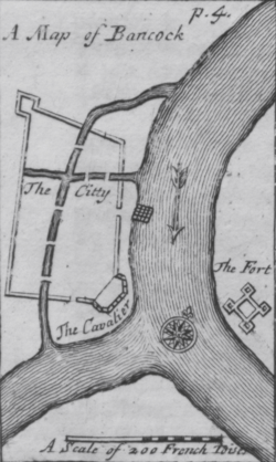
An engraved map titled "A Map of Bancock", showing a walled settlement on the west of a river, and a fort on the east
Map of 17th-century Bangkok, from Simon de la Loubère's Du Royaume de Siam

Key Facts

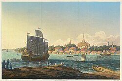
Engraving of the city from British diplomat John Crawfurd's embassy in 1828
  • Official Name: Krung Thep Maha Nakhon.
  • Founded: April 21, 1782.
  • Population: Approximately 9.1 million (2024 estimate), with a metro population of 17.4 million.
  • GDP: Nominal GDP of ฿6.352 trillion (US$180 billion) as of 2024.
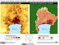
  • Geography: Low-lying elevation of 1.5 meters, making it vulnerable to sea-level rise.
  • Climate: Tropical savanna climate (Aw) characterized by high temperatures and significant rainfall.

Geography and Climate

ภาพประกอบบทความ
ภาพประกอบจากบทความต้นฉบับ

Bangkok is located in the lower Chao Phraya delta. The urban area is characterized by its low elevation, averaging just 1.5 meters above sea level, which presents significant challenges regarding coastal flooding and rising sea levels.
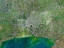
Satellite image showing a river flowing into the ocean, with large built-up areas along its sides just before the river mouth
The city of Bangkok is highlighted in this satellite image of the lower Chao Phraya delta. The built-up urban area extends northward and southward into Nonthaburi and Samut Prakan provinces.

The city's layout is heavily influenced by its waterways. Historically, a network of canals (khlongs) served as the primary means of transport, a legacy that remains visible in the city's geography today.
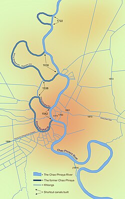
Bangkok's major canals are shown in this map, detailing the original course of the river and its shortcut canals.

The climate is classified as a tropical savanna climate. This means the city experiences high temperatures year-round, with a distinct rainy season. The highest recorded temperature reached 41.0°C, while the lowest dipped to 9.9°C. Precipitation peaks in September, averaging 335.9 mm.

City Structure and Demographics
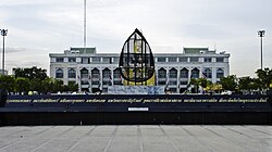
A granite sign with a long name in Thai script, and a building in the background
The city's ceremonial name is displayed in front of Bangkok City Hall.

Bangkok is divided into 50 districts, ranging from the historic Phra Nakhon to the financial hubs of Sathon and Bang Rak. The population has grown exponentially over the last century, rising from roughly 437,000 in 1919 to over 8 million in the 2010 census.
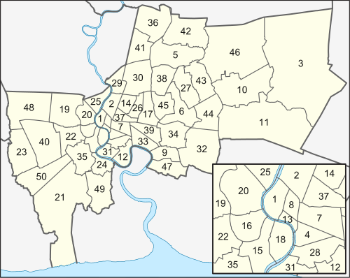
A map of Bangkok
Map showing the 50 districts of Bangkok (labelled version showing subdistricts)

The city's demographic profile is diverse, with a significant historical influence from Chinese immigrants, particularly evident in the Yaowarat Road area of Chinatown.
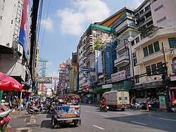
A street during daytime lined with many stalls and shops with a lot of signs bearing Thai and Chinese names
Yaowarat Road, the centre of Bangkok's Chinatown. Chinese immigrants historically formed the majority of the city's population.

Urban Landscape and Green Spaces

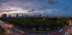
The skyline is a mix of traditional spires and modern skyscrapers. Landmarks like the MahaNakhon building and Baiyoke Tower II define the city's vertical growth. To balance this urbanization, the city maintains green oases such as Lumphini Park and Benjakitti Park.
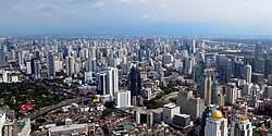
A lot of high-rise buildings
The Sukhumvit area appears as a sea of high-rise buildings from Baiyoke Tower II, the tallest building in Bangkok from 1997 to 2015.
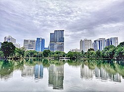
A park with many trees and a lake at sunset; many buildings in the background
Panorama of Lumphini Park at sunset, an oasis amid the skyscrapers of Ratchadamri and Sukhumvit, July 2015.

Economy, Tourism, and Culture

Bangkok population density and low elevation coastal zones. Bangkok is especially vulnerable to sea level rise.

Bangkok is the economic engine of Thailand, boasting a nominal GDP of US$180 billion. Its economy is driven by commerce, finance, and a massive tourism industry. The city is world-renowned for its shopping centers in the Siam area and its legendary street food culture.
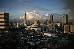
Many low-rise buildings in the foreground, with an elevated rail line and several medium box-saped buildings beyond; many tall buildings in the background
The Siam area is home to multiple shopping centres catering to both the middle and upper classes and tourists.
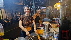
Street food vendor "Puy the Roti Lady" – "Benjawan Kaewsaen" and her sister Palm in the Silom – Saladang area of Bangkok

Cultural landmarks are central to the city's identity. The Grand Palace and Wat Phra Kaew are primary attractions, while the Bangkok Art and Culture Centre (BACC) serves as a hub for contemporary art.
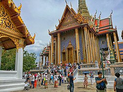
A Thai temple complex with several ornate buildings, and a lot of visitors
Wat Phra Kaew in the Grand Palace is among Bangkok's major tourist attractions.
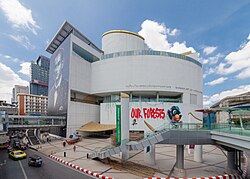
A modern-looking building with a smooth curved exterior on the corner of a road junction with several paintings on the wall
The Bangkok Art and Culture Centre, the city's major public contemporary art venue, was opened in 2008 after many delays.

Infrastructure and Transport

View of Chao Phraya River surrounded by buildings
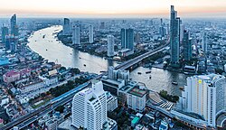
View of the Chao Phraya River looking south from Bang Rak, 2017

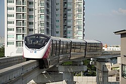
Transport in Bangkok is a complex system of rail, road, and water. The city utilizes the BTS (Skytrain) and MRT (Metropolitan Rapid Transit), including newer monorail lines like the Pink Line, to alleviate surface traffic.
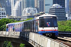
An elevated train, painted in blue, white and a red stripe and with advertisements
A BTS train in Bangkok
A pink line monorail train
The MRT Pink Line, one of the monorail lines in Bangkok

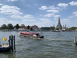
Despite the rail network, road congestion remains a significant issue, with over 1.5 million vehicles utilizing the expressway system daily. For those traveling by water, the Chao Phraya Express Boat provides a vital link across the river.
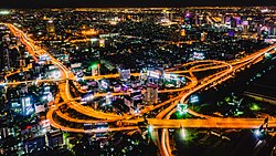
Night photograph looking down at a large elevated road interchange; many billboards along the roads
Streetlamps and headlights illuminate the Makkasan Interchange of the expressway. The system sees a traffic of over 1.5 million vehicles per day.[132]
A Chao Phraya Express Boat on the Chao Phraya near Wat Arun

International connectivity is handled primarily by Suvarnabhumi Airport, the hub for Thai Airways International.
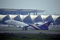
Suvarnabhumi Airport is home to flag carrier Thai Airways International.

Education and Healthcare
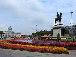
A large plaza with a bronze statue of a man riding on horseback; beyond the plaza is a large two-storey building with a domed roof, arched windows and columns
The Royal Plaza in Dusit District was inspired by King Chulalongkorn's visits to Europe.

Bangkok is the educational center of Thailand, home to prestigious institutions like Chulalongkorn University. The city also provides world-class healthcare, featuring Siriraj Hospital, the oldest hospital in the country, established in 1888.
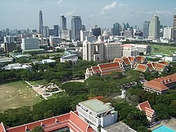
The campus of Chulalongkorn University, with many red-roofed buildings and trees; many tall buildings in the background
The campus of Chulalongkorn University was surrounded by rural fields when it was established in 1917. Pathum Wan District has since become part of the Bangkok city centre.
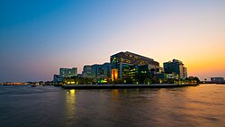
A large complex of buildings, most over ten storeys high, on the bank of a river; one bears a sign with the words "SIRIRAJ HOSPITAL"; another says "FACULTY OF NURSING"
Siriraj Hospital, established in 1888, is the oldest hospital in Thailand.

City Overview Summary

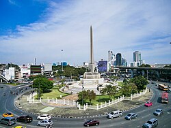
View of Victory Monument
Victory Monument in 2021
Bangkok Quick Reference Guide
Category Detail
Founded 1782 by Rama I
Administrative Type Special local administrative area
Total Area 1,568.737 km²
Metro Population 17.4 Million
Nominal GDP (2024) US$180 Billion
HDI (2023) 0.833 (Very High)

Frequently Asked Questions
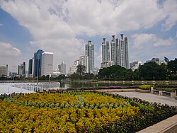
Benjakitti Park
Benjakitti Park
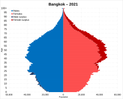
Bangkok population pyramid, based on 2021 population registry
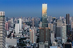
Lots of skyscrapers
MahaNakhon, the city's tallest building from 2016 to 2018, stands among the skyscrapers of Sathon Road, one of Bangkok's main financial districts.
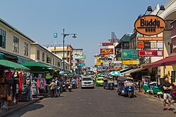
Khao San Road is lined by budget accommodation, shops, and bars catering to tourists.
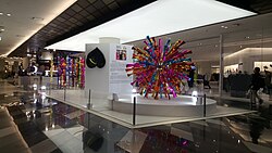
Temporary art display at Siam Discovery during the Bangkok Art Biennale 2018
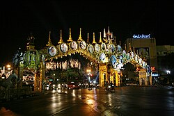
An elaborate double archway above a road, with pictures of King Bhumibol Adulyadej; trees decorated with lights
Ratchadamnoen Avenue is annually decorated with lights and displays in celebration of King Bhumibol's birthday.
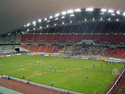
Rajamangala Stadium was built for the 1998 Asian Games and Thailand national football team home stadium.
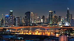
View of the Krung Thep Bridge at night with many skyscrapers in the background
Krung Thep Bridge spanning the Chao Phraya river
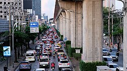
Traffic jams, seen here on Phahonyothin Road, are common in Bangkok.
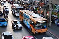
A partial view of a road with many vehicles, including buses, cars, taxis and motorcycles
Many buses, minibuses and taxis share the streets with private vehicles
The building complex of King Chulalongkorn Memorial Hospital, the teaching hospital of the Faculty of Medicine, Chulalongkorn University, as seen from Lumphini Park.
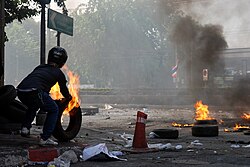
A person pushing burning tyres onto a street
Political violence has at times spilled onto the streets of Bangkok, as seen during the military crackdown on protesters in 2010.
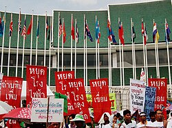
Many people holding signs in front of a building with green layered roofs; many national flags on flag poles lined in two rows in front of the building
Protesters in front of the United Nations Building during the 2009 Bangkok Climate Change Conference. Bangkok is home to several UN offices.

What is the full ceremonial name of Bangkok?

The ceremonial name is Krung Thep Maha Nakhon, a long title composed of Pali and Sanskrit root words that describes the city's divine and grand nature.

How does Bangkok's geography affect its safety?

Because Bangkok is located in a low-lying delta with an average elevation of only 1.5 meters, it is particularly vulnerable to sea-level rise and coastal flooding.

What are the main modes of public transport in the city?

Bangkok utilizes a combination of the BTS Skytrain, MRT subway and monorail lines, public buses, taxis, and Chao Phraya Express Boats.

Which is the oldest hospital in Thailand?

Siriraj Hospital, established in 1888, is the oldest hospital in Thailand and is located within Bangkok.

What is the climate like in Bangkok?

Bangkok has a tropical savanna climate, meaning it is generally hot throughout the year with a significant rainy season, particularly in September.