Argentina Climate: Regional Diversity and Weather Patterns
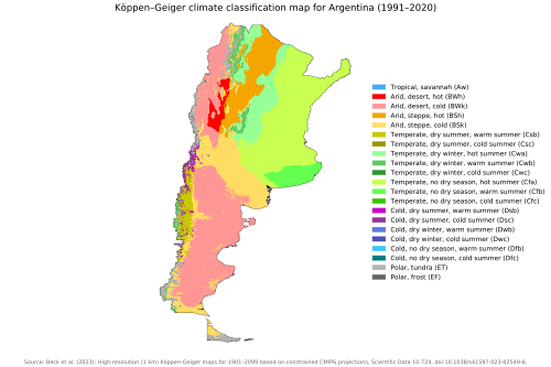
Argentina is a land of immense geographic contrast. Due to its vast territorial extent and dramatic variations in altitude, the country encompasses a wide array of climate types. From the tropical warmth of the north to the frigid, wind-swept plains of the south, Argentina's weather is shaped by its unique position between the Atlantic Ocean and the towering Andes mountains.
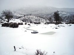
Generally, summers are the warmest and wettest season for most of the country, with the notable exception of Patagonia, where summer is the driest period. Transition seasons—spring and autumn—typically bring mild weather, while winters range from mild in the north to severe in the south, where frost and snow are frequent.
Key Facts
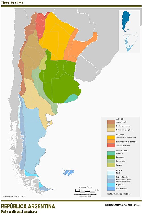
- Extreme Diversity: Climates range from tropical in the north to cold and subpolar in the south.
- Topographical Influence: The Andes mountains act as a primary barrier, creating significant precipitation gradients.
- Regional Extremes: The Chaco region is the warmest, while Patagonia is characterized by persistent strong westerly winds.
- Seasonal Variation: Most regions experience wet summers and dry winters, though Patagonia reverses this pattern.
- Vulnerability: The flat topography of the Pampas makes the region highly susceptible to flooding.
Factors Influencing the Climate
Geographic and Topographical Factors
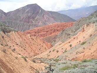
The most significant topographical influence is the Andes mountain range. This massive chain creates orographic precipitation (rainfall produced when moist air is lifted over mountains), resulting in thick jungles on the eastern slopes and arid conditions in the rain shadow areas.
Atmospheric and Oceanic Circulation
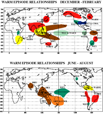
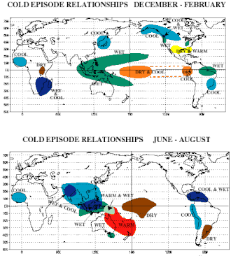
Argentina's weather is heavily influenced by large-scale atmospheric patterns. The surrounding oceans moderate temperatures in the south, making the cold less intense than in similar latitudes in the Northern Hemisphere. Additionally, global phenomena such as El Niño and La Niña significantly impact regional precipitation and temperature levels.
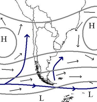
Other influential factors include the Antarctic Oscillation and the Indian Ocean Dipole, which contribute to the variability of weather systems across the southern cone of South America.
Regional Climate Breakdown
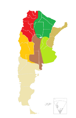
Mesopotamia and the Chaco
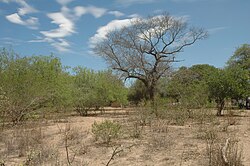
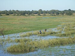
The northeast, known as Mesopotamia, experiences high temperatures and abundant rainfall year-round, making droughts uncommon. To the west lies the Chaco region, the warmest part of Argentina. In the Chaco, precipitation decreases as one moves west, causing vegetation to shift from dense forests in the east to shrubs in the west.
Northwest Argentina
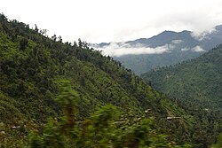
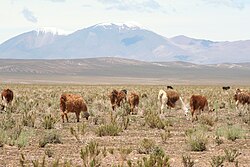
This region is predominantly hot and dry, but its rugged terrain creates diverse microclimates. These range from the Puna—a cold, arid, and sunny high-altitude plateau with large diurnal (daily) temperature ranges—to lush, thick jungles on the mountain slopes.
The Center: Pampas and Cuyo
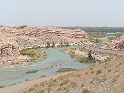
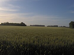
The central region is split between the humid Pampas to the east and the arid Cuyo region to the west. Both experience hot summers and cool, dry winters. The Pampas are characterized by flat terrain and poor drainage, which often leads to flooding. The Cuyo region is largely dry and relies heavily on river irrigation for agriculture.
Patagonia
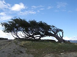
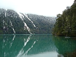
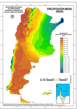
The southern region of Patagonia is defined by a dry climate, cold winters, and strong, persistent westerly winds that blow year-round. These winds are so powerful they often shape the local flora into "Flag trees." This region also exhibits one of the strongest precipitation gradients in the world.
Weather Extremes and Natural Disasters
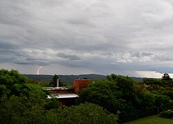
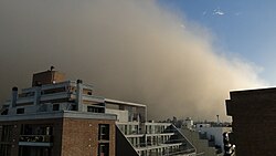
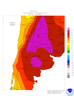
Argentina's geography often precipitates extreme weather events. Severe storms in the central regions can produce tornadoes, damaging hail, and high winds. The country also faces periodic heat waves and cold waves that disrupt agriculture and spike energy demand.
Climate Statistics Summary
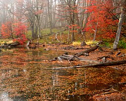
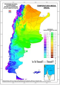
The following table provides a snapshot of mean temperatures and annual precipitation across key Argentine cities.
| Location | Region | Annual Mean Temp (°C) | Annual Precipitation (mm) |
|---|---|---|---|
| Posadas | Mesopotamia | 21.8 | 1,867.2 |
| Formosa | Chaco | 22.3 | 1,436.8 |
| Buenos Aires | Humid Pampas | 17.9 | 1,236.3 |
| Salta | Northwest | 16.7 | 748.1 |
| San Juan | Cuyo | 17.8 | Low (Arid) |
| Bariloche | Patagonia | 8.3 | 801.7 |
| Ushuaia | Patagonia | 5.9 | 537.0 |
Frequently Asked Questions
Which is the warmest region in Argentina?
The Chaco region is recognized as the warmest region in the country, characterized by high temperatures and a decrease in precipitation from east to west.
How do the Andes mountains affect Argentina's weather?
The Andes create a rain shadow effect and cause orographic precipitation, leading to heavy rainfall and jungles on the eastern slopes while leaving other areas, like the Cuyo region, very dry.
Why is the Pampas region prone to flooding?
The Pampas have a very flat topography and poor water drainage, which prevents rainwater from clearing quickly, making the area vulnerable to floods during heavy storms.
What defines the climate of Patagonia?
Patagonia is characterized by a dry climate with cold winters and strong, persistent westerly winds that occur throughout the year.
How does the southern climate compare to the Northern Hemisphere?
Because the southern parts of Argentina are moderated by surrounding oceans, the cold is generally less intense and prolonged than in areas at similar latitudes in the Northern Hemisphere.